Elevation: 8,387 ft
Prominence: 299
This peak is not in the book. The elevation and prominence figures are based on recent LiDAR updates. Published October 2025
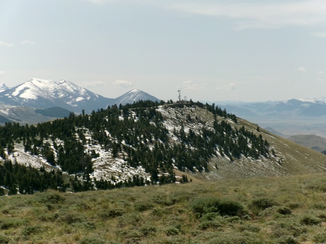
Peak 8387 recently lost its ranked status with the recent LiDAR updates. It is still a magnificent peak that sits at the head of Leaton Gulch. It is the highest point in the White Hills section of the Pahsimeroi Mountains. USGS Grouse Peak
Peak 8387 as viewed from the north. Livingston Douglas Photo
Access
Same as for Peak 6809. Continue northeast up Leaton Gulch Road, which gets quite steep and rocky higher up. At 3.2 miles (from the base of Leaton Gulch Road), reach the Challis National Forest boundary (FSR-111 sign). At 5.9 miles, reach a road junction on the high ridge crest. Go right/south onto the unsigned access road that leads up to the antenna-clad summit.
North Ridge/East Face, Class 1
The Climb
A 2-track service road leads to the communications towers on the summit. A 4WD vehicle is required to navigate this narrow, dirt-and-rock road. The high point of Peak 8387 is behind the buildings, next to an antenna. A small summit cairn is in an open area just south of the actual high point.
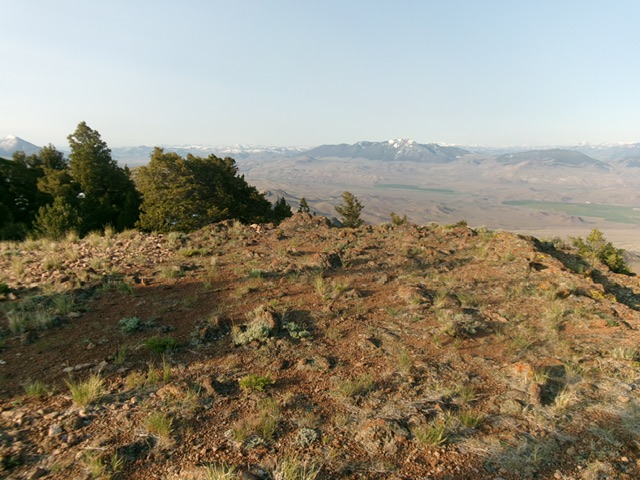
The bare summit of Peak 8387 with the antennas nearby. Livingston Douglas Photo
Additional Resources
Regions: EASTERN IDAHO->Lost River Range->Pahsimeroi Range
Mountain Range: Lost River Range
Longitude: -114.07729 Latitude: 44.53097