Elevation: 8,618 ft
Prominence: 358
This peak is not in the book. Published October 2025
Peak 8618 is on a high ridge in the foothills of the Pioneer Mountains, directly on the Blaine/Butte County line. It sits above the headwaters of Walton Canyon, Riley Canyon, and Trail Creek. Peak 8618 is most easily climbed from nearby Fish Creek Road to its southeast. USGS Trail Creek
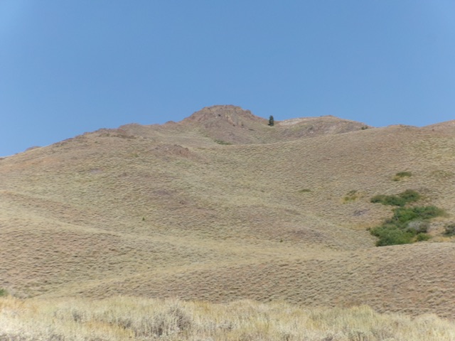
Peak 8618 as viewed from the east. Livingston Douglas Photo
Access
Fish Creek Road is located along US-20 at virtual MM212.1. This road junction is 6.6 miles east of the north end of Carey. Turn north onto [signed] Fish Creek Road and reset your odometer. At 5.4 miles, pass the left turnoff for West Fork Fish Creek Road (signed for “Boat Ramp”). At 6.6 miles, pass the right turnoff for East Fork Fish Creek Road (unsigned). At 9.8 miles, go right at an unsigned junction. At 13.8 miles, reach a junction with a weak, overgrown 2-track road (shown on the USGS topo map) heading left/north. Park in a large pullout area here [6,046 feet; 43⁰32’29.6”N, 113⁰44’58.6”W].
Map Errors
The USGS topo map shows this side road bending west to head up toward Walton Canyon. That section of the old, overgrown 2-track road is long gone and no trace of it remains.
East Spur/Southeast Ridge, Class 2
The Climb
Thanks to the ACCESS YES program, Peak 8618 can be climbed from this roadside pullout. From the pullout, hike north up the old, overgrown jeep trail as it follows the right/east side of Walton Creek. The jeep trail ends in a bowl of sorts. Bushwhack left/west and cross Walton Creek (small). Continue west up onto a scrub shoulder with a good use trail on its crest. Follow this shoulder north past Point 6776, a magnificent rocky pillar to the left/west. Look for a gully on the right/north side of Point 6776.
Head left/west in open scrub into this forested gully. Cross to the left/south side of the main fork of Walton Creek and bushwhack briefly up through the pine forest. Angle right/northwest and cross a tiny feeder stream to reach the toe of the east spur. Follow this ridge/shoulder up through thick scrub (not fun) as the terrain steepens and becomes rockier. The ridge gains definition but is still a somewhat tedious scrub climb (sometimes steep) to its juncture with the southeast ridge.
Once on the southeast ridge, the terrain is rockier but the scrub is easier. There are a few areas of thick scrub but, overall, it is not a difficult bushwhack/climb all the way up to the juncture with the south ridge high up. Once on the south ridge, scramble right/north up through some rocky outcrops to reach the small, cairned summit of Peak 8618. There are some weak goat trails on this final ridge section.
An alternative way to climb the southeast ridge is directly from a pullout that is 0.2 miles southwest down Fish Creek Road and is on the west side of the Walton Creek drainage. This is a more direct ascent route but requires more bushwhacking and a few more rocky ridge outcrops to navigate. Aesthetically, it is a beautiful route to the top.
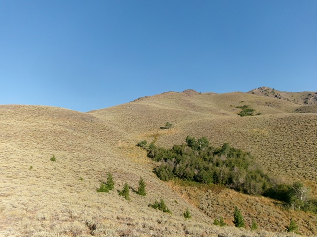
Looking up the east spur (left of center) at the southeast ridge (skyline left of center). The summit hump is in dead center. This was my ascent route. Livingston Douglas Photo
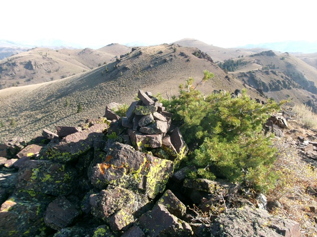
The summit cairn atop Peak 8618 with the [lower] north summit behind it. Livingston Douglas Photo
Additional Resources
Regions: EASTERN IDAHO->Pioneer Mountains
Mountain Range: Pioneer Mountains
Longitude: -113.7773 Latitude: 43.5066