Elevation: 8,894 ft
Prominence: 460
This peak is not in the book. Based on recent LiDAR measurements, the correct elevation is 8,894 feet rather than the 8,889 feet shown on the USGS quad. Published October 2025
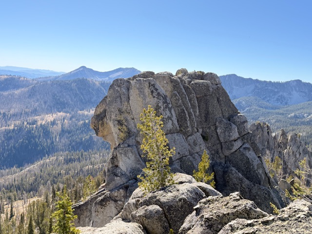
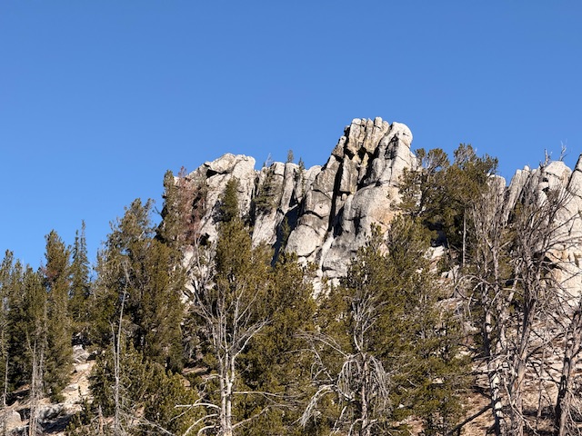
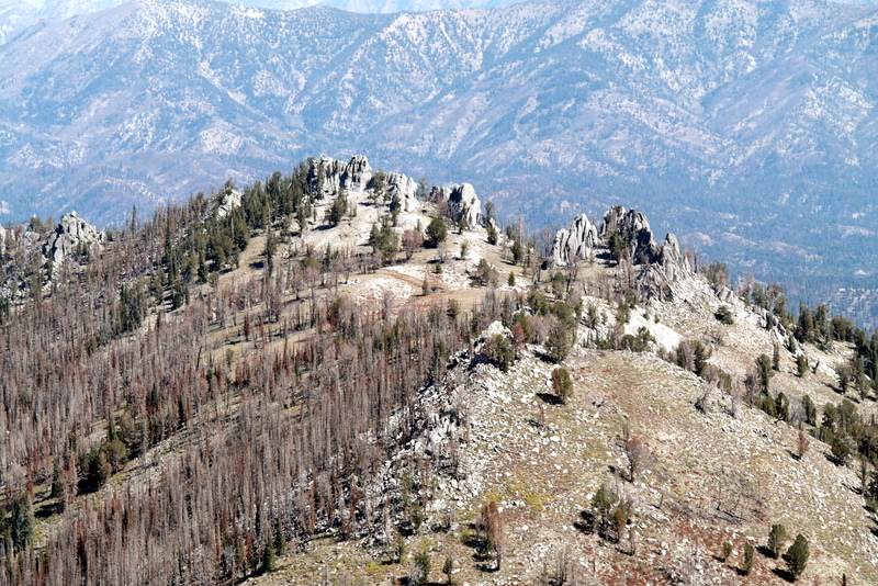
This beautiful peak is the northernmost summit on the Trinity Mountain crest. It is located east of Big Trinity Lake. Several impressive granite fins culminate with the largest fin which has the high point. This summit area with its variety of granite formations and short hiking access should interest rock climbers. USGS Trinity Mountain
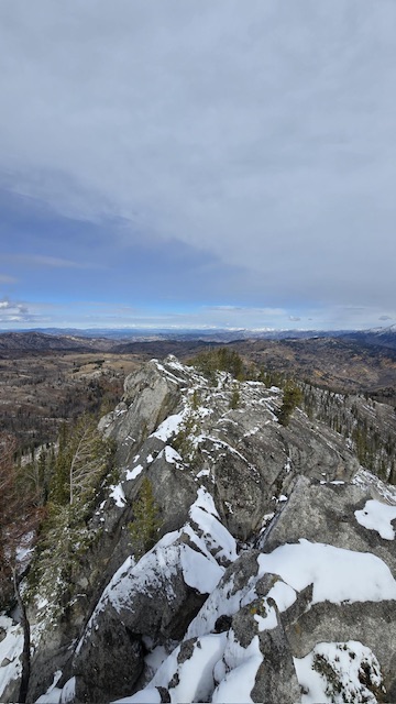
Approaching the summit fin from the south
Access
Featherville, Idaho Access. At the south end of Featherville, turn onto FSR-172 which is signed for Trinity Lakes. Follow FSR-172 for 15 miles to its junction with FSR-129/Trinity Ridge Road. Turn left/south and follow the road past the various Trinity Lakes and then to the pass between Trinity Mountain and Peak 9037 in 5.0 miles. At the pass, turn left onto a rough road that leads east for 0.25 miles to the closed gate. There is parking for up to four vehicles near the gate.
These roads do get regular maintenance and I have spotted passengers cars on them. Nevertheless, the quality and steepness vary and they can be quite rough in places. A high-clearance vehicle with AT tires is always recommended on road in the Boise mountains. Follow the road to the [signed] Big Trinity Lake Campground turn. Drop down to the lake and follow the road along its northern side to the Rainbow Lakes Trailhead.
Southern Access. FSR-129/Trinity Ridge Road [(E)(2.2) on Page 155] leads up from Anderson Ranch Reservoir to the pass between Trinity Mountain and Peak 9037. It is a rough road that is often in need of major repairs. A 4WD is required. Cross the pass and descend the [signed] Big Trinity Lake Campground turn. Drop down to the lake and follow the road along its northern side to the Rainbow Lakes Trailhead.
The Approach
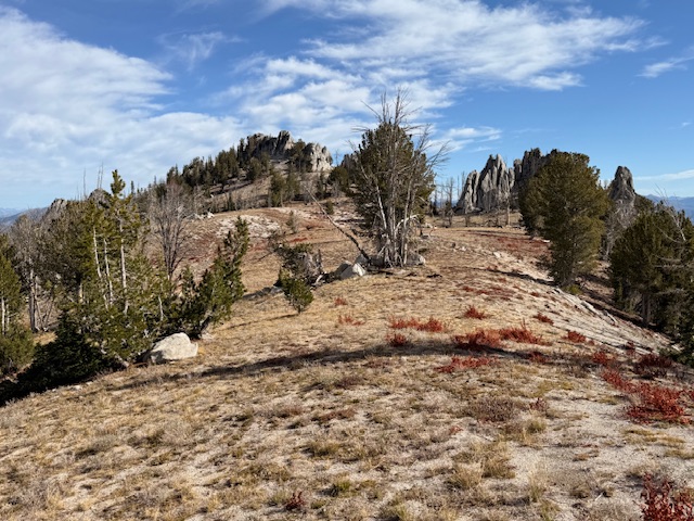
From the trailhead, follow a good trail to the saddle between Fiddlers Perch and Peak 8889. The first section of the trail goes through an old burn and, as a result, there will be some deadfall. Nevertheless, this is a good trail that reaches the saddle in roughly a mile. Leave the trail and climb north up the steep, broad ridge. Pass the first ridge bump on its east side. Once past the bump, the broad ridge is covered by beautiful meadows. You will soon have a view of the summit fin as well as other impressive outcrops. Note (1) that the USGS quad erroneously shows the trail beginning on the south side of the lake and (2) the most recent USFS map does not even show the trail.
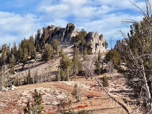
The southernmost granite fins which are located south of the true summit.
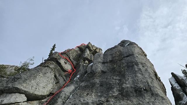
West Face, Class 5.2
Kaden Platt made the first ascent a few days after I told him about the peak. He free climbed it. He reports “The drawn line was the route, and arrow the “crux”. The climbing was all pretty easy, even in the snow. There may even be an easier route from the ridge in dry conditions, so I gave it a “5.fun” rating 5.0-5.2. As for getting off, there was plenty opportunity up top for secure tat if one was to rappel off.”
Kaden’s lime as described above. Kaden Platt Photo
The north/false summit from the true summit. Kaden Platt Photo
North Ridge to False Summit, Class 5
Ridge Baldner wrote a trip report and published it on peakbagger. He wrote in pertinent part “We made our way to the northern side of the high point and found a decent little ‘chute’ to scramble up. Once up on the rock, the high point is just a short walk back in a southern direction (A few Class 3 moves).” On October 10, 2025 Alex Feldman, Steve Grantham, Michael Pelton and I followed this advice to the peaks north ridge. We climbed up ridge via some easy bouldering on granite slabs. There is a register left by John Fredland in this area. The slabs top out on an exposed knife edge ridge which as Baldner correctly writes does lead to a high point. However, the high point is not the true summit. We followed the knife edge a short distance where we encountered high point separated from the true summit by a small notch. The true summit rises vertically out of the notch. Relying upon the Baldner ‘Class 3’ rating, we did not bring any technical gear. As you will see from the photo below, the tower is basically a short, but difficult, exposed bouldering problem with its difficulty increased by at least a 50-foot drop on three sides. Clearly, the summit tower is not Class 3 from this point. So we reversed our route and, without success, looked for another nontechnical route up the tower. The final climb of the summit block route looks is according to Laden Platt (as noted above) an exposed Class 5.2 climb.
Upon returning home I contacted Derek Percoski and asked him to evaluated the peak using LiDAR data. He determined that “the southernmost tower (43.61990851,-115.41270428) is 2.5′ taller than the one 70′ to the north.”
The false summit is on the left/north end with the true summit on the right/south end of the summit block.
The summit tower viewed from the false summit
The summit of Peak 8889
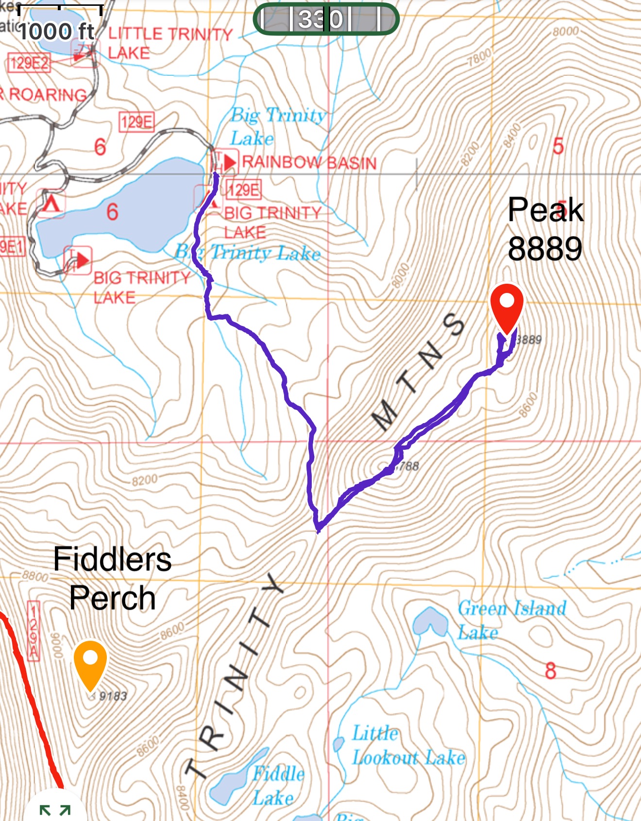
My GPS track showed 3.8 miles with 1,200 feet of elevation gain. Keep in mind that we added distance as we searched for the non-existent Class 3 route.
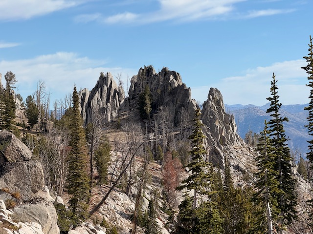
Peak 8889, which is several hundred feet shorter than its neighbors, is interesting because it is covered by many granite towers of varying sizes.
Additional Resources
Regions: Boise Mountains->Trinity Mountains->WESTERN IDAHO
Mountain Range: Boise Mountains
First Ascent Information:
- First Ascent Year: 2025
- Season: Fall
- Route: West Face
- Party: Kaden Platt
Longitude: -115.4127 Latitude: 43.6198