Elevation: 8,933 ft
Prominence: 673
This peak is not in the book. Rick Baugher suggested the name which is based on Irish brothers James snd Neil McDevitt who were pioneer cattlemen in the Lemhi Valley in the 1870s. Published October 2025
Peak 8933 is the high point on a ridge that separates Twelvemile Creek to the west from McDevitt Creek to the east. It is most easily climbed from a ridgeline Forest Service road to its east. USGS Poison Peak
Peak 8933 as viewed from the south. Livingston Douglas Photo
Access
From ID-28 at virtual MM 113.9 (about two miles south of Tendoy), turn west onto [signed] McDevitt Creek Road/FSR-150 and reset your odometer. At 4.1 miles, reach the Salmon National Forest boundary. At 5.4 miles, reach an unsigned road junction with Mormon Canyon Road/FSR-151 (left). At 6.4 miles, cross a cattle guard to reach public land again. At 6.5 miles, reach a signed junction with Sawmill Canyon Road/FSR-209 (left).
Reset your odometer at this junction. Continue west up McDevitt Creek Road. At 2.9 miles, the road bends hard left and leaves the McDevitt Creek drainage. The road gets much rockier and slower from here. At 5.3 miles, reach a “T” junction on the high ridge crest. Go left/south here and drive 0.4 miles up the rocky, narrow 2-track ridge road and park in a pullout about 0.1 miles before the road crests. This pullout is at 8,530 feet and 44°56’50.0”N, 113°48’40.0”W.
Southeast Ridge, Class 2
The Climb
From the roadside pullout, bushwhack directly west up through thinned pine forest to reach the southeast ridge. Scramble northwest up through pine forest with areas of substantial blowdown. Find a massive clearcut area on the right/northeast side of the ridge. Walk north across the edge of this clearcut (next to the forest) then re-enter the forest and bushwhack up the forested summit hump. Move to the left/west side of the ridge crest high up to reach open scrub and avoid endless, large downed trees. The high point is in a semi-forested area and had two torn-down cairns and a fire ring. I built a nice, new cairn on the summit. The terrain falls away in every direction from this point.

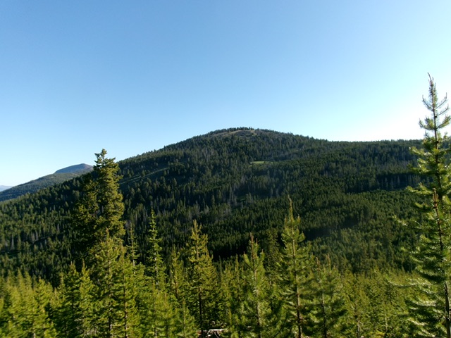
Peak 8933 (summit hump is well left of center) and its southeast ridge (skyline in center and right of center). This was my ascent route. Livingston Douglas Photo
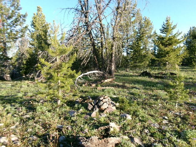
The forested summit of Peak 8933. Livingston Douglas Photo
Additional Resources
Regions: EASTERN IDAHO->Lemhi Range
Mountain Range: Lemhi Range
Longitude: -113.8179 Latitude: 44.9525