Elevation: 9,102 ft
Prominence: 791
This peak is not in the book. The elevation and prominence figures are based on recent LiDAR updates on Peakbagger.com. The USGS quad shows an elevation of 9,098 feet. Published October 2025
Peak 9102 sits on a high ridgeline that connects with both Peak 9140 and Blizzard Mountain (9,313 feet) to the south. It is most easily climbed via its west ridge from Fish Creek Road. USGS Blizzard Mountain North
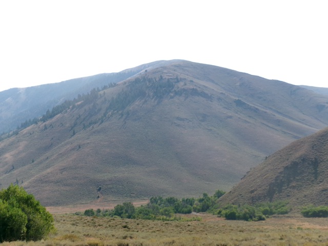
Peak 9102 as viewed from the west. The west ridge (my ascent route) is in dead center coming at the camera. Livingston Douglas Photo
Access
Fish Creek Road is located along US-20 at virtual MM212.1. This road junction is 6.6 miles east of the north end of Carey. Turn north onto [signed] Fish Creek Road and reset your odometer. At 5.4 miles, pass the left turnoff for West Fork Fish Creek Road (signed for “Boat Ramp”). At 6.6 miles, pass the right turnoff for East Fork Fish Creek Road (unsigned). At 9.8 miles, go right at an unsigned junction. At 14.8 miles, reach the Mine Creek Trailhead (right side of Fish Creek Road) at a sharp left/north turn in Fish Creek Road. Park here in a large parking area just below the beginning of Mine Creek Trail [6,155 feet; 43⁰32’39.6”N, 113⁰44’05.0”W].
West Ridge, Class 2
The Climb
Thanks to the ACCESS YES program, Peak 8618 can be climbed from the Iron Mine Creek trailhead. It can also be climbed entirely on BLM land from a bit farther up Fish Creek Road. From the parking area, bushwhack east-northeast through thick-ish sagebrush and cross a dry gully and a shoulder to reach the crest of the west ridge just below a patch of pine forest on the ridge crest. This entry point is also just below steep, loose shale slopes on the south side of the ridge.
Once on the crest of the ridge, scramble right/southeast up a mix of talus/scree and sagebrush to reach the ridge pines. Continue southeast up the steep-ish ridge in a mix of pines, scrub, and talus/scree patches. This forested section is surprisingly rocky underneath. Reach tree line at abut 7,300 feet (surprisingly low). From here, the going is easier on short scrub and stable ground talus. The slope also eases about 100 vertical feet above tree line.
The ridge now heads east then east-southeast then east to the summit. There are a few minor ridge humps (no rocky outcrops) along the way. The ridge terrain has some areas of thicker, gapped sagebrush and becomes rockier underneath as you advance higher. Drop to cross two narrow ridge saddles/notches on the way to the elusive summit hump. The cairned high point sits back and is not visible until you approach it on the tilted summit plateau.
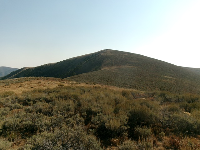
The summit hump of Peak 9102 as viewed from high on the west ridge. This was my ascent route. Livingston Douglas Photo
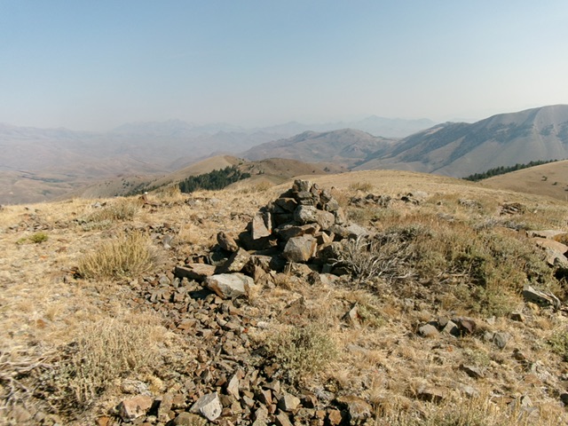
The summit cairn atop Peak 9102. Livingston Douglas Photo
Alternate Climbing Routes, Class 2
Peak 9102 can also be climbed via Point 8808 to the north and its forested west ridge, which begins at an old, unmapped mining road near its base along Fish Creek Road.
Additional Resources
Regions: EASTERN IDAHO->Pioneer Mountains
Mountain Range: Pioneer Mountains
Longitude: -113.6886 Latitude: 43.5419