Elevation: 9,121 ft
Prominence: 284
This peak is not in the book. The elevation is based on LiDAR measurements. The map elevation is 9,108 feet. Updated October 2025
Peak 9121 is an unranked bump on the southwest ridge of Peak 9625. It is most easily climbed in combination with Peak 9625 or directly from Pierce Canyon Road to its west. USGS Copper Mountain
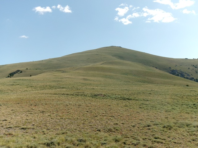
Peak 9121 (dead center) as viewed from early in the ascent of the southwest ridge. Livingston Douglas Photo
Access
From ID-28 at virtual MM51.5 (7.3 miles north of the north entrance to the Birch Creek Campground), turn right/northeast onto a narrow Forest Service road signed for Mahogany Canyon. Reset your odometer at this junction. At 0.8 miles, reach an unsigned road junction soon after crossing a cattle guard/fence. Go right/southeast here onto a 2-track that heads to Worthing Canyon, Pierce Canyon, and Timber Canyon. This rugged 2-track is slow and tedious with lots of rocky areas, rutted sections, and dried mud. Do not attempt to drive this road in wet conditions.
At 1.7 miles, reach a signed road junction. Go right/southeast for Pierce Canyon and Timber Canyon. At 3.7 miles, reach a signed junction (and parking area) with Pierce Canyon Road/FSR-537. Park here [7,001 feet; 44⁰12’36.5”N and 112⁰53’48.04”W) or drive east then northeast up rugged Pierce Canyon Road for 0.5 miles and park alongside the road [7,217 feet; 44°12’52.8”N, 112°53’14.2”W].
Map Errors
The USGS topo map fails to show an old mining road that comes up onto the southwest ridge from the southeast and continues partway up the southwest ridge.
Southwest Ridge, Class 2
The Climb
From the improvised pullout on Pierce Canyon Road, walk briefly up Pierce Canyon Road to a sharp left/northeast bend. Leave the road and bushwhack east through thick-ish sagebrush and a dry gully to reach easier, shorter grass/scrub on the west face of the southwest ridge, staying just right/south of pine forest and left/north of some rocky outcrops. Scramble directly east up steep, but easy, grass/scrub to reach the rounded, open southwest ridge of Peak 9121.
Head left/northeast up the ridge, passing two old mines and finding an unmapped jeep road coming up from the right/southeast onto the ridge. Follow this decent gravel road up the ridge to the base of the final, steep push to the summit hump. Leave the good road here (the road continues left/northwest to God-Knows-Where). Hike up a steep, but good, gravel 2-track to near the summit then scramble a short distance in short grass/scrub to the rocky summit outcrop. I rebuilt the torn-down cairn on the high point.
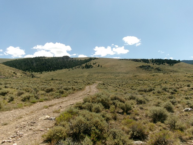
The lower section of the southwest ridge and its west face as viewed from Pierce Canyon Road (start of climb). This was the first leg of my ascent route. Livingston Douglas Photo

The rocky summit of Peak 9121. Livingston Douglas Photo
Additional Resources
Regions: Beaverhead Range->EASTERN IDAHO
Mountain Range: Beaverhead Range
Longitude: -112.85471 Latitude: 44.22047