Elevation: 9,427 ft
Prominence: 302
This peak is not in the book. The elevation is and prominence figures reflect recent LiDAR updates on Peakbagger.com. The USGS quad shows an elevation of 9,431 feet. Published October 2025
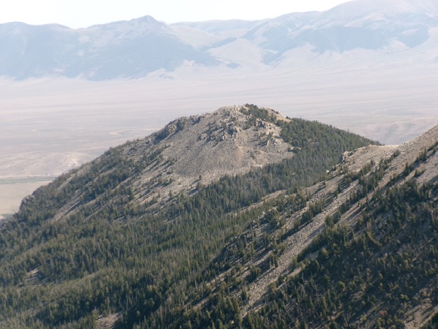
Peak 9427 is a rocky, conical-shaped peak that sits above Deer Creek and the Brown Bull Mine. It is most easily climbed from nearby Deer Creek. Although a patch of the north side of Peak 9427 is private land, there is no fencing or signage to prohibit hiking in this area. USGS Gilmore
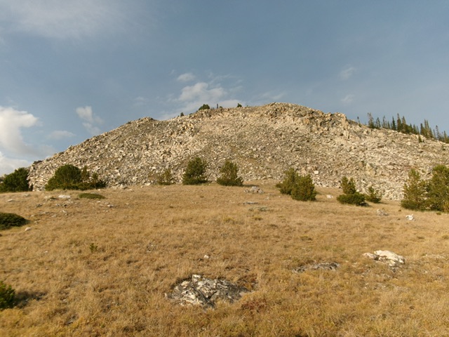
Peak 9427 and its blocky, quartzite summit. Livingston Douglas Photo
Access
Deer Creek Trail [(A)(6.1)(a) on Page 314]. Deer Creek Road/FSR-160 is a brutal road and, except for the first mile or so (up from Junction 6836), is only suited for ATVs and MCs. Prepare to hike most of this road. It is seldom used by motorized vehicles of any kind anymore.
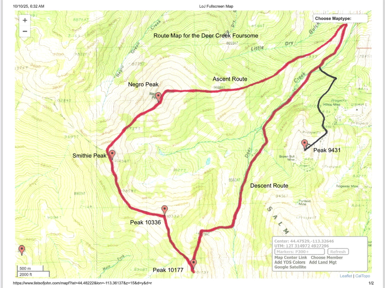
Route map for Peak 9427/9431 (black line).
North Spur/Northeast Ridge, Class 2+
The Climb
Drive (or hike) up Deer Creek Road and leave it to cross Deer Creek at about 7,600 feet. Cross Deer Creek on fallen logs then scramble across a mess of downed timber and boulders in two dry drainages to reach the pine forest at the base of the steep, forested northwest face of the north spur ridge. Bushwhack up through steep, but easy, gapped pines using diagonal elk trails to zig-zag your way to the ridge crest. Reach the crest of the north spur at about 8,000 feet.
Follow the forested, narrow ridge crest (with a game trail in some sections) southwest then south-ish to a sharp left/south-southeast bend. Scramble up a very easy, gapped pine forest and find an elk trail high up that heads right/south toward a ridge saddle just south of Point 8460+. Find an old, unmapped mining road here and follow it briefly right/south to a junction with the jeep road on the ridge crest. Hike up this rocky jeep trail as it heads southwest then south up the forested north spur. The road bends left/southeast cross (and go around) the northeast ridge.
Leave the road soon after it crosses the ridge and scramble right/west up easy grass and scrub to reach the crest of the open, rounded ridge. Head southwest past some scattered pines to reach a flat, grassy area at the base of the rocky summit cap of Peak 9427. Scramble up large quartzite boulders and blocks (Class 2+) to reach the summit area. The summit area is a mix of pines and rocky outcrops and boulders. Go around a false summit hump then scramble up a short patch of easy quartzite boulders to reach the rocky, flat summit. There was a cairn on the high point, which I built up and reshaped. The summit offers magnificent views of Portland Mountain and Negro Peak.
Peak 9427 (in center) and its wicked north face. Livingston Douglas Photo
Peak 9427 and its blocky, quartzite summit. Livingston Douglas Photo
Additional Resources
Regions: EASTERN IDAHO->Lemhi Range
Mountain Range: Lemhi Range
Longitude: -113.3269 Latitude: 44.4743