Elevation: 9,500 ft
Prominence: 560
This peak is not in the book. Updated October 2025
Peak 9500 is the first ranked summit on the Continental Divide south of Lemhi Pass. While reachable via the CDT on the Continental Divide, both the approach from the north and from the south are very long. The west side of Peak 9500 is the shortest approach and comes up from Yearian Creek. It can also be climbed from the Montana side without any private land issues. USGS Lemhi Pass
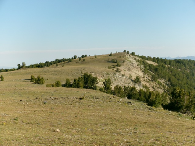
Peak 9500 (in mid-ground) as viewed from Point 9482 to its north. Livingston Douglas Photo
Access and Route from the Montana Side, Class 2
Access
From Tendoy along ID-28, turn east onto Tendoy Lane and drive a short distance to a “T” junction. Go right/south and soon find a gravel road signed for “Lemhi Pass.” Turn left/east onto this road and drive 11.9 up to a 4-way road junction on Lemhi Pass. From Lemhi Pass, go left/north onto [signed] FSR-3909. Reset your odometer here. FSR-3909 soon turns sharply right/south and then heads mostly southeast to reach a signed junction with FSR-3901/Frying Pan Creek Road in 2.7 miles.
Reset your odometer at this road junction. Turn right/south onto FSR-3901 and drive 7.7 miles to reach a sharp bend in the road at a major dry gully. Park on a spur road in the gully near the junction with FSR-3901. This parking spot is at 7,462 feet and 44°54’13.5”N, 113°27’23.9”W.
Northeast Shoulder, Class 2
The Climb
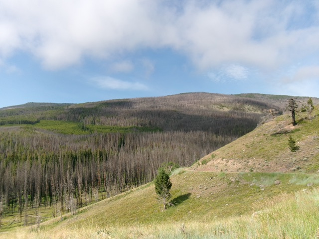
From the road bend, bushwhack briefly south up through a thick pine forest with some burnt snags and logs. Quickly reach easier forest and find a ridge crest heading left/southeast that sits above (and skirts the north side of) a massive patch of thick, new growth pines. Head right/south on the shoulder as it skirts the left/east side of the patch of new growth pines. This ridge quickly leads to the crest of the northeast shoulder. Follow a game trail up through the easy, mature pine forest. The game trail soon disappears. The ridge steepens and bends right-ish/southwest then west-southwest. The forest is thicker, steeper, and has much more deadfall and burnt logs. The forest soon becomes a burn area with a tedious amount of downed logs and trees to work around.
Higher up, reach a flattish area and a marsh. Skirt its right/north side and head directly west up a headwall of sorts at 8,800 feet. Move right/north a little to lessen the steepness of the climb. You are now back in a live pine forest with minimal blowdown. Find a game trail at about 8,900 feet and follow it diagonally left/southwest as it goes up to the ridge area north of Point 9394. Point 9394 is a rocky hump with a MT/ID iron post (and cairn) just below it to its southwest in the forest.
From Point 9394, bushwhack south-southwest up the narrowing ridge in easy pine forest. Quickly cross to the west side of a fence row and find the ridge road. Follow the ridge road south to just northwest of Point 9482. Leave the road and hike up easy tundra to reach the cairned top of Point 9482. This point actually measured HIGHER than the official high point of Peak 9500. Go figure. From Point 9482, the official, gentle hump that is Peak 9500 is due south-southeast.
Descend south-southeast to a minor saddle in easy scrub/grass and intercept the ridge road. Follow the ridge road briefly then leave it to scramble left/east to the actual high point in the Peak 9500 area. The high point sits in Montana and is not on the ID/MT state line. There is no noticeable hump with a higher contour line (as the USGS topo map shows). The actual high point sits on the ridgeline that connects with Point 9482 and is west of Point 9468. The ridge road goes past an ID/MT iron post nearby to the south of the high point.
I found a large fire ring (of sorts) just northwest of the ID/MT marker. Is this where LOJ believes the high point of Peak 9500 is? I don’t know. But I do know that this fire ring is NOT the high point in this small area. And, most interestingly of all, Point 9482 (about a half mile to the north) measures higher than anything in this area. Since, in actuality, there is no higher contour line on this south summit area, the map is wrong and so is LOJ. Point 9482 measured a whopping 25 feet higher than the highest point in the southern summit area. So even the Point 9468 measurement seems too high for that spot.
All I can say is, stand atop the official/southern summit hump area AND atop Point 9482 because LiDAR may rectify this situation in the near future and show the southern summit at about 9,460 feet or so. That would make Point 9482 the ranked summit in this area. Point 9482 sits on the ID/MT state line.
Peak 9500 (high ridge in dead center) and its massive northeast side (in Montana). This was the bulk of my ascent route to the summit ridge. Livingston Douglas Photo
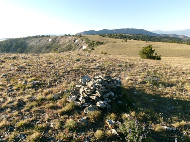
Point 9482 as viewed from the south. This may be the actual high point rather than mis-measured Peak 9500. Livingston Douglas Photo
North Access and North Ridge Route, Class 1
From ID-28 at Tendoy, drive up the well-maintained Lewis and Clark Backcountry Byway to Lemhi Pass. From Lemhi Pass, drive south on the ridge road until the road becomes impassable or is closed to motor vehicles. Hike the remaining distance on the ridge road (or on remnants of it) or on the CDT to reach the summit.
South Access and South Ridge Route, Class 1
Please refer to the access for Peak 9180. Climb Peak 9180 then continue northwest then north along the Continental Divide on an old 2-track to reach the summit.
West Access and West Ridge Route, Class 2
From ID-28 at Lemhi, turn right/east onto [signed] Lemhi Road and follow it southeast then south to Yearian Creek Road. Drive east then north up 4WD Yearian Creek Road to about 5,800 feet and park. Leave the road and bushwhack east up onto a jeep road that follows a ridge crest up to 7,500 feet. Leave the jeep road here and follow the ridge east then northeast to find another 2-track road at 8,300 feet. Hike northeast up this road to the summit. If Yearian Creek Road is accessible to the public, this is the shortest route to the top. However, it requires a substantial amount of elevation gain compared to the other two approaches.
Additional Resources
Regions: Beaverhead Range->EASTERN IDAHO
Mountain Range: Beaverhead Range
Longitude: -113.4578 Latitude: 44.8762