Elevation: 8,314 ft
Prominence: 318
This peak is not in the book. Published October 2025
Pepper Creek Ridge HP is the high point on lengthy Pepper Creek Ridge. It sits above the headwaters of Deep Creek. Pepper Creek Ridge sits below, and west of, the main ridge crest that heads south from Williams Creek Summit. Pepper Creek Ridge is most easily reached from a spur road off of Iron Lake Road. USGS Cobalt
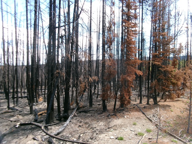
Pepper Creek Ridge (behind the charred snags) as viewed from Saddle 8178 to its southwest. Livingston Douglas Photo
Access
From US-93 about five miles south of Salmon, turn west onto Williams Creek Road (signed for Williams Lake) and drive 13.5 miles up this well-maintained county road to Williams Creek Summit. Reset your odometer here. From Williams Creek Summit, head south on FSR-020, a rocky ridge road. A sign here says “China Spring 7 miles; Iron Lake 19 miles.”
At 6.2 miles, reach a signed junction with Degan Mountain Road/FSR-045 (left). Continue straight on FSR-020. At 8.2 miles, reach an unsigned junction. Go right here onto unsigned FSR-025 and drive 0.9 miles to a saddle and a 4-way junction. Park at this junction [7,980 feet; 45°00’54.5”N, 114°08’04.4”W]. There is an unmapped jeep road that crosses this saddle from southwest to northeast.
Map Updates
The USGS topo map fails to show all of the old 2-track roads in this area.
Southwest Ridge, Class 2
The Climb
From the road junction, hike northwest then north up FSR-025 which is now a more rugged 2-track road with fallen trees poking into the road. After 0.6 miles, reach Saddle 8178. There is an unmapped road junction here with another weak 2-track. Go right/east onto a weak 2-track and follow it into the forest where it soon bends left/north and drops 60 vertical feet.
The 2-track skirts the left/west side of Pepper Creek Ridge and goes to God-Knows-Where. Leave the 2-track and bushwhack northeast to the summit area in an easy burn area with scattered snags, no understory, and an ashen ground base with no rocks. The high point is at the north end of a forested area (live pines plus charred snags). It has a minor hump with a large tree stump as the high point. I built a summit cairn next to it.
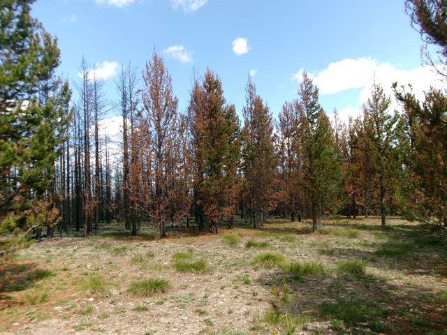
The semi-open, charred summit area of Pepper Creek Ridge. Livingston Douglas Photo
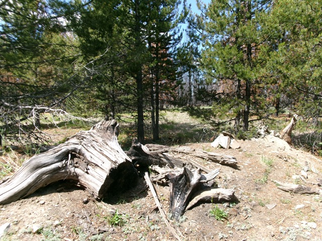
The forested high point of Pepper Creek Ridge. Livingston Douglas Photo
Additional Resources
Mountain Range: Eastern Salmon River Mountains
Longitude: -114.12961 Latitude: 45.02744