Elevation: 5,590 ft
Prominence: 540
This peak is not in the book. This peak is popular with Carey, Idaho residents. For an alternative route popular with locals, use the link below for Dave Pahlas’ trip report. Published October 2025
Queens Crown is a beautiful butte located on the south side of US-20 just west of Carey, Idaho. This area is a mix of private and public land, so be careful. This climb is entirely on public land. Queens Crown is mostly on BLM land. USGS Carey
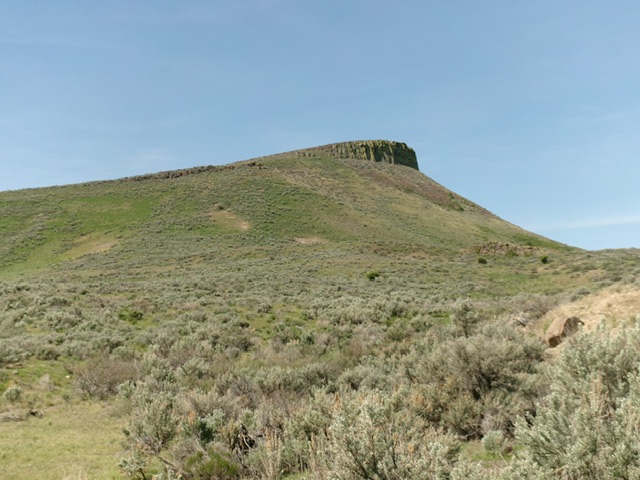
Queens Crown as viewed from the northeast (start of climb). Livingston Douglas Photo
Access
Park at the junction of US-20 and a spur road to a Waste Transfer Station (highway sign). This junction is 1.9 miles west of the US-20/US-93 junction in downtown Carey and is Junction 4992 on maps. This spur road is on county land and is publicly accessible. The pullout at this junction is at 43°17’36”N, 113°58’46”W.
Northeast Shoulder, Class 2
The Climb
From the pullout, bushwhack southwest through thick-ish sagebrush and cross a cattle fence. Continue southwest in easier grass and scattered scrub to reach a prominent shoulder to the right/north. Climb this steepening shoulder. Bash your way up through much steeper, thick-ish sagebrush and underlying talus/scree to reach a rocky headwall.
Find a gap in the headwall near its right/northwest end at a large block. Once atop the headwall, scramble southwest in easier (less rocky) grass, scrub, and gravel. Ascend a steep-ish face/minor shoulder of thick-ish sagebrush to reach the open rock of the top of this beautiful butte. Head right/northwest to the open summit and high point. The primary USGS benchmark is gone but the secondary one remains in a ground boulder.
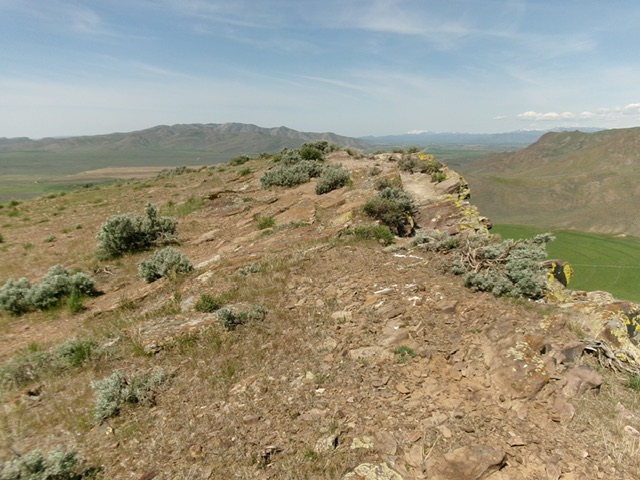
The rocky summit of Queens Crown. Livingston Douglas Photo
Additional Resources
Regions: EASTERN IDAHO->Pioneer Mountains
Mountain Range: Pioneer Mountains
Longitude: -113.9887 Latitude: 43.2898