Elevation: 4,305 ft
Prominence: 38
This peak is not in the book. Published October 2025
Register Rock is a perplexing objective. There is no rocky outcrop or obvious hump (as LOJ and the USGS topo map suggest). It seems like the high point is on minor ridge (with a fence row) on the southeast side of I-86, not too far above the highway. USGS Register Rock
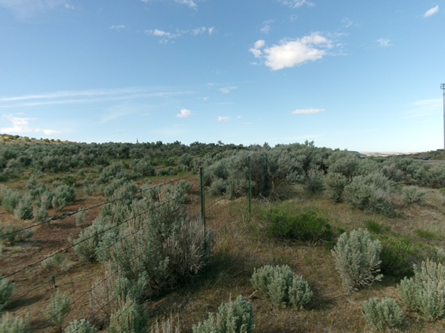
The sagebrush summit area (and fence row) of Register Rock. Livingston Douglas Photo
Access
From Exit 28 on I-86, head southeast then south then southwest on [paved] Register Road for 2.0 miles to the [signed] Register Rock Picnic Area. Park along the road to avoid the $7 day use fee at the picnic area (an Idaho State Park).
North Face, Class 2
The Climb
From the picnic area, bushwhack southeast through scrub to reach I-86. Cross both lanes of I-86 and bushwhack up to a fence row near the highway. Head right/southwest up the fence row to the high point area. There is no summit cairn or obvious high point or hump. This is truly a confusing one. I ran my GPS to find the LOJ high point, but it was not the highest point at all. If you continue southeast and reach the [marked] gas pipelines, you’ve gone too far southeast. I found nothing even close to a 38-foot rise for this peak.
Additional Resources