Elevation: 5,436 ft
Prominence: 86
This butte is not in the book. Published October 2025
Rock Butte is a rocky outcrop that sits south-southeast of mighty Big Southern Butte and due east of nearby Rock Corral Butte. It is most easily reached via BLM roads that get you reasonably close to the butte. USGS Rock Butte
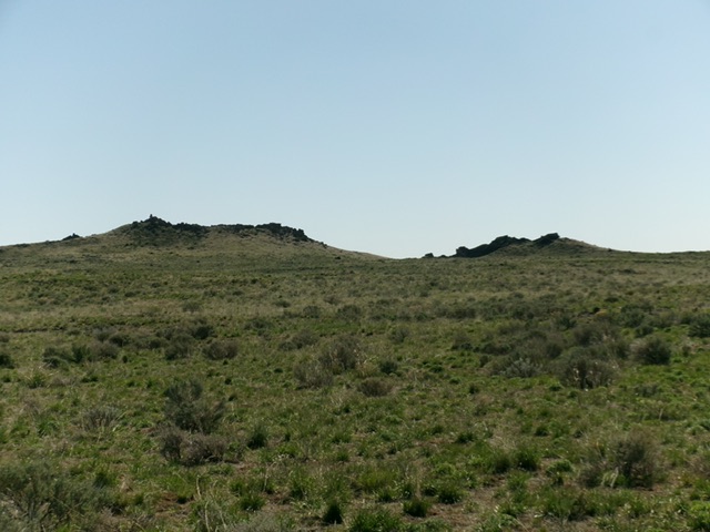
Rock Butte as viewed from the west. The cairned high point is well left of center. Livingston Douglas Photo
Access
Same as for Rock Corral Butte. From the critical unsigned junction at the 2.7-mile point on Cow Pasture Road, reset your odometer and head left/south (then east-southeast) on a decent 2-track road that heads toward Rock Butte. At 0.6 miles, go straight/east at an unsigned (and unmapped) junction. At 1.9 miles, pull off the road and park in the field grass [5,322 feet; 43°18’29”N, 112°58’26”W].
Map Errors
The “jeep trail” shown on the USGS topo map is actually an “OK” 2-track road that continues down along the east side of Rock Corral Butte. The 4WD road on the lower east side of Rock Corral Butte (and on the northwest side of Rock Butte) no longer exists and there are no remnants of it that remain. There are unmapped 2-track roads in the area around Rock Corral Butte and Little Wildhorse Butte that are not shown on the USGS map. A 2-track road that separates Rock Corral Butte from Rock Butte (and heads south to Point 5396) no longer exists.
West Face/North Ridge, Class 2
The Climb
From the 2-track road [improved] pullout, bushwhack east toward the obvious butte. The north summit is the high point. Aim for a flat spot just left/north of the north summit and climb it easily from there. There is a massive cairn atop the high point, visible for miles. The terrain on this climb is an easy grass/scrub bushwhack with some ups and downs. There is a 20-foot hidden rock shelf to downclimb (then re-climb on the return) on the way to the final push up the west face to the north ridge.
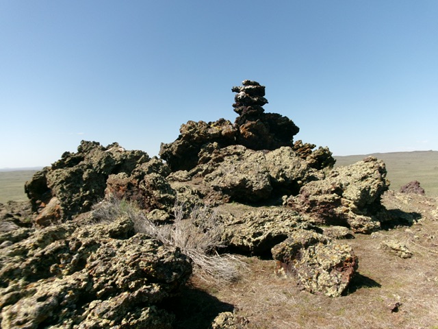
The summit of Rock Butte with its massive summit cairn. Livingston Douglas Photo
Additional Resources