Elevation: 5,650 ft
Prominence: 461
This butte is not in the book. Published October 2023
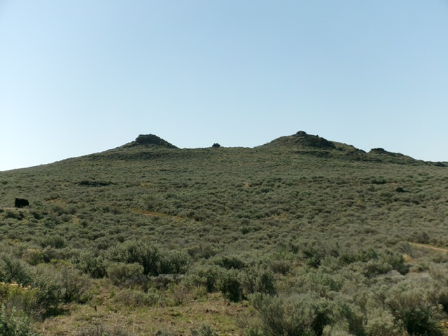
Rock Corral Butte is a minor rocky outcrop that is located south of Big Southern Butte on the Snake River Plain west of Idaho Falls. It can be approached on decent BLM roads and combined with a climb of nearby Little Wildhorse Butte (5,445 feet). USGS Sunset Lake
Rock Corral Butte as viewed from the northwest. Livingston Douglas Photo
Access
Same as for Cedar Butte. Drive west then southwest on well-graded Cedar Butte Road (signed) to an unsigned, critical junction near the southeast corner of Big Southern Butte. Ignore any side roads and go left at a signed junction at 4.8 miles. Reset your odometer at the critical junction. Go left/southeast onto Stage Road (unsigned) [Big Butte Springfield Road on the USGS topo map] and drive 2.7 miles to an unsigned road junction.
Go right/southwest at this junction onto Cow Pasture Road (USGS map) and reset your odometer. Drive 2.7 miles to an unsigned, critical junction with a 2-track road that heads left/south (then southeast) to Rock Butte. Continue straight/west at this junction. At 3.4 miles, reach an unmapped junction. Go left/south here to stay on the main road. At 3.6 miles, reach an unsigned junction with a 2-track road (“jeep trail” on the USGS map) that heads left/southeast.
Go left onto the 2-track road and follow it for 0.8 miles to an unmapped road junction. Go right/southwest here and drive 100 yards on this spur road or continue a short distance to the road’s end at a dispersed camping area amidst the rocky outcrops of the summit area of Rock Corral Butte (at its north end). Due to a steep, rocky section, I parked short of the road’s end at 5,595 feet and 43°18’16.3”N, 113°00’03.1”W.
This is the first leg of a 2-peak adventure that includes Rock Corral Butte and Little Wildhorse Butte (5,445 feet). It covers 4.4 miles with 475 feet of elevation gain round trip.
Map Errors
The “jeep trail” shown on the USGS topo map is actually an “OK” 2-track road that continues down along the east side of Rock Corral Butte. The 4WD road on the lower east side of Rock Corral Butte (and on the northwest side of Rock Butte) no longer exists and there are no remnants of it that remain. There are unmapped 2-track roads in the area around Rock Corral Butte and Little Wildhorse Butte that are not shown on the USGS map. A 2-track road that separates Rock Corral Butte from Rock Butte (and heads south to Point 5396) no longer exists.
North Face, Class 2+
The Climb
From the spur road, hike briefly up the road. Leave the road and scramble west then slightly right/north to the top of a rocky hump. This is NOT the northernmost outcrop that Baugher refers to. Descend south to the top of the spur road at a flat campsite area. From there, scramble northeast the north to the blocky, cairned high point of Rock Corral Butte.
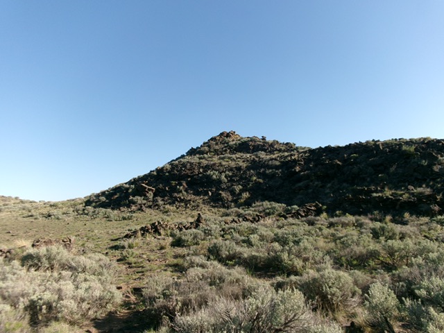
Rock Corral Butte as viewed from the flattish road end just to its southwest. Livingston Douglas Photo
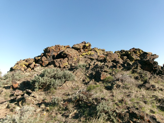
The rocky summit of Rock Corral Butte. Livingston Douglas Photo
South Ridge, Class 2
The Descent (then Ascent)
From the summit, carefully descend back to the campsite area. Follow a use/cattle trail south through the middle of the rocky outcrops of this butte to reach less-rocky terrain and the left/east side of the southern section of the butte’s summit massif. Bushwhack directly south at [visible] Little Wildhorse Butte. The terrain is relatively easy—cattle-grazed grass and gapped sagebrush with some ground boulders/talus and minor rock strata/shelves to skirt or climb over. Continue south, straight at Little Wildhorse Butte and reach a road junction (shown on maps) at the base of the north face. This concludes the first leg of today’s 2-peak journey. Little Wildhorse Butte is up next.
Additional Resources