Elevation: 8,956 ft
Prominence: 584
This peak is not in the book. Updated October 2025
Round Mountain is a forested hump located in the southeast corner of Copper Basin. It sits above the Middle Fork of Cherry Creek and is northeast of Antelope Pass. Round Mountain is most easily reached via an up-and-down ridge traverse from Lupine Mountain. USGS Shelly Mountain
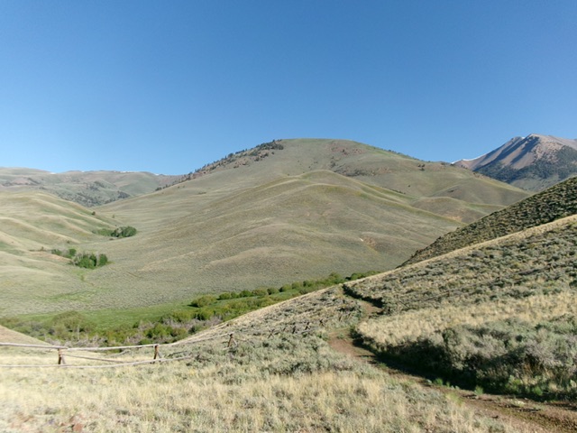
Round Mountain (dead center) as viewed from Cherry Creek Road (start of climb). Livingston Douglas Photo
Access
From US-93 about 10.8 miles northwest of the US-93/US-20 junction in downtown Arco, turn left/southwest onto [signed] Antelope [Creek] Road. Drive 10.8 miles on this well-maintained county road to a signed junction with Cherry Creek Road just before a bridge crossing of Antelope Creek. Reset your odometer here. Drive west on Cherry Creek Road for 2.7 smoothly-graded miles to an unsigned road junction.
Go right/northwest at this junction to continue up Cherry Creek Road. The road now becomes a rough, narrow 2-track road. Reset your odometer at this junction. At 4.8 miles, reach an unsigned junction with a 2-track spur road (FST-4335) heading left/west. Continue northwest up Cherry Creek Road. At 6.9 miles, the rugged 2-track road ends and becomes an ATV trail. Park in a nice parking area here at the ATV trailhead [6,904 feet; 43°46’11.3”N, 113°41’40.1”W].
Map Updates
The USGS topo map mis-positions the Cherry Creek ATV trail. The trail stays on the east side of Cherry Creek. It drops slightly from the trailhead then contours north along the east side of Cherry Creek about 75-100 feet above the creek drainage.
Southeast Ridge, Class 2
The Climb
From the trailhead parking area, hike about 50 yards north on the ATV trail as it drops to cross an open iron National Forest gate. Leave the ATV trail here and follow an old 2-track left-ish/northwest down a dry gully to reach the Cherry Creek drainage. Look hard for this gully because it is easy to pass it by. Once down at creekside, continue north on the remnants of an old 2-track (which is still shown on the USGS topo map) as it becomes mostly a cattle trail. The 2-track soon heads left/west and fords Cherry Creek. Jump across the small creek just upstream from the 2-track crossing.
Once across the creek, scramble northwest up a sagebrush shoulder that gains definition as you move higher. The ridge wiggles left-ish/west-northwest then jogs right-ish/north to reach Point 7594, the second of two bare humps here. Continue northwest on the narrow ridge crest and follow a game trail 30 vertical feet down to a saddle. From the saddle, head west on a game trail then northwest until the ridge ends and becomes part of the southeast face.
The terrain steepens and the game trail disappears. The face is rockier and has thicker sagebrush than the terrain lower down. Continue up the slope between pine trees (to the left/west) and a few large boulders (to the right/east). Higher up, the slope eases and the underlying rock disappears. The final scramble to the summit is on short grass and scrub. Head right/north to reach the high point. I built a cairn there.
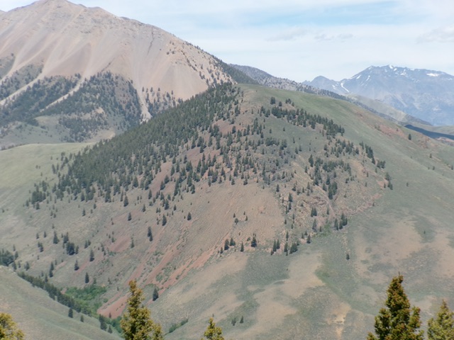
Round Mountain (in mid-ground) as viewed from Middle Mountain to its south. Livingston Douglas Photo
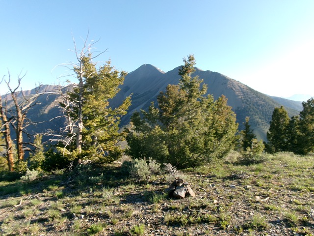
The summit of Round Mountain with Shelly Mountain in the distance. Livingston Douglas Photo
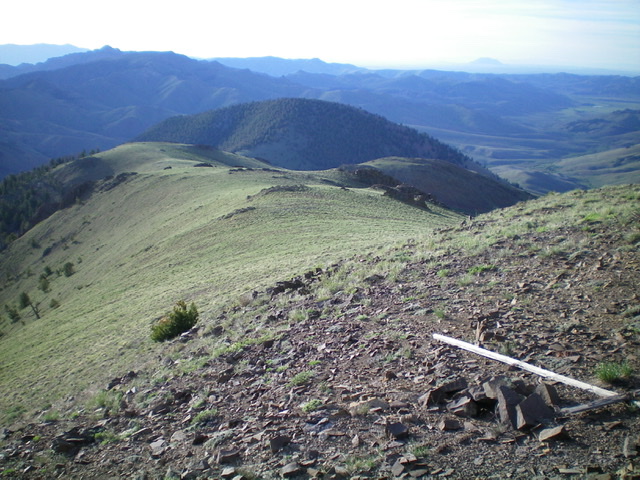
Round Mountain is the forested hump in mid-ground (dead center). This view is from Lupine Mountain. It shows the weaving, undulating connecting ridge between the two peaks. Livingston Douglas Photo
Additional Resources
Regions: EASTERN IDAHO->White Knob Mountains
Mountain Range: White Knob Mountains
Longitude: -113.71979 Latitude: 43.78801