Elevation: 10,545 ft
Prominence: 525
Climbing and access information for this peak is on Page 256 of the book. Livingston Douglas revised this page adding more detail, a new descent route, and new photos. Additionally, he linked this peak up with two additional 10ers. See his trip report at this link: The Scorpion Cirque Traverse. Updated October 2025
While not the highest peak in the mid-section of the Pioneer Mountains, Scorpion Mountain is one of the few peaks in this area with an official name. It is also a nice scramble. USGS Star Hope Mine
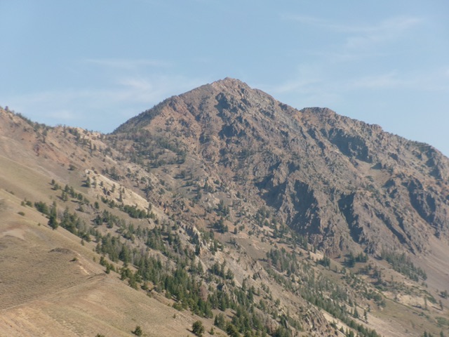
Scorpion Mountain as viewed from the south. Livingston Douglas Photo
Access
Copper Creek Road/Garfield GS Access [(E)(1) on Page 261]. Here are more detailed driving directions. From US-20 at the north end of Carey, turn west onto [signed] Little Wood Reservoir Road. Reset your odometer here. At 13.7 miles, go straight (left is signed High Five Road). At 14.7 miles, go left (right is signed Flat Top Road). At 20.1 miles, go left (right is signed for the Flat Top Ranch). At 23.3 miles, reach the spur road for the Muldoon Canyon Ranch.
Go straight to stay on Copper Creek Road. At 23.6 miles, reach the Muldoon Canyon Road/FSR-126 (right). Stay straight on Copper Creek Road. At 25.3 miles, reach a cattle guard and the National Forest boundary. At 26.0 miles, reach the Copper Creek Campground. At 26.1 miles, reach a signed road junction. Go right/north and drive 0.7 miles up a rugged 2-track road to its end at the mouth of Garfield Canyon. Park here [6,910 feet; 43⁰37’09.1”N, 113⁰55’41.6”W]. Motorized access up Garfield Canyon ends here.
This is the first leg of a 3-peak adventure that includes Scorpion Mountain, Pincer Peak (10,650 feet), and Antares Peak (10,651 feet). It covers 9.5 miles with 5,050 feet of elevation gain round trip.

Scorpion Mountain as viewed from the west. The west rib begins where the canyon forks (just right of center) and climbs to the south ridge (skyline right of center). This was my ascent route. Livingston Douglas Photo
Map Errors
Contrary to the USGS topo map, there is only a foot trail for the first mile up into Garfield Canyon. The old road is simply gone.
West Rib/South Ridge, Class 3
The Climb
From the parking area at the trailhead (and mouth of Garfield Canyon), hike up a foot trail into Garfield Canyon. The trail is initially in an old road bed. The road bed ends fairly soon and the trail becomes a pathetic, overgrown, narrow foot trail that is difficult to follow. About a mile up Garfield Canyon, find an old mining road (shown on maps) that heads left/west from the middle of the drainage up onto the west side of the drainage.
Hike up the old, overgrown, 2-track mining road for a short distance as it switchbacks right/northeast and follows the Garfield Canyon drainage. Reach a major switchback that heads left/west-southwest and goes well up and away from the creek drainage. Either continue to follow the weaving road and follow other mining roads higher up that head toward the east fork of Garfield Canyon OR leave the road here (as I did) and bushwhack up the west side of the drainage in sagebrush to more directly reach the major fork in the canyon at 7,700 feet. The terrain is thick-ish grass and scrub with some meager game trails. Not a whole lot of fun.
From the fork, bushwhack east in easier grass and scrub to find another canyon fork with small streams on either side of a forested shoulder. This shoulder is the west rib of Scorpion Mountain. Its toe is at about 8,000 feet. Climb east up the west rib in a mix of scrub and aspens/pines with a game trail of sorts on the ridge crest. Higher up, the trees end and the ridge becomes a steep-ish talus/scree climb. There is a better, forested ridge to the right/south across a minor gully. That ridge is the continuation of the west rib. If you were to continue directly ahead, the west rib ends and a very steep, rocky, ugly face awaits you.
Angle over onto the pine-clad ridge/rib and follow a game trail through thick pine forest to reach its south side and open sagebrush. Climb east up this steepening rib with scattered pines and much rockier terrain. The Class 2+ terrain is a mix of talus/scree, gravel patches, rocky outcrops, and scrub. Scramble up onto the south ridge in open, steep rock with rocky outcrops to boot (Class 3 work). Once on the south ridge, head left/northeast up the Class 3 ridge crest with endless rocky outcrops, ridge rock, and talus.
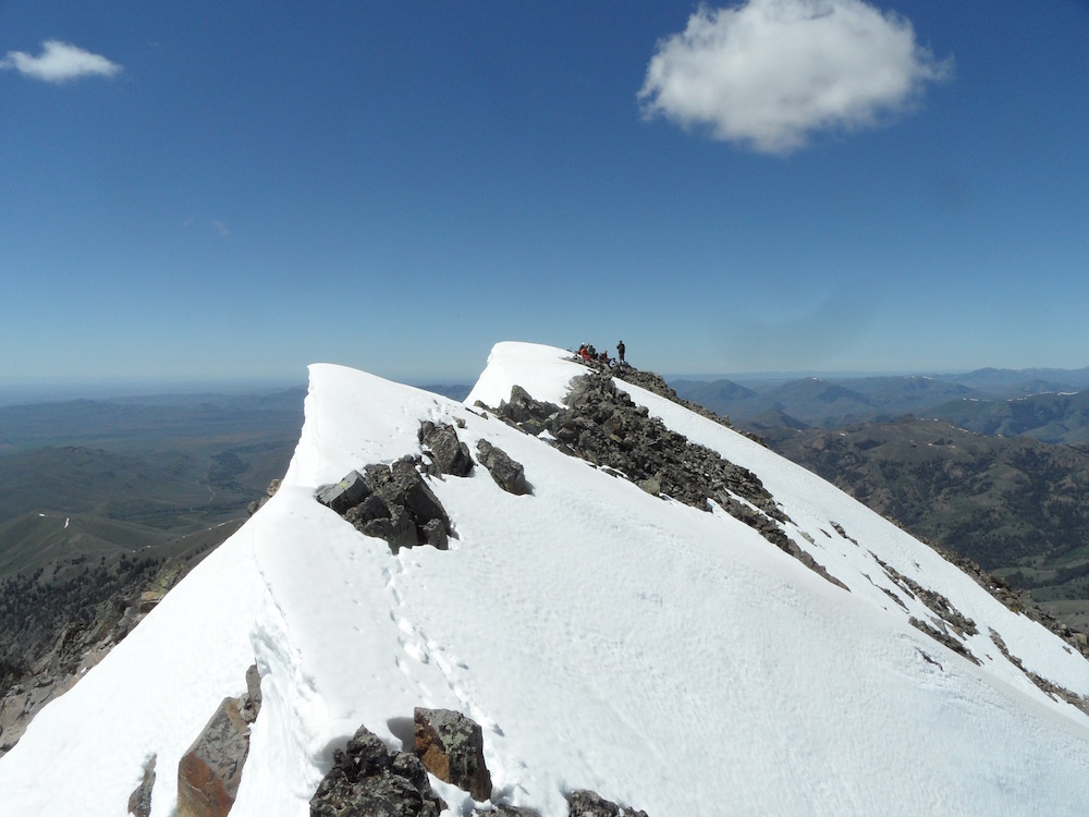
Reach the southwest summit hump (USGS benchmark “Scorp” is here) with several wooden boards laying on the ground. You should realize that this is NOT the high point. Continue scrambling northeast to a rocky hump of similar height with the USGS benchmark “Scorpion” atop it with a small cairn. THIS is the official high point of Scorpion Mountain.
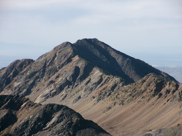
Scorpion Mountain as viewed from The Claw (10,613 feet) to its northwest. Livingston Douglas Photo

The USGS benchmark (“Scorpion”) atop Scorpion Mountain. Not to be confused with another USGS benchmark (“Scorp”) on a nearby rocky hump. Livingston Douglas Photo
North Ridge, Class 3
The Descent
From the official/northeast summit, descend northeast then left/north-northwest amidst many rocky ridge outcrops to reach flatter, easier ridge rock. The final descent to the connecting saddle with Pincer Peak (10,650 feet) requires some Class 3 maneuvers through ridge outcrops on the narrow ridge crest. The 10,020-foot connecting saddle concludes the first leg of today’s 3-peak journey. Pincer Peak is up next.
My 1994 photos of the route found in the book
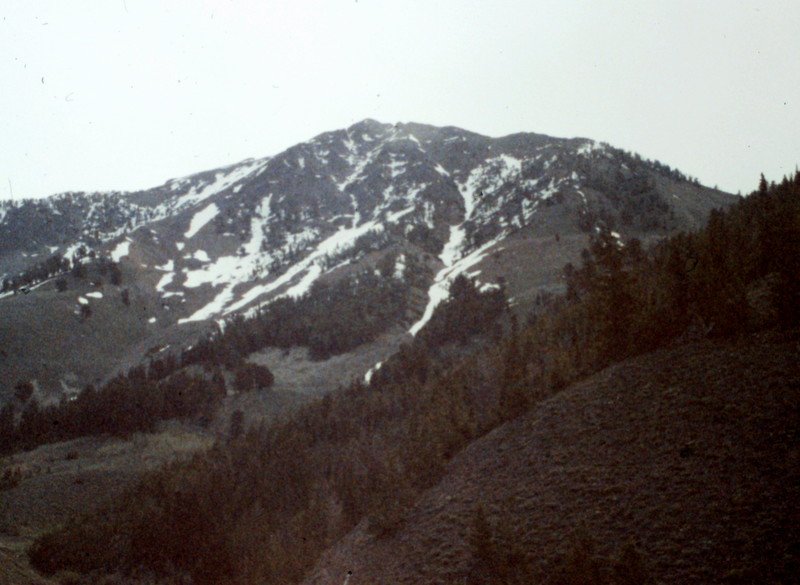
The west face of Scorpion Mountain
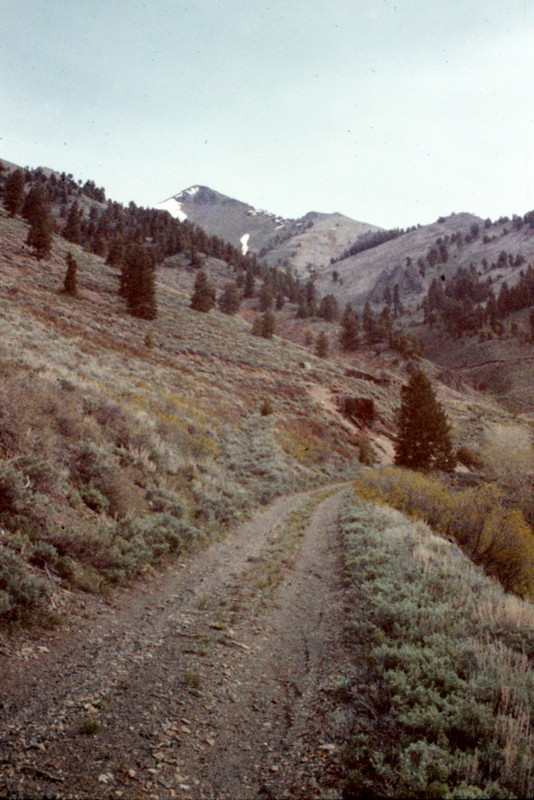
The old mining road leading to Scorpion Mountain
The summit of Scorpion Mountain. John Platt Photo
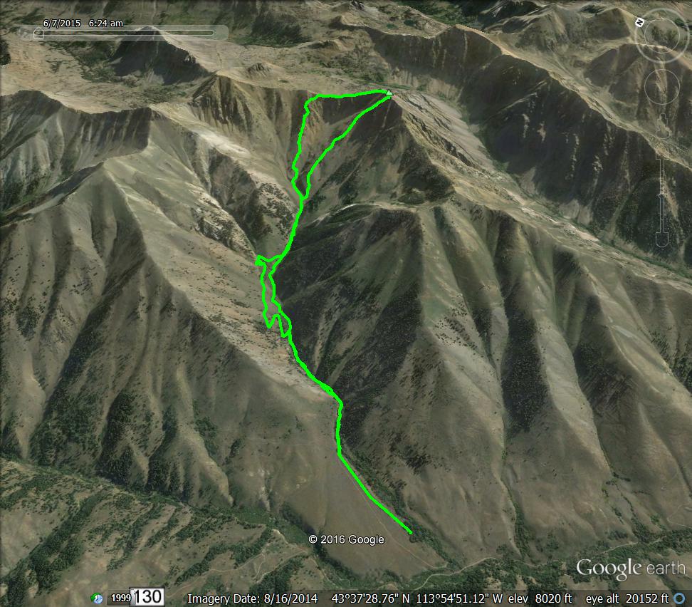
This Western Route parallels the stream on the approach and follows the old mining road on the descent (2016). Margo Mandella GPS track
Additional Resources