Elevation: 8,159 ft
Prominence: 859
This peak is not in the book. Livingston Douglas added a new access point, new climbing route, and new photos. Updated October 2025
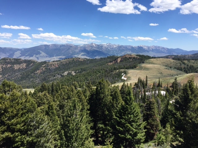
I ignored Sheephorn Mountain when I wrote the book because it has a road to the summit. Big mistake! This is an impressive peak with great views. The peak is located on the Eastern Edge of the Salmon River Mountains between Challis and Salmon. Although the peak has only 815 feet of prominence, it seems taller because of the precariously perched lookout, the depth of the nearby Salmon River Canyon, and the fact that higher terrain is a long distance away. I have never had a better view of the Northern Lemhi Range and you can see as far south as Mount Borah. The view of the surrounding Salmon River Mountains provides a seldom-seen perspective on the vastness of the range. USGS Degan Mountain
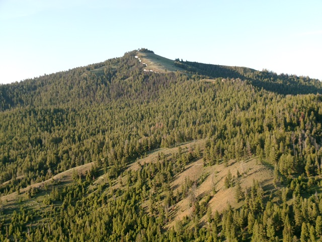
Sheephorn Mountain as viewed from Peak 7502 to its north. Livingston Douglas Photo
Access and Driving Route, Class 1
To reach the peak, take US-93 for 23 miles south of Salmon or 34 miles north of Challis. Turn onto Iron Creek Road and follow it for 4 miles. Then turn left onto Peel Tree Road, which becomes FS-083 in 6.8 miles.
Another 2.7 miles on FS-083 will take you to a saddle and a junction with the Sheephorn Mountain Road. The road is steep but great up to this point. Turn left at the junction and follow the rough road for another five miles to the summit. I recommend a high-clearance vehicle for the last five miles. You can park at any point and hike or ride a mountain bike to the summit. The lookout is no longer in use but is still in fair condition.
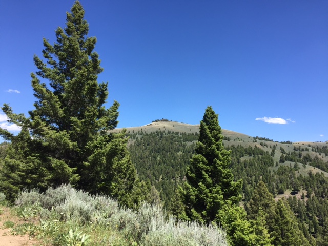
Sheephorn Mountain as viewed from the east
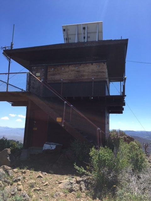
The boarded-up lookout
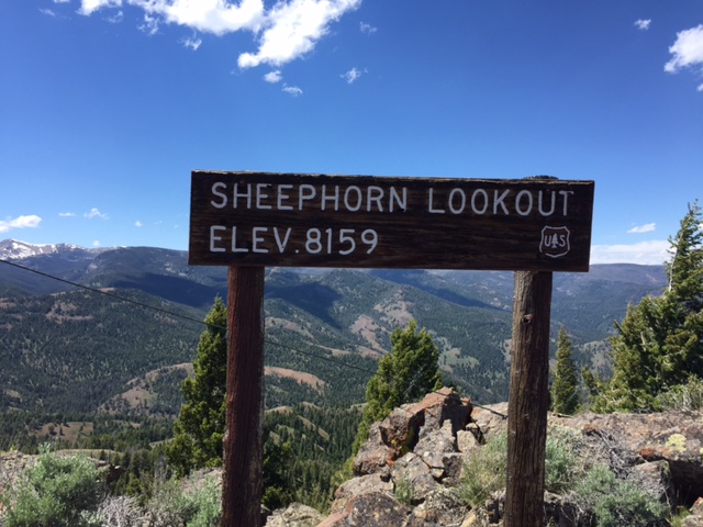
The obligatory sign photo
The Northern Lemhi Range
West Face/Northwest Ridge by Livingston Douglas
Access
From US-93 northwest of Challis at virtual MM280.9, leave the highway and cross a nice bridge to the west side of the Salmon River. After crossing the bridge, reach a “T” junction. Go right/north onto Iron Creek Road and drive 3.9 miles northwest up this well-maintained county road to a signed junction with Peel Tree Road/FSR-083. Reset your odometer here.
Drive southwest up the winding, steep-ish road. At 6.8 miles, reach a saddle crossing and a signed road junction with FSR-446 (right). Continue straight on Peel Tree Road/FSR-083 and drive another 1.0 miles to a pullout. This pullout is about 0.1 miles before reaching a major right/northwest bend in the road. Park at this pullout [7,015 feet; 44°53’25.1”N, 114°06’04.6”W]. This is a better access point if you want to avoid the more rugged road approach used by Tom Lopez.
Map Updates
The jeep trail to the summit (shown on the USGS topo map) no longer exists. There are not even any remnants of it. There IS a decent service road coming up from the south to the lookout on the summit. This service road is not shown on the USGS topo map.
West Face/Northwest Ridge, Class 2
The Climb
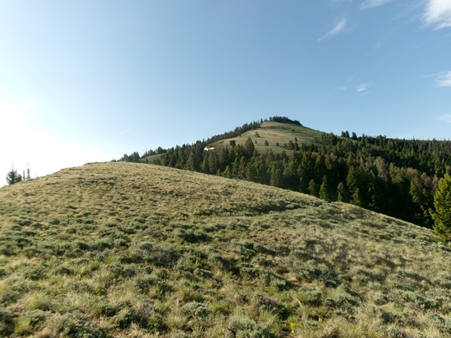
From the roadside pullout, bushwhack east straight up the slope in an easy pine forest. The trees are gapped due to logging. The understory is short grass if anything. Once above the forest, scramble up open, steeper, thick-ish sagebrush. Reach the crest of the northwest ridge just south of two blocky ridge outcrops.
There is no ridge rock after this point until you reach the summit area. Head right/southeast up the easy, open ridge in short grass/scrub with a game trail to help initially. Higher up, stay close to the ridge crest. Reach the service road and follow it to near the summit. Walk up a set of stairs to the lookout. Go left/southwest past the lookout to quickly reach the high point and the USGS benchmark embedded in the highest ground boulder.
Looking up the northwest ridge from my ridge entry point. This was the second leg of my ascent route. Livingston Douglas Photo
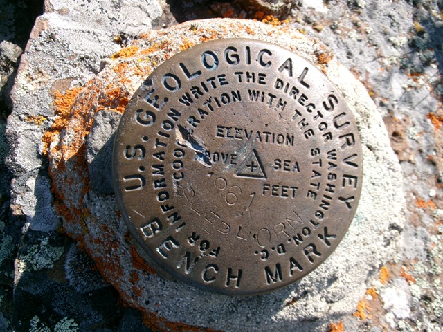
The USGS benchmark atop Sheephorn Mountain. Livingston Douglas Photo
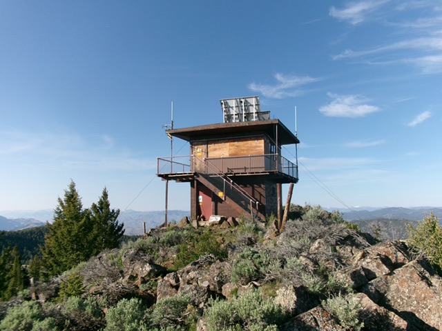
The fire lookout atop Sheephorn Mountain. Livingston Douglas Photo
Additional Resources
Regions: Eastern Salmon River Mountains->Salmon River Mountains->Southeast Corner Peaks->WESTERN IDAHO
Mountain Range: Eastern Salmon River Mountains
Year Climbed: 2016
Longitude: -114.09129 Latitude: 44.88239