Elevation: 8,418 ft
Prominence: 438
This peak is not in the book. Published October 2025
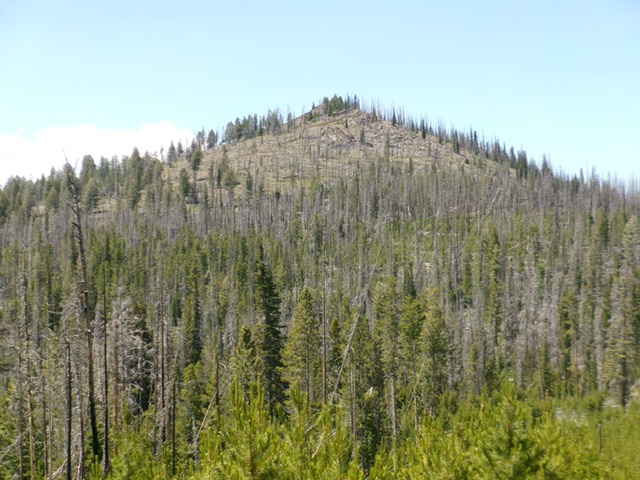
Swan Peak is an obscure, forested hump that sits west of Pepper Creek Ridge in the Eastern Salmon River Mountains. It is in a burn area and requires a difficult bushwhack to reach the summit. FSR-099 gets you close to the east face. USGS Cobalt
Swan Peak as viewed from the east. Livingston Douglas Photo
Access
From US-93 about five miles south of Salmon, turn west onto Williams Creek Road (signed for Williams Lake) and drive 13.5 miles up this well-maintained county road to Williams Creek Summit. Reset your odometer here. From Williams Creek Summit, head south on FSR-020, a rocky ridge road. A sign here says “China Spring 7 miles; Iron Lake 19 miles.”
At 6.2 miles, reach a signed junction with Degan Mountain Road/FSR-045 (left). Continue straight on FSR-020. At 8.2 miles, reach an unsigned junction with FSR-025 (right). Continue straight on FSR-020. At 10.1 miles, reach a signed junction with FSR-099. Go right/northwest onto rugged FSR-099 and drive 2.5 miles to an unsigned “T” junction (Junction 7947) at the base of the east face. Park here [8,000 feet; 45°00’49.5”N, 114°11’02.6”W].
FSR-099 goes through a serious burn area with lots of standing snags. Some snags poke into, or cross, the road. Carry a chain saw if you plan to drive this road for any real distance.
East Face, Class 2
The Climb
From the road junction, bushwhack west (or west-northwest) through a flattish area that is a brutal mix of downed trees, charred logs, and young live pines to reach the base of the semi-bare, rocky summit hump. Scramble up 200-250 feet of scree/gravel without much downed timber to reach the rocky summit area. The summit is open and has two USGS benchmarks. There is a large cairn (and post) on a slightly-lower hump about 100 feet to the east of the actual high point.

The open summit of Swan Peak. Livingston Douglas Photo
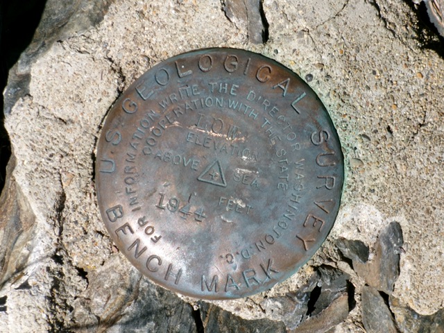
The USGS benchmark (“Low”) atop Swan Peak. Livingston Douglas Photo
Additional Resources
Mountain Range: Eastern Salmon River Mountains
Longitude: -114.1921 Latitude: 45.0143