Elevation: 5,500 ft
Prominence: 70
This peak is not in the book. Published October 2025
Table Rock sits at the southeast tip of the Kelly Mountain massif. It towers over the Snake River and nearby Spaulding Ranch. This area is a mix of private and public land, so be careful. This climb is entirely on National Forest land. USGS Heise SE
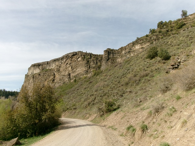
Table Rock and its rugged, sheer east face. Livingston Douglas Photo
Access
From US-26 northeast of Idaho Falls and east of Ririe, turn left/north onto the paved road that heads to the Kelly Mountain Ski Resort. Bear right at an unsigned “T” junction and continue east then left/north to cross the Snake River on a beautiful bridge. Once across the bridge, turn right/southeast onto [signed] Heise Road. Follow Heise Road along the Snake River to a signed junction with Kelly Canyon Road. This junction is 5.4 miles from US-26. Go straight to stay on Heise Road. Reset your odometer here. Drive 6.7 miles southeast then east then north on Heise Road (a rocky, bumpy, washboard road) to reach a nice roadside pullout just northeast of Table Rock. Park here[5,079 feet; 43°36’14”N, 111°34’34”W].
East Face/North Ridge, Class 3
The Climb
The easiest way to the top of Table Rock is from Goe Flat to its southwest on easy terrain. However, this route is blocked by fenced, posted ranch land. The east face of Table Rock is sheer, so you must climb up onto a high ridge well north of the summit then descend south to a saddle and have an easy finishing scramble up scrub/gravel to the flat summit area.
From the roadside pullout, head south on Heise Road for about 100 feet to reach a wide gully. Leave the road and bushwhack up the right/north edge of the gully briefly. Leave it to climb up onto a shoulder on its right/north side (Class 3). Follow this shoulder northwest as it heads up to the base of the sheer east face. Head right/north up the base of the cliff face until the slope eases and allows entry up onto the flat ridge crest (Class 3).
Once above the initial cliff band, head left/south and angle up onto the ridge crest on a game trail of sorts. The terrain on this climb is a mix of grass/scrub, embedded ground rock, and face rock. Once on the flattish crest of the north ridge, head south and quickly reach a cross/cairn/memoriam. This is Point 5642. Descend south-southeast from Point 5642 to a saddle on steep-ish gravel/dirt, scrub/grass, and embedded slabs/boulders. Stay near the east edge of the ridge crest for the easiest going, avoiding the large boulders to the west).
Once down a bit, the slope eases and things go quickly. Follow a cattle trail near the east edge of the ridge crest as it climbs and quickly reaches the summit plateau of Table Rock. The high point is at the north end of the plateau in the middle of the relatively narrow plateau section here. There is no summit cairn or obvious high point. On the descent, avoid a steep, thick gully to the north of the ascent gully up the east face. You must descend a short section of cliff bands to reach the easier, but still steep, terrain below.
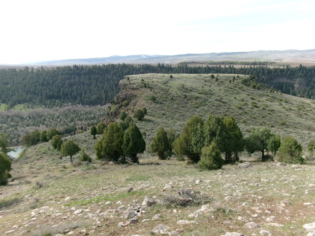
Table Rock (flat plateau in dead center) as viewed from the north. This was my ascent route. Livingston Douglas Photo
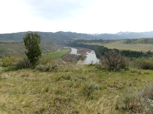
View of the Snake River from atop Table Rock. Livingston Douglas Photo
Additional Resources
Mountain Range: Big Hole and Snake River Mountains
Longitude: -111.5789 Latitude: 43.6005