Elevation: 10,557 ft
Prominence: 856
Climbing and access information for this peak is on Page 302 of the book. The elevation and prominence figures reflect recent LiDAR updates. Updated October 2025
Timber Creek Peak is located due south of Sheephorn Peak (10,469 feet) and northwest of Negro Peak (10,583 feet) in the Lemhi Range. It sits above a small lake and the headwaters of Nez Perce Creek. Timber Creek Peak is most easily climbed in combination with nearby Sheephorn Peak or directly from Nez Perce Lake. USGS Iron Creek Point
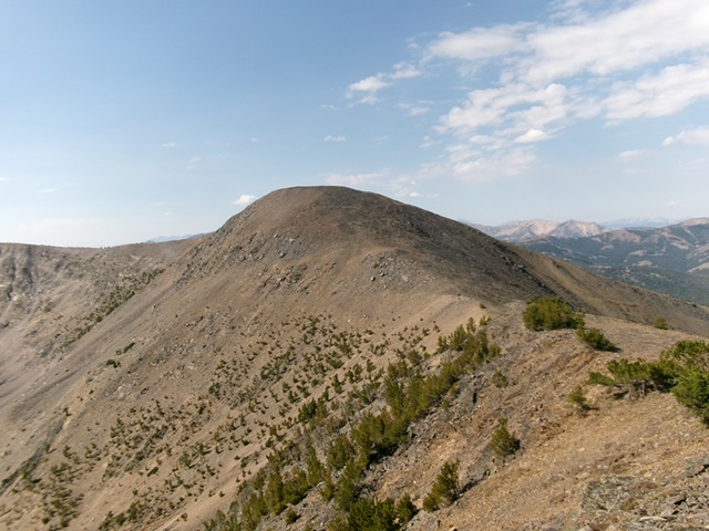
Timber Creek Peak (center) and Point 10372 (left of center) as viewed from Sheephorn Peak to the north. Livingston Douglas Photo
Access
Same as for Sheephorn Peak (10,469 feet). This is the secondleg of a 2-peak adventure that includes Sheephorn Peak and Timber Creek Peak. It covers 10.5 miles with 4,175 feet of elevation gain round trip.
North Ridge, Class 2
The Climb
From the 10,140-foot connecting saddle with Sheephorn Peak, scramble south and skirt the right/west side of Point 10372. Angle diagonally upward to reach a higher saddle at 10,220 feet. This section is on somewhat loose, angled scree, so it is a bit tedious. It only had a few short sections of goat trails. From this higher saddle, climb south up a pile of talus and scree to reach the large, tilted summit plateau of Timber Creek Peak. A massive cairn sits on the high point toward the south end of the plateau.
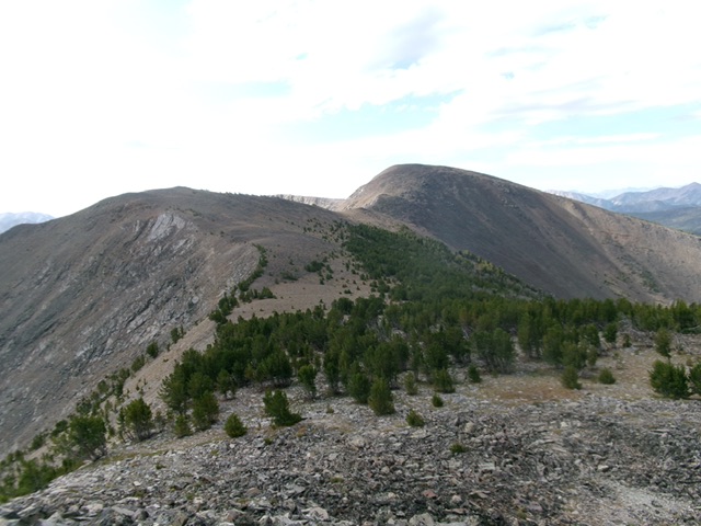
Timber Creek Peak as viewed from Point 10372 to its north. Livingston Douglas Photo
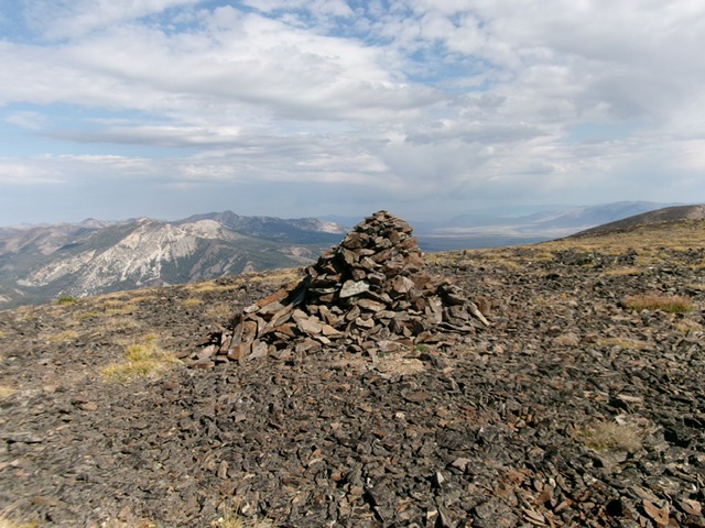
The massive summit cairn atop Timber Creek Peak. Livingston Douglas Photo
North Ridge/North Face Descent to Nez Perce Lake, Class 3
The Descent
From the summit, return down the north ridge to the 10,220-foot saddle just south of Point 10372. Scramble northeast up easy talus and scree to the small ridge corner that is Point 10372. From here, descend east on a rocky ridge of talus/scree to an area where it is safe to downclimb the steep north face. Carefully descend the Class 3 mix of loose scree, gravel, and rock ribs to the safer, flatter ground of the gully below. Follow the gully right-ish/northeast down to Nez Perce Lake.
The gully itself is a mix of talus, scree, and boulders. It is very tedious. Rather than descend the gully, bushwhack down a nice forested shoulder to its left/west. This shoulder soon gets dangerously steep and cliffed. Angle left/north into a gentler pine forest and descend diagonally downward. Lower down, bushwhack diagonally right/east to reach the west shore of Nez Perce Lake. Walk south then east to reach the southeast corner of the lake and the Nez Perce Lake trail. Follow the trail back to FSR-212 and your parked vehicle.
Additional Resources
Regions: EASTERN IDAHO->Lemhi Range
Mountain Range: Lemhi Range
Longitude: -113.40589 Latitude: 44.9601