Elevation: 5,145 ft
Prominence: 10
This formation is not in the book. Published October 2025
Twentymile Rock is a minor, rocky outcrop that sits on the south side of US-20 west of Idaho Falls and just east of INL land. It is entirely on BLM land and is easily accessed from a BLM side road off US-20. USGS Kettle Butte
Access
From US-20 at virtual MM286.7, turn south onto a side road signed for “Lava Rock Hiking Trail” on the highway. About 50 yards onto this side road, reach a triple junction and a BLM sign for “Hells Half-Acre Wilderness Study Area.” Continue straight on a 2-track road and park in a pullout about 0.2 miles from the highway (my ascent route) or continue another 0.1 miles to the end of this spur road at a turnaround and picnic area (my descent route).
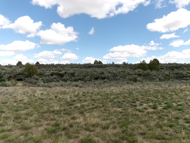
Twentymile Rock as viewed from the southwest. Livingston Douglas Photo
Map Errors
The USGS map fails to show all of the 2-track roads in this small area of BLM land off US-20.
West Face/Northwest Ridge, Class 2+
The Climb
From the pullout at the 0.2MP [5,112 feet; 43°33’17.6”N, 112°26’35.5”W], bash carefully through thick, tall sagebrush and boulders/sub-ridges to reach a ridge that leads right/northeast up onto the embedded rock of the narrow summit ridge crest. Once on the ridge crest, scramble right/east then southeast through a thick mix of junipers, ridge rock (with dangerous gaps to jump across) to reach the cairned high point that is farther southeast than LOJ indicates.
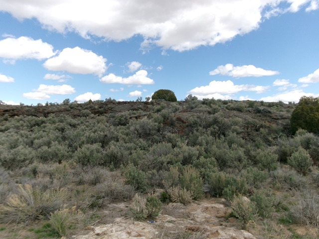
The brush-and-boulder west face of Twentymile Rock. This was my ascent route. Livingston Douglas Photo
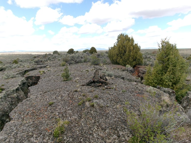
The summit cairn atop Twentymile Rock, looking northwest along the solid rock ridge crest. Livingston Douglas Photo
South Face, Class 2
The Descent
From the cairned summit, descend south then southwest on rock-embedded ribs (lava rock) to reach a mix of sagebrush and boulders below. Find minor lanes and easy ribs to reach the picnic area and the spur road. Follow the spur road northwest back to the parking pullout.
Additional Resources