Elevation: 6,765 ft
Prominence: 115
This butte is not in the book. Published October 2025
Twin Buttes, North (6,765 feet) and Twin Buttes, South (6,750 feet) are sandwiched between Black Canyon to the east and Rocky Canyon to the west in a remote area of the southern Snake River Plain. They are easily accessed from [surprisingly-good] Monument Springs Road to the east. USGS Browns Bench North
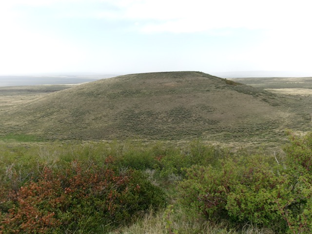
Twin Buttes, North as viewed from the south. Livingston Douglas Photo
Access
From downtown Rogerson, drive west on the paved Rogerson-Jarbidge highway for 9.3 miles to a signed left/south turn for Browns Bench Road (signed for “China Creek 12 Miles”). Continue another mile west on the highway to reach a signed junction with Monument Springs Road. Turn left/south onto Monument Springs Road and drive 5.4 miles on this good gravel/dirt road to reach Junction 6519. There is a weak 2-track road heading right/west from this junction. Park here[42°08’12.4”N, 114°48’29.5”W]. This is the first leg of a 2-peak adventure that includes Twin Peaks, North and Twin Peaks, South. It covers 4.5 miles with 850 feet of elevation gain round trip.
North Face, Class 2
The Climb
From the road junction, hike west then southwest along the spur road to reach an unsigned junction in a gully. Leave the main road and follow a weaker 2-track as it descends northwest in a gully then rises up out of the gully and heads left/west to cross the north face of Twin Buttes, North. Leave the 2-track road after it gets past the thick brush and aspens to reach easy field grass on the north face. Scramble south up the field grass and keep going south until you reach the high point at the south edge of the summit cap. There was no summit cairn on top.
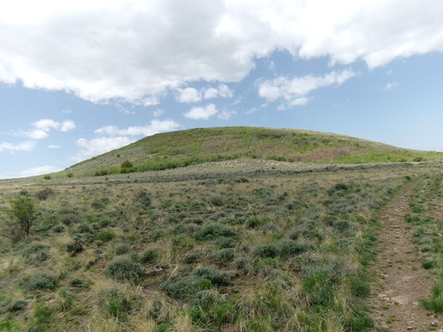
Approaching the summit hump of Twin Buttes, North from the northeast. Livingston Douglas Photo
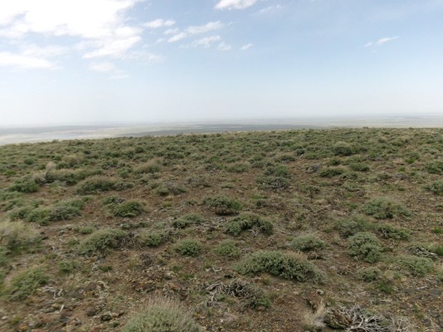
The sagebrush summit of Twin Buttes, North. Livingston Douglas Photo
Southwest Face, Class 2
The Descent
From the summit, descend southwest in relatively easy grass/scrub to a connecting saddle at about 6,650 feet. This concludes the first leg of today’s 2-peak journey. Twin Peaks, South is up next.
Additional Resources