Elevation: 2,784 ft
Prominence: 310
This butte is not in the book. There is a lot of private land in this area which complicates access to this butte. Published October 2025
Thanks to recent LiDAR updates, Wild Horse Butte is now a ranked summit. It is located on the west side of the Snake River on Snake River Birds of Prey BLM land. Getting close to it on dubious BLM 2-track roads is the crux of this climb. USGS Wild Horse Butte
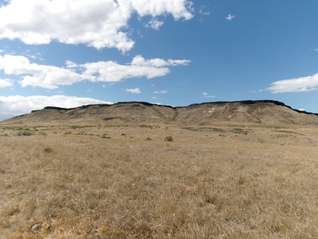
Wild Horse Butte as viewed from the southeast. Livingston Douglas Photo
Access
These 2-track BLM roads are rutted and required a 4WD with high clearance for the narrow gully crossings. Do not drive these roads in wet conditions. From ID-78 about 50 yards west of MM44, turn north onto a 2-track BLM road. Reset your odometer here. Stay on the main road and ignore any side roads. At 4.1 miles, the road makes a sharp left turn at a fence row. At 4.5 miles, go left to avoid a steep, tilted hill climb. At 5.0 miles, go hard right at a “T” junction. At 5.2 miles, go left/north. At 6.1 miles, go straight (not right). At 6.3 miles, park at an unsigned junction just before an impossibly steep/narrow crossing of a gully [2,426 feet; 43°07’20”N, 116°19’16”W].
An alternative route that may be better is the better-quality BLM road that leaves ID-78 a few miles farther to the northwest and heads north to Rye Patch. However, it crosses a patch of private land in Rye Patch and may be gated/closed there. In addition, the road becomes rougher and descends the Fossil Creek drainage which may or may not be a good decision.
Map Updates
Some of the roads in this area are unmapped, so don’t rely entirely on the USGS topo map. There are more 2-track roads here than you would expect, so it can get confusing. There is also nearby private ranch land to avoid, so be careful which roads you choose to drive on and stay on public BLM land.
South Face, Class 2
The Climb
From the parking spot, bushwhack directly at the large gully that splits the south face of Wild Horse Butte. The terrain is easy field grass and scrub. Use minor ridges to avoid gully crossings on your way to the large gully. Once you reach the base of the main gully, find a game trail that heads up a shoulder (then the south face) on the left/west side of the gully. A final, short rock scramble gets you up through the summit cliff band and onto the summit plateau just left/west of the head of the gully.
Once atop the tilted summit plateau, head west then northwest across the sagebrush terrain to reach the high point area at the west edge of the butte. There is a set of boulders that seem to mark the high point that LOJ indicates for Wild Horse Butte. There was no summit cairn so I built two new summit cairns (see photo) to help future climbers locate the spot.
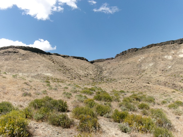
The large gully that cuts the south face of Wild Horse Butte. This was my ascent route. Livingston Douglas Photo
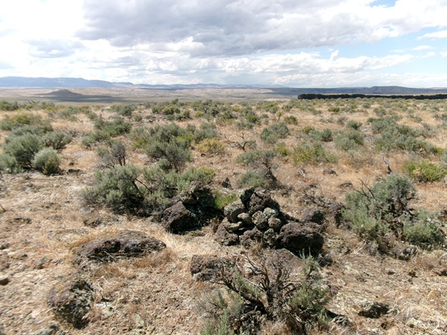
The double-cairned summit of Wild Horse Butte. Livingston Douglas Photo
Additional Resources