The folowing update was provided by R. Baldner. “This weekend (10/18/25), I tried to access Collett Mountain/Pixley Basin using the eastern approach mention on the page “Castle Creek Area Access”. The gate on the road that allowed for entranced on to the Collett’s property is now locked. Seems like permission is now required for access, if allowed at all. I am not not sure if access remains the same from the southern approach. We abandoned our efforts to access the area upon this discover.” It is possible the gate is only locked during hunting season.
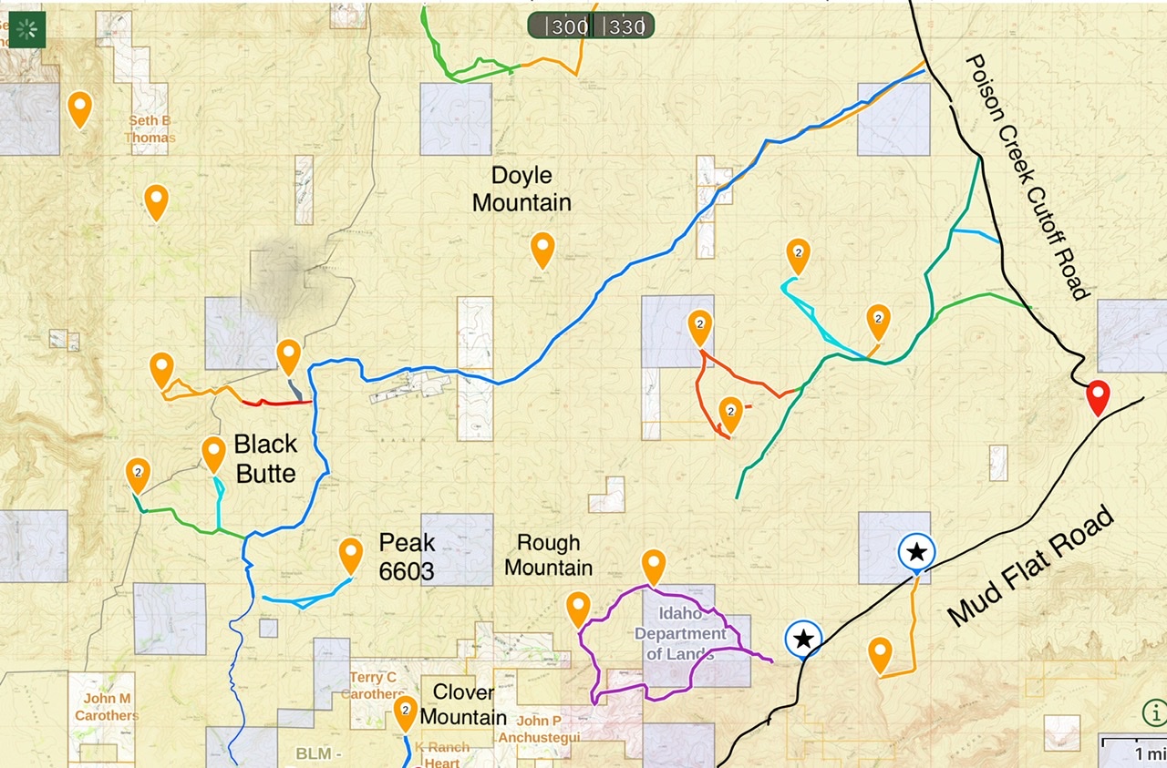
Castle Creek and it’s spectacular canyons are situated west of Rough Mountain. There are two access routes. Both require crossing private property. As of June 2022 access was allowed on both routes. The roads in this area are shown on the following map. A 4WD is recommended.
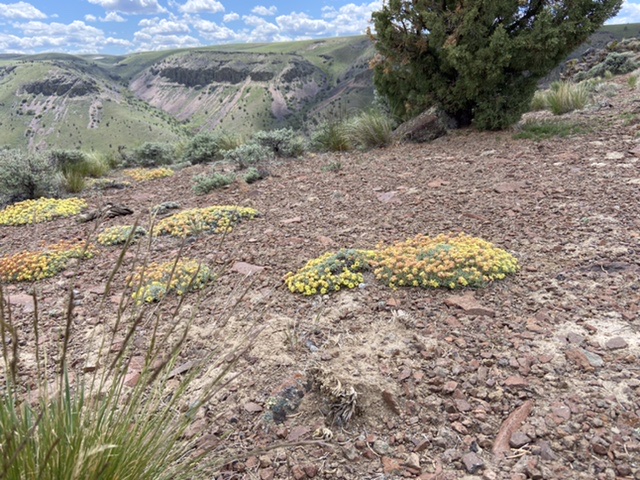
Castle Creek Canyon.
Eastern Approach—Pixley Basin Road
The eastern approach is accessed from Poison Creek Cutoff Road which, in turn, is accessed from Mud Flat Road. From the junction of ID-167/ID-78 in Grand View, drive south for 2.1 miles and then turn right onto [paved] Mud Flat Road. Follow Mud Flat Road south and then southwest for 15.9 miles to the signed junction for the Poison Creek Cutoff Road. Turn right and follow this well-maintained gravel road south for 6.1 miles. Turn left at onto a rough but sometimes maintained road runs west/southwest to up into the mountains.
Soon after the crossing a pass on the west side of Pixely Basin you will come to a fence marking private property. Cross through and leave the gate closed.
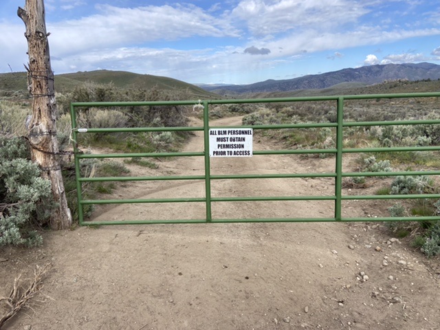
The first gate you encounter along the Pixely Basin Road.
Continue west crossing through and closing a second gate. Follow the road, up, down and around. The road eventually turns north and exits out to the Mud Flat Road.
Overview of the eastern approach to Castle Creek.
Southern Approach—Castle Creek Road
From the junction of ID-78/ID-167 in Grand View, Idaho drive east on ID-78 for 2.1 miles. Take a slight right onto the Mud Flat Road (which is part of the Owyhee Scenic Byway). Follow this good paved (and then gravel) road for 28 miles. Turn right/north onto Castle Creek Road which is an occasionally-maintained dirt road. Follow this road north for 0.7 miles where the road reaches a gate. This gate is on public land.
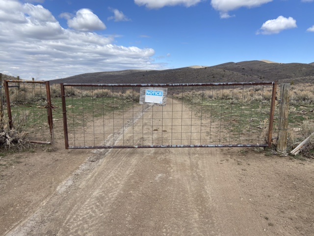
The gate at 0.7 miles.
Pass through the gate and drive a short distance down the hill to a junction where the Castle Creek Road turns hard to your left. Turn left and follow road as it winds its way south toward Black Butte. You will encounter two parcels of private land and four gates. As of May 2022 access across these parcels may or may not be allowed. The first gate you encounter has two somewhat conflicting signs (see photo). Camping is unquestionably not allowed. I note the entire road on public and private land is graded and undoubtedly the grading was done by the BLM. These two signs could be interpreted that the road is open to the public—stay on the road. Please check with the BLM for the current access status before using this route.
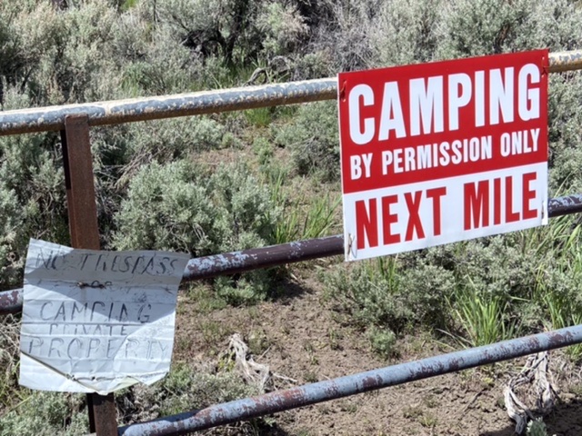
The two conflicting signs found at the first section of private land along Castle Creek.
The road eventually climbs out of Castle Creek and winds south toward Black Butte where it hooks up with the road that leads to Pixely Basin.
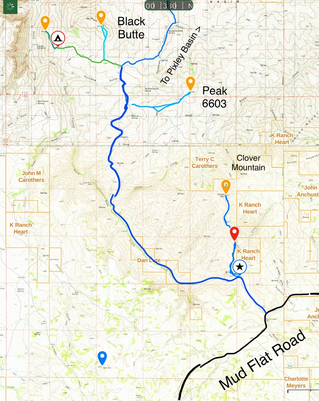
The southern access route.