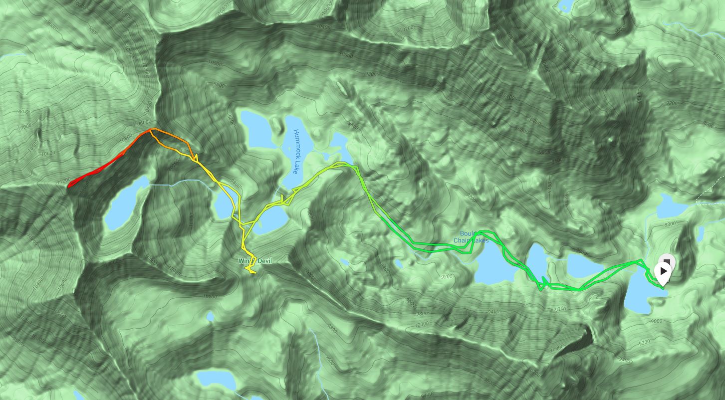
Access
Hike up the well-established Little Boulder Creek Trail into the Boulder Chain of Lakes. This is roughly a 9 mile approach with 3,000 feet of elevation gain just to get to Hatchet Lake, so this is pretty much a minimum 2-day outing. From Hatchet Lake (8,900 feet), follow the Little Boulder Creek Trail until you get to Headwall Lake (9,800 feet).
The Route
At this point, leave the established trail to ascend the remaining 1,500 vertical feet. When looking across the lake, there is a stream that runs nearly directly down the center of the slope. Skirt around the right side of the lake until you reach the open talus slope about 150 feet before you reach the stream. Work your way up the talus slope and through the trees, generally trending to your left.
Taylor Amato Photo
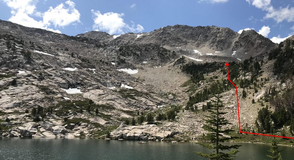
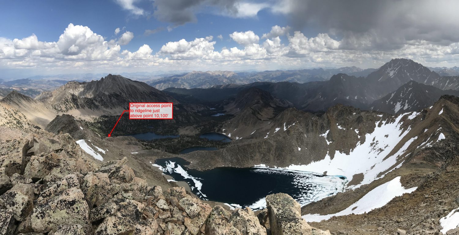
At about 10,100 feet, you reach a flatter section in the talus field. To the left brings you up to Lonesome Lake and to the right is an obvious ridge that brings you due mostly east (Image 2). Work your way up to the ridge and start working your way to the left.
Taylor Amato Photo
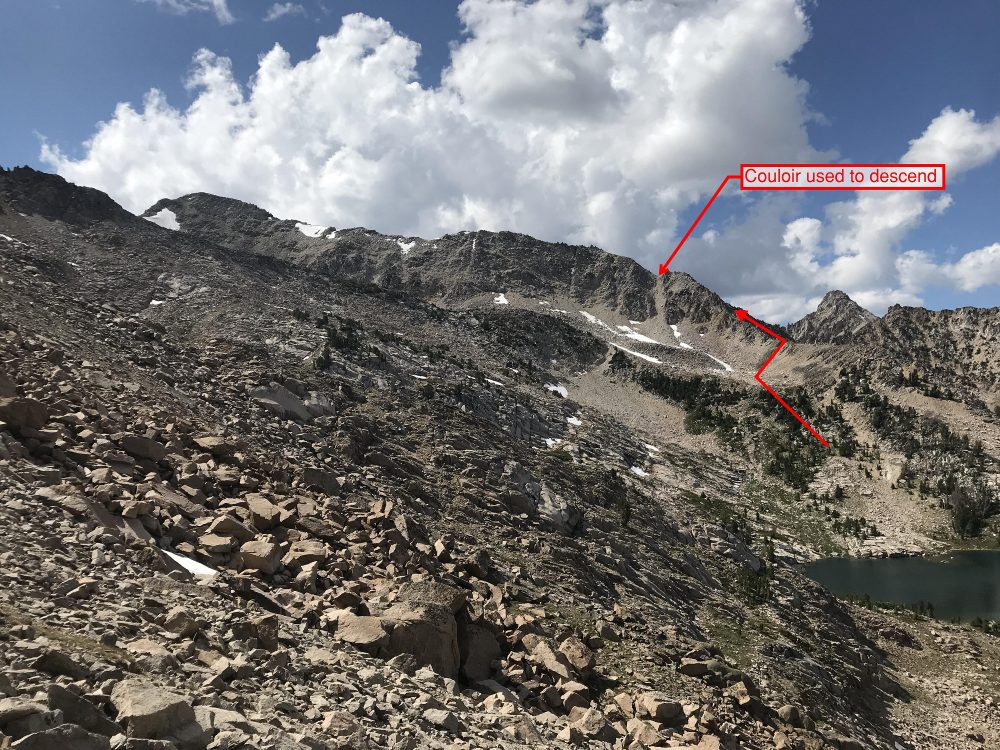
A couple hundred feet of easy boulder hopping brings you to the first real challenge. To gain the Northeast Ridge of Lonesome Peak, you have to get around a large bulge of very large, steep and sketchy-looking boulders. I did not go up it. Instead I traversed the around the left side of it, slowly working my way left and upwards (Image 3). At this point, there is some decent exposure with a lot of really loose rocks everywhere. I gave each hold a little pull test before putting more weight on it.
Taylor Amato Photo
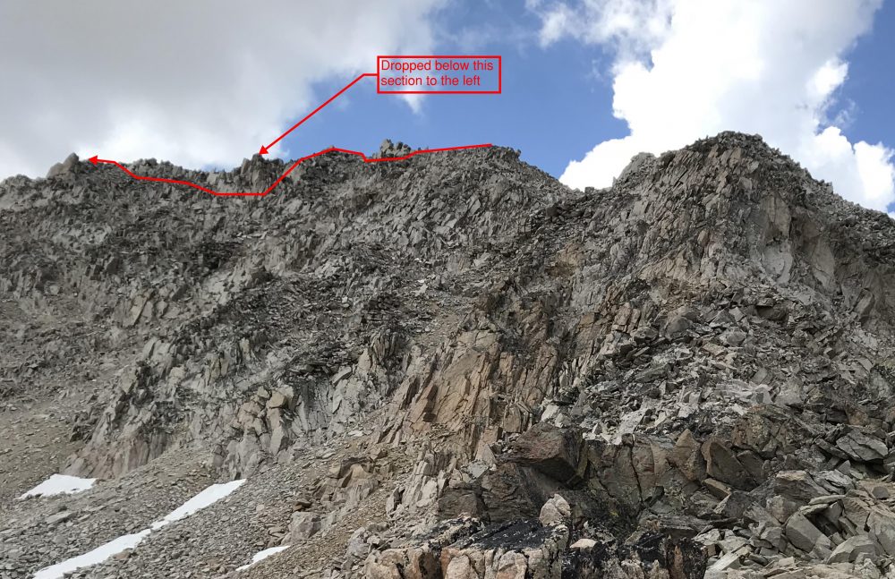
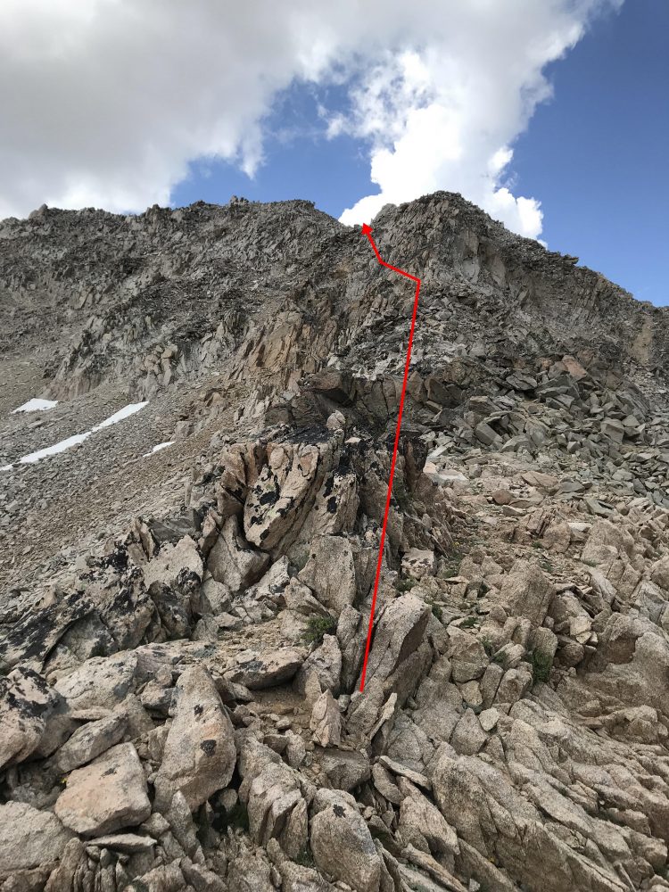
Once you reach the slight low spot right after the bulge in the beginning, you can stay a bit more on top of the ridge. From here, it becomes a mix of navigating around refrigerator-sized, precariously-perched. The boulder hopping is Class 3 (Image 4) with some Class 2 breaks mixed in. I generally trended towards the top and left side of the ridge, finding the rock generally a bit more stable there. Just before the last push to the top, I dropped down pretty far (around 30-40 vertical feet from the top of the ridge) onto the left side of the ridge before climbing nearly straight back up to get several yards away from the summit (Image 5). I’m not sure if this was necessary, but I just did not like the look of some of the really large, loose rocks that I would have had to put my weight on.
Taylor Amato Photo
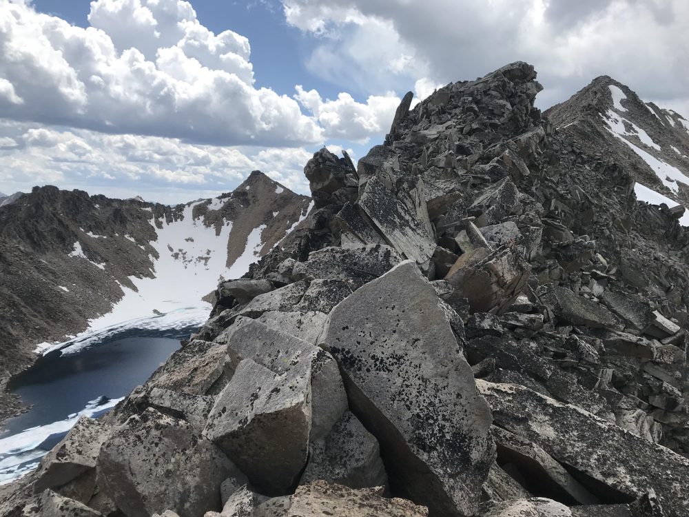
To get back down, I reversed my ascent route (Image 6) but instead of traversing around the bulge at the beginning of the ridge, I dropped down a very steep couloir (Image 2). This slope is steep and is filled with lots of very loose and sketchy rock. I stayed to skier’s right and tried to maintain decent handholds in the mostly stable rock on the right.
Taylor Amato Photo
From the flatter section at 10,100 feet, it took about 40 minutes to reach the summit.
Taylor Amato Photo