Peak 8037/Goodenough Peak
Southeast Spur/Northeast Ridge, Class 3
Date of Climb: May 19, 2019
Access
From the McCammon exit on I-15 (Exit 47), drive about 1-1/4 miles W on Merrill Road across I-15 to reach a signed junction with Marsh Creek Road (a “T” junction). Turn L/S on Marsh Creek Road and drive ¼ mile to a signed junction with Green Road (signed for the BLM’s Goodenough Creek Campground). Turn R/W onto Green Road and drive 2.7 miles to the Goodenough Creek Campground entrance. Continue another 0.5 mile to the road’s end and a parking area.
This parking area has three BLM trailheads. BLM Trail #195 (signed) goes L/S and immediately crosses Goodenough Creek on a nice footbridge; this trail goes to Mormon Canyon and reaches an old jeep road higher up with easy access to the South Ridge of Peak 8037. BLM Trail #194 (unsigned) goes W/straight and follows the N side of Goodenough Creek; this trail provides access to the Southeast Ridge of Peak 8037. BLM Trail #152 (signed) goes R/N and follows a feeder stream, goes up a side/N canyon then climbs/traverses R/E across open scrub to eventually reach Walker Creek Road. The most current Caribou-Targhee National Forest/Westside Ranger District Map shows all of these trails.
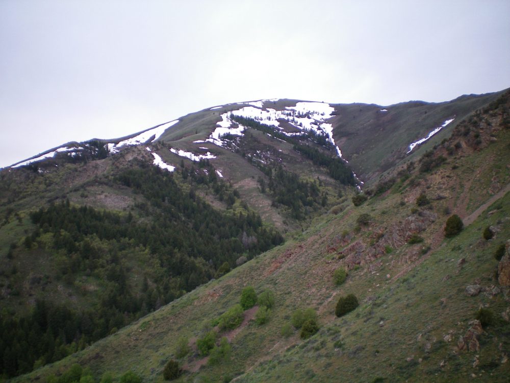
The view of Peak 8037 from the Southeast Spur. Livingston Douglas Photo
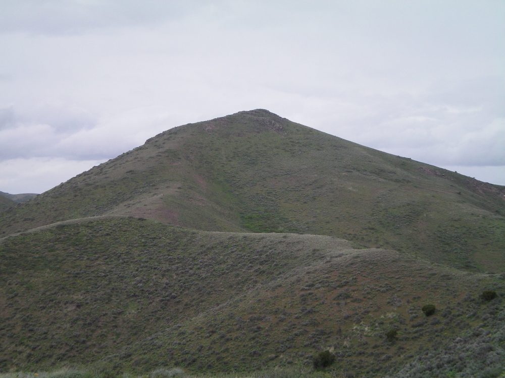
The final scramble up the Northeast Ridge to the summit. Livingston Douglas Photo
The Climb
From the trailhead parking area, hike up BLM Trail #152 a short distance to about 5,650 feet where the trail is headed due N up a drainage. Leave the trail here and bushwhack up through a short section of forest to reach the crest of the Southeast Spur. Scramble up the narrow spur northward. This Spur is a mix of choppy, narrow ridge rock and easy, short scrub.
There are a few ridge points to climb over as you gain altitude.The upper section is a cruise on broken rock and short scrub. The ridge bends L/NW at about 6,400 feet and heads up to a junction with the Northeast Ridge at 7,540 feet. Turn L/SW here and follow the ridge crest to the summit. The summit is a ridge corner and has ridges emanating from it that head NE, SE, and W. There is a nice summit cairn on the rocky top.
Southeast Ridge (Descent), Class 3
Access
Same as for the Southeast Spur/Northeast Ridge Route
The Descent
From the summit, follow the magnificent crest of the Southeast Ridge on easy, open scrub. Enjoy it, because this good time won’t last. The ridge soon narrows and has rocky outcrops to navigate. The ridge quickly gets even rougher. There are blocks to down-climb, rock slabs to cross, and mountain mahogany to wrestle with. There are a few chimneys/chutes to down-climb (Class 3/3+).
Lower down, the ridge bends R/E in a flat ridge section. After a few more rocky points to navigate, the ridge plunges down to a fork in the canyon. At this point, you will find BLM Trail #194 and very quickly arrive back at the trailhead parking area. These two routes (Southeast Spur/Northeast Ridge, Southeast Ridge) are short, steep alternatives to the [mostly] road/trail hike from the South. For a scrambler, these options are much more challenging and fun than the standard route.