The Grangeville-Salmon Road/FS-221 [(F)(2) on Page 80] is the major access route in the southwest corner of the Clearwater Mountains. It is also the best way to reach the West Side of the Gospel-Hump Wilderness and Moores Station Road/FS-444 [(F)(2.1) on Page 80]. The Grangeville-Salmon Road runs between Grangeville in the north and the Salmon River in the south, a distance of 77.5 miles. This page expands on the information found in the book and includes the Slate Creek Road access which is not in the book.
The road is closed during Winter. The majority of the road is gravel with lots of curves and steep grades. Be sure to check with the Forest Service before driving the road. Safety considerations warrant taking a Clearwater National Forest map, a GPS, a chainsaw for dealing with blowdowns, a tow chain and a shovel. A 4WD is always recommended for using remote roads. There are no services along these roads so be sure that your gas tank is full. Use this link: Forest Service webpage for Southwest Clearwater Mountains Road Status
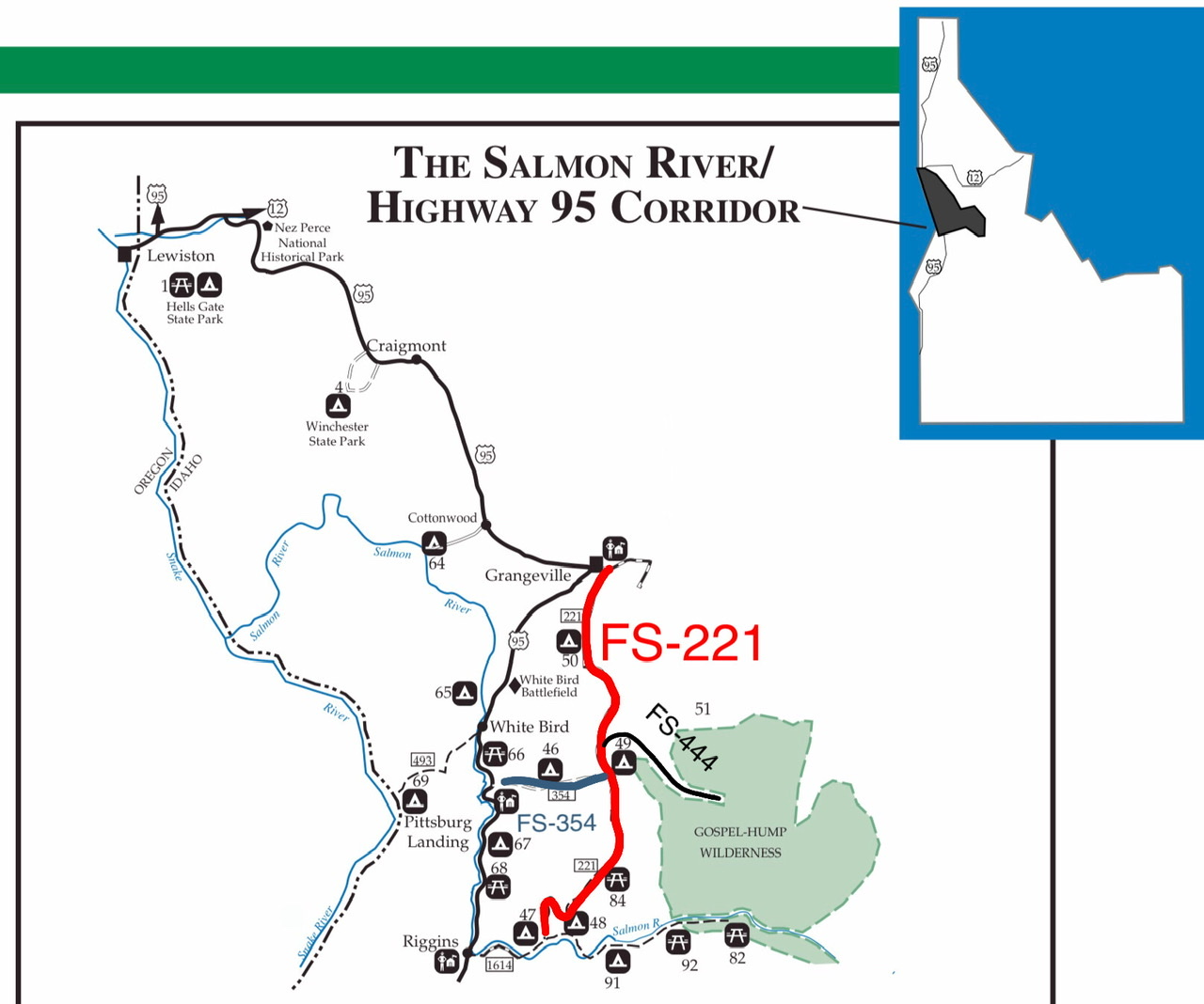
Southwest Clearwater Mountains Access Route Overview—adapted from a USFS map.
Grangeville-Salmon Road
Grangeville Access: From the east end of Grangeville, turn south on the Grangeville-Salmon Road/FS-221. The road is paved to Boulder Creek (Milepost 36.6).
Riggins Access: From Riggins, leave US-95 near the south city limits. Cross the Little Salmon River and follow the Salmon River Road/FS-1614 [(A)(1) on Page 134] to Allison Creek (Milepost 9.7). Turn north on FS-221.
There are also access roads along the US-95 corridor between Riggins and White Bird. The best of these roads is Slate Creek Road.
Slate Creek Access
Slate Creek Road/FS-354 [(F)(2.1) on Page 80]. Slate Creek is located on US-95, 19.0 miles north of Riggins and 10.0 miles south of White Bird. This road is found on the north end of the developed area that includes the Slate Creek Ranger Station and a few private homes. Follow Old Highway 95 for 0.3 miles where the actual State Creek Road starts at a slight left turn.
Moores Station Road/Gospel Hump Access
Moores Station Road/FS-444 [(F)(2.1) on Page 80]. This road leaves FS-221 between Grangeville (46.0 miles to the north) and the Salmon River (31 miles to the south). It penetrates into the center of the Gospel-Hump Wilderness and ends at the summit of Square Mountain.
To access the Moores Station Road from Slate Creek, follow FS-354 generally east for 17.0 miles, following its twisting path to FS-221. Turn left onto FS-221 and, in about 0.7 miles, turn right onto FS-444. It is 12.0 miles to the Moores Station Work Center. There are a number of trails and peaks accessible from this road.