Elevation: 4,973 ft
Prominence: 393
This peak is not in the book. Updated February 2020
Peak 4973 is the westernmost peak in the Danskin Mountains. The peak sits just east of Lucky Peak Reservoir. Kepros Mountain is located to the NE and Peak 5380 is to the ESE. USGS Arrowrock Dam
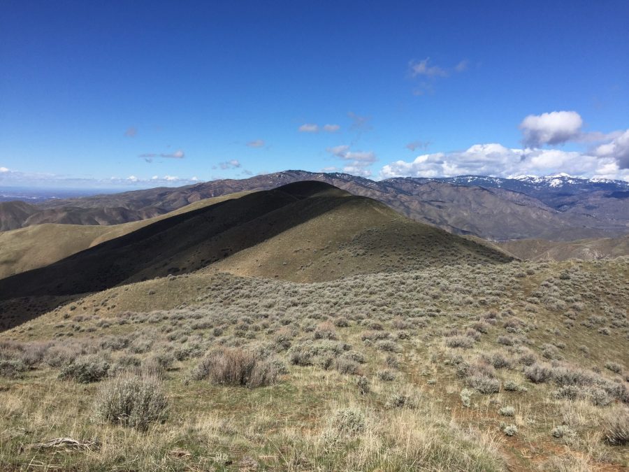
The summit ridge of Peak 4973 (middle of photo) as viewed from Peak 5380.
I was told that a few people have boated across the reservoir and climbed the peak’s West Slopes. Undoubtedly, this would be the shortest approach.
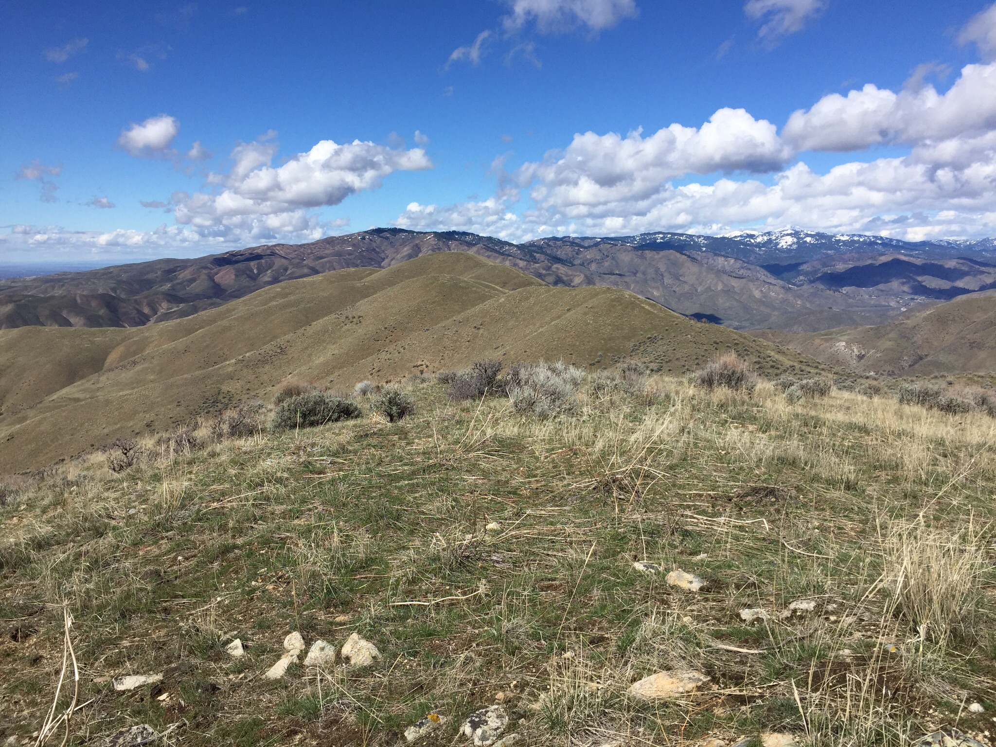
Peak 4973 (center) showing its West Approach with Kepros Mountain (left) as seen from Kodiak Peak. Steve Mandella Photo
For those of us without a boat, reach the summit by a long ridge walk. This route can be shortened if you have a high-clearance, short-wheelbase 4WD vehicle (preferably an ATV/UTV) and can take advantage of a hunting road when it is open.
Access
Access Peak 4973 from FS-189 [(G)(1)(a) on Page 156]. I describe this same access on the Kepros Mountain page.
Southeast Route, Class 1
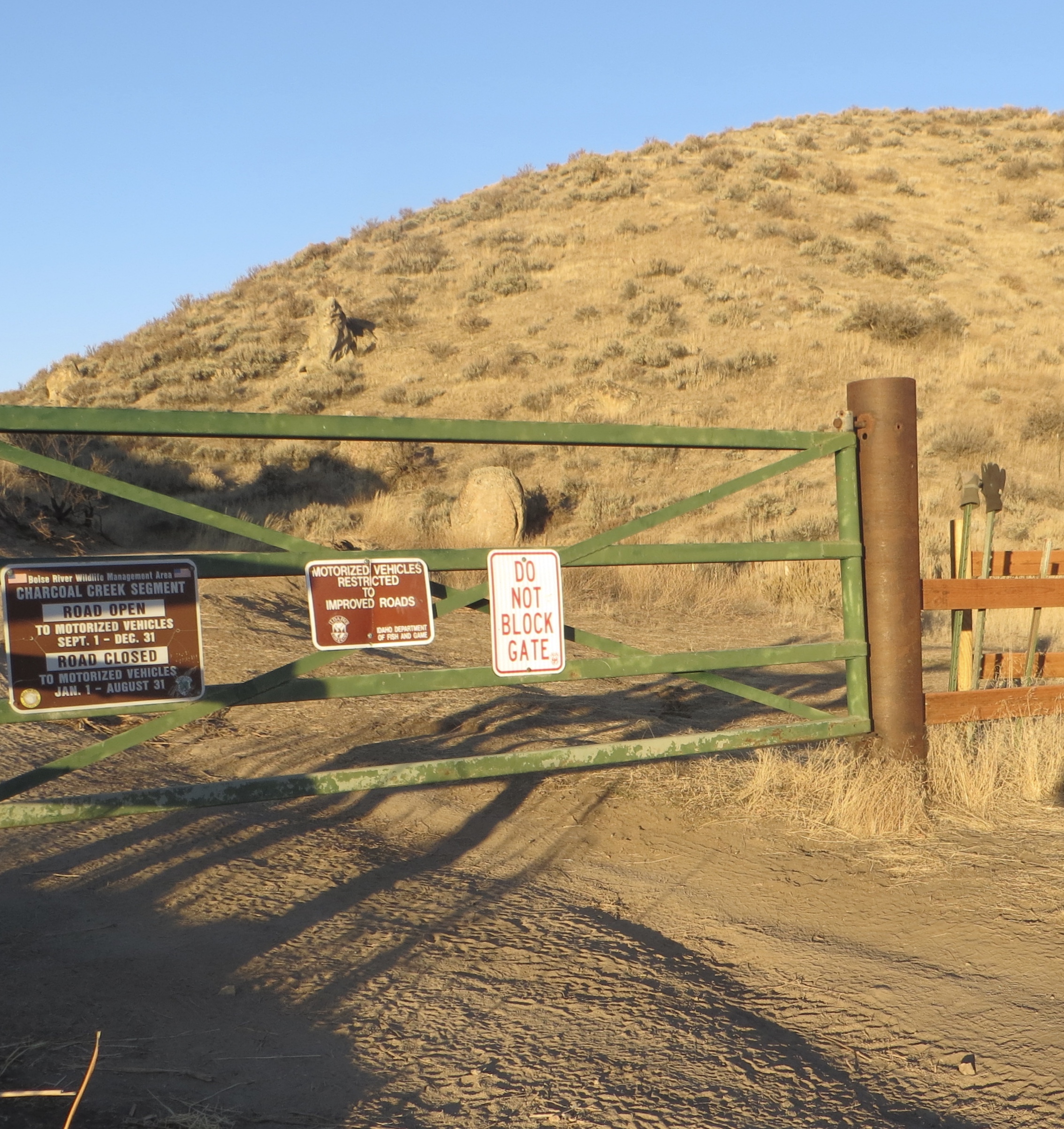
Follow the Kepros Mountain climbing directions for roughly 3 miles to a saddle 0.75 miles north of Peak 5380. The elevation at this point is 5,100 feet and you will find a locked gate. Climb over the gate and follow the old road to the summit. The road undulates, making the 2.5-mile walk a significant undertaking.
My GPS recorded 3,100 feet of elevation gain and 11 miles on the round-trip journey. The peak has two summits of nearly equal height separated by a 0.5 mile. Though the West Summit is marked as the high point on maps, based on my observations, I am not sure that is correct.
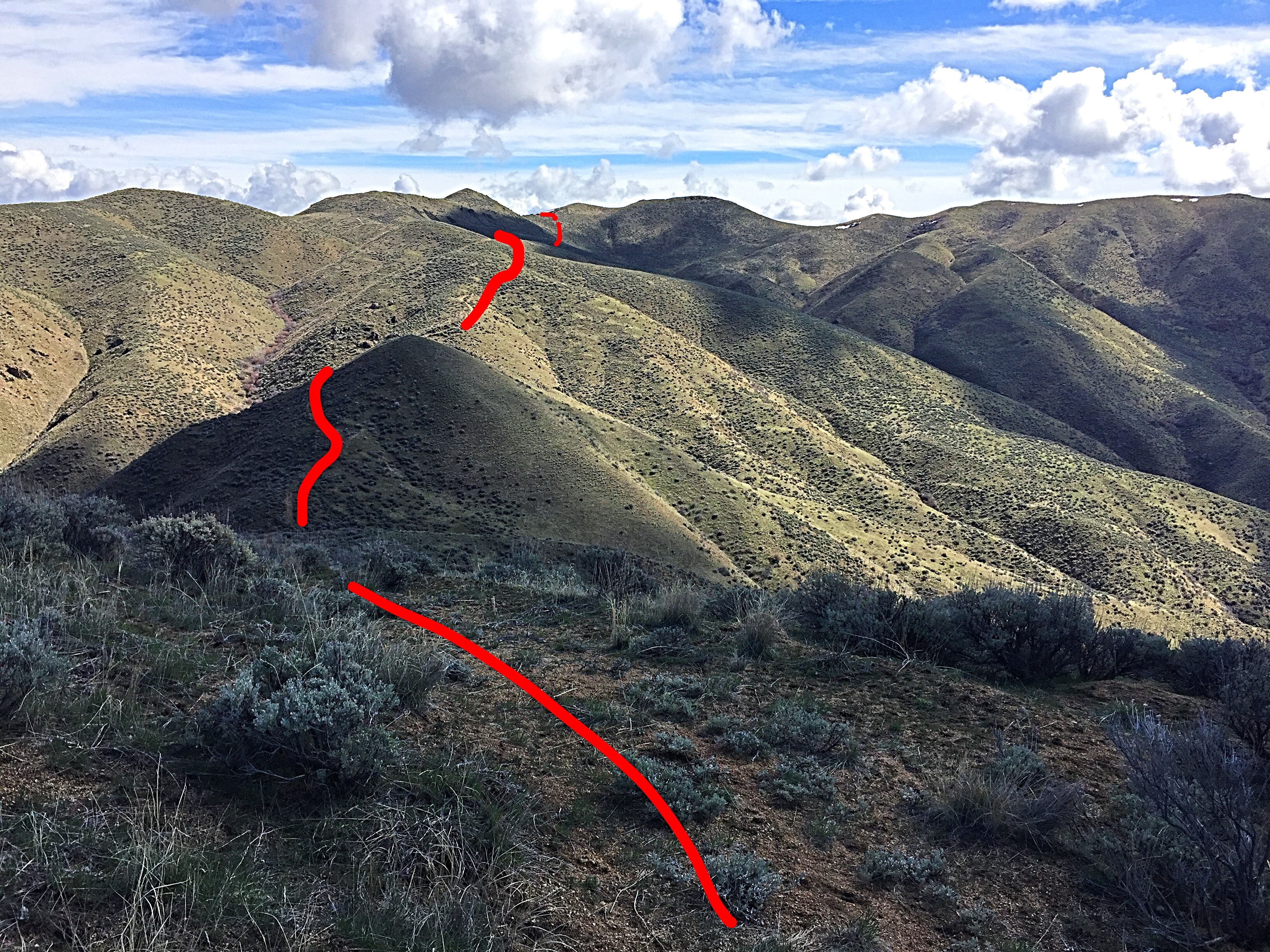
Looking back east to the main ridge from the midpoint. I marked the route where it is visible in the photo to give you an idea of the undulating nature of the route.
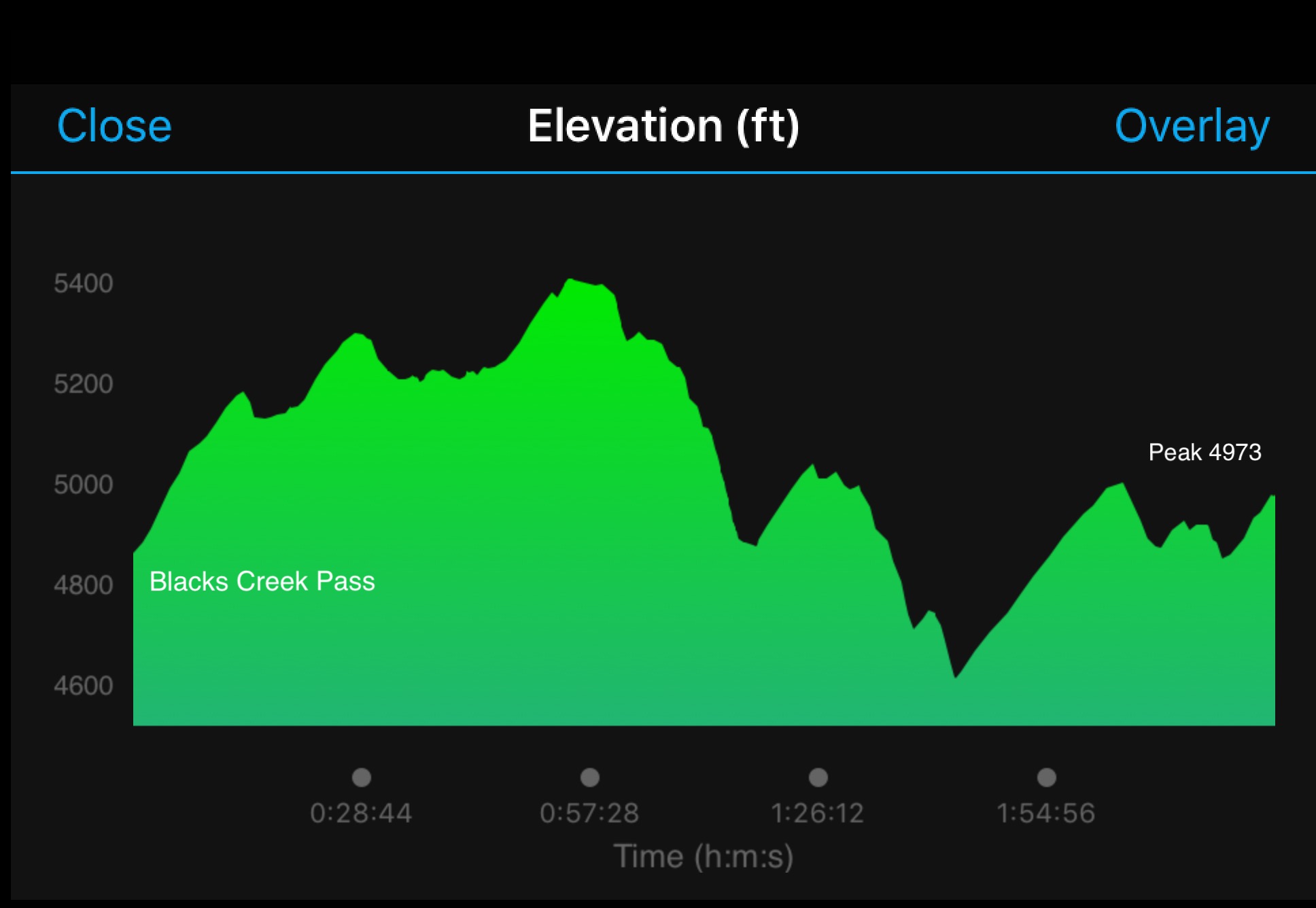
My GPS-generated elevation profile shows the significant ups and downs required to hike Peak 4973 from Blacks Creek Pass.
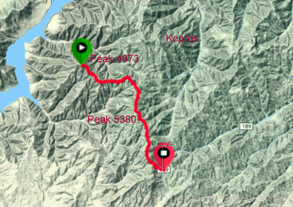
My GPS track.
Alternative Access by Margo Mandella
This route uses a 4WD road that is only open during hunting season (9/1-12/31). This road allows you to get closer to the peak. Primary access is the same access set out above. Instead of going all the way to Blacks Creek Pass (9.0 miles), look for the signed and gated road at the 7.6-mile mark.
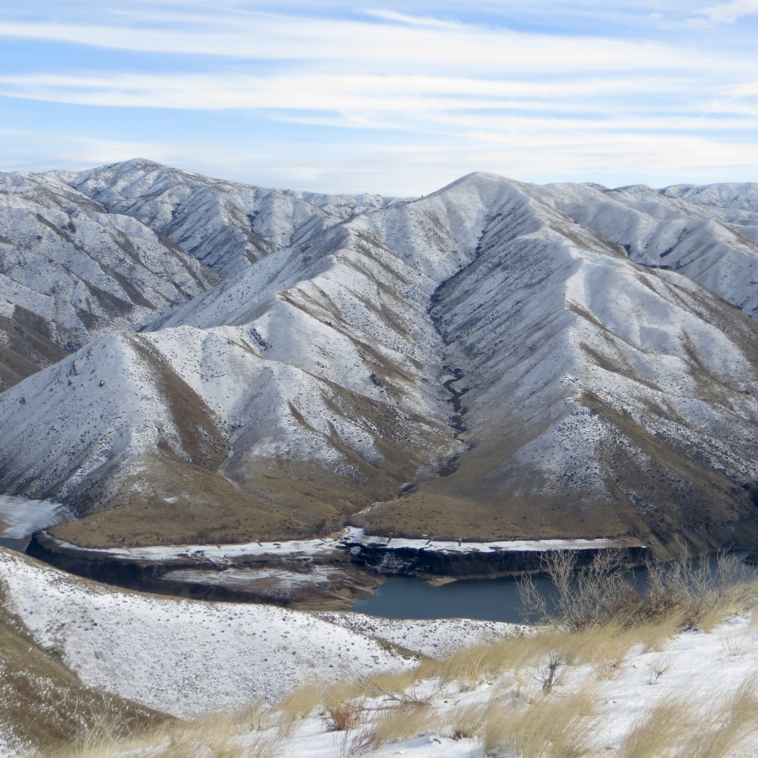
Hunting access gate/road that goes to Peak 4973, Peak 5380 and Kepros Mountain. Margo Mandella Photo
As you crawl along the road, reach a junction with a steep descent to the left. Descend to the left and continue until you reach a wide area on the ridge that is an obvious pull-out. This is the point where most 4WD vehicles should park. The road gets narrower, rockier, tougher to navigate, and there are few pullovers or backup options from this point on. If you have an ATV/UTV, you can travel to the summit of Peak 5380 and begin your climb there. Starting midway between the saddle and Peak 5380, the climb was 8.1 miles round-trip with 1,810 feet of elevation gain.
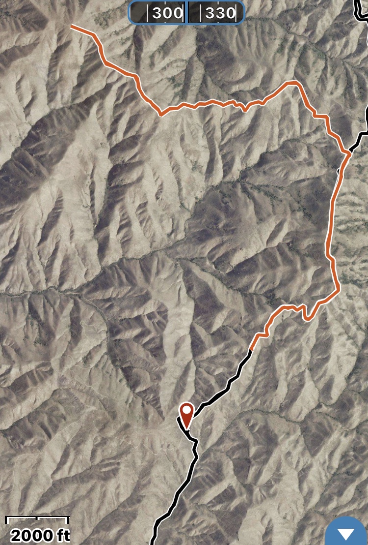
The red location pointer is the saddle that a high-clearance 4WD vehicle can reach. Margo Mandella track
Additional Resources
Regions: Boise Mountains->Danskin Mountains->WESTERN IDAHO
Mountain Range: Boise Mountains
Year Climbed: 2017
Longitude: -115.97319 Latitude: 43.54959