Beaverhead Mountains access information is on Pages 328-331 of the book. Below are access updates.
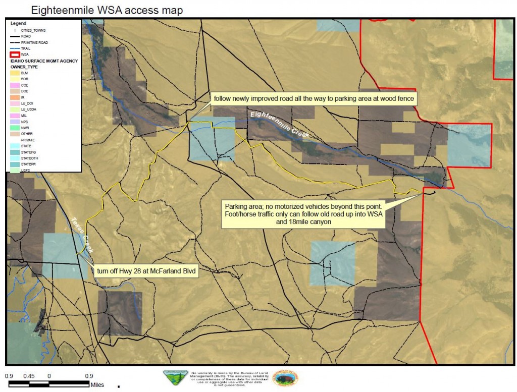
Judi Steciak reports that access has changed for the Eighteenmile Peak and Jump Peak area. Please find the 2011 BLM map below for access to the Eighteenmile Wilderness Study Area in the Beaverhead Mountains. This replaces the (B)(6.1) Eighteenmile Creek Road description on Page 329 and it avoids private property. We used this map with an Idaho Back Roads Atlas and topographic maps.The road was re-graded in 2011 and is accessible to higher-clearance passenger cars. There are at least two outfitter camps in the Eighteenmile WSA during hunting season.
BLM map for the Eighteenmile Wilderness Study Area in the Beaverhead Mountains. This updates the directions [(B)(6.1) on Page 329 (Eighteenmile Creek Road and access to Cottonwood Mountain and Eighteenmile Peak)]. Thanks to Judi Steciak and Carl Hamke for this update.