Elevation: 6,402 ft
Prominence: 582
This peak is not in the book. Published November 2022
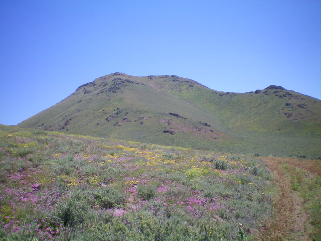
Peak 6402 is a beautiful, pyramidal peak that towers over the mouth of the Little Wood River Reservoir and Burgess Flats. Thanks to ACCESS YES, the peak is accessible from the northwest along the Little Wood River Reservoir Road. This area is a mix of private and public land, so be careful. The west side of the peak is almost entirely on BLM land but the east side of the peak is entirely on private land. USGS Lake Hills
Peak 6402 as viewed from the northwest. The summit is left of center. Livingston Douglas Photo
Access
From US-20 at the north end of Carey, turn left/west onto [signed] Little Wood River Reservoir Road and follow the road west then north all the way to the mouth of the reservoir. Just after crossing the outlet creek on a sturdy bridge, look for an unsigned 2-track road on the right/east side of the road about 0.1 miles north of the bridge, just after passing another unsigned 2-track road on the left/west side of the road. Park along Little Wood River Reservoir Road near the junction with the right-side 2-track road (5,110 feet). This 2-track road is quite overgrown, has a cattle fence and wire gate, and an ACCESS YES sign. (Use the link to read about the ACCESS YES program and to learn the terms governing use of this access point.)
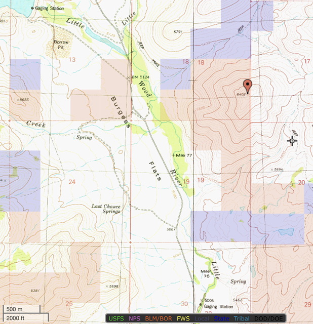
Land ownership for Peak 6402. Blue is State of Idaho land, brown is BLM land and the remainder is private property.
West Face/West Ridge, Class 3
The Climb
From the road junction, jump the cattle fence and hike along the weak, overgrown 2-track as it follows the left/west side of Little Fish Creek and then bends sharply right/east to cross the small stream. The 2-track continues right/southeast (and is shown on the USGS topo map) to reach a wide gully at the base of the west face/west ridge of Peak 6402. The gully and the land east of it is all BLM land. The 2-track turns left/northeast and continues its journey up the dry gully.
Leave the 2-track road soon after it enters the gully and cross a dry stream bed to begin the steep climb up a sagebrush slope to reach the rocky ridge crest. Once on the ridge, scramble up a headwall (Class 3) to get atop the ridge cliffs/boulders and continue east-southeast to the gentle summit. The rocky ridge crest gives way to a final, easy push up some easy scrub to the top. The view of nearby Little Wood River Reservoir is magnificent.
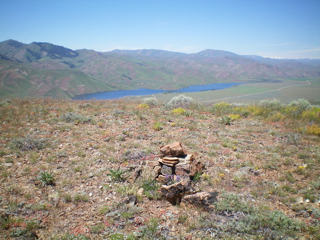
View of Little Wood River Reservoir from the summit of Peak 6402. Livingston Douglas Photo
Additional Resources
Regions: EASTERN IDAHO->Pioneer Mountains
Mountain Range: Pioneer Mountains
Longitude: -113.99209 Latitude: 43.41489