Elevation: 7,660 ft
Prominence: 400
This peak is not in the book. Published May 2019
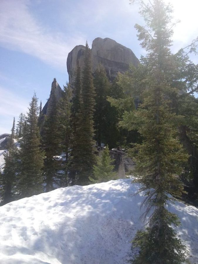
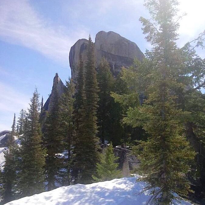
Peak 7660 is located in the Middle Fork of the Payette River Section of the Salmon River Mountains north of Crouch. Peak 6985 (which appears to be technical) is just to the west. Like many summits in this area, Peak 7660 is capped by a granite dome. USGS Wild Buck Peak
The summit block of Peak 7660. Brett Sergenian Photo
Access
To access the peak, take the Middle Fork Road north of Crouch to its end at the Silver Creek Summit and Long Fork trailheads. Take the the Long Fork Trail and head east for a few miles to the drainage west of the peak.
South Ridge, Class 3
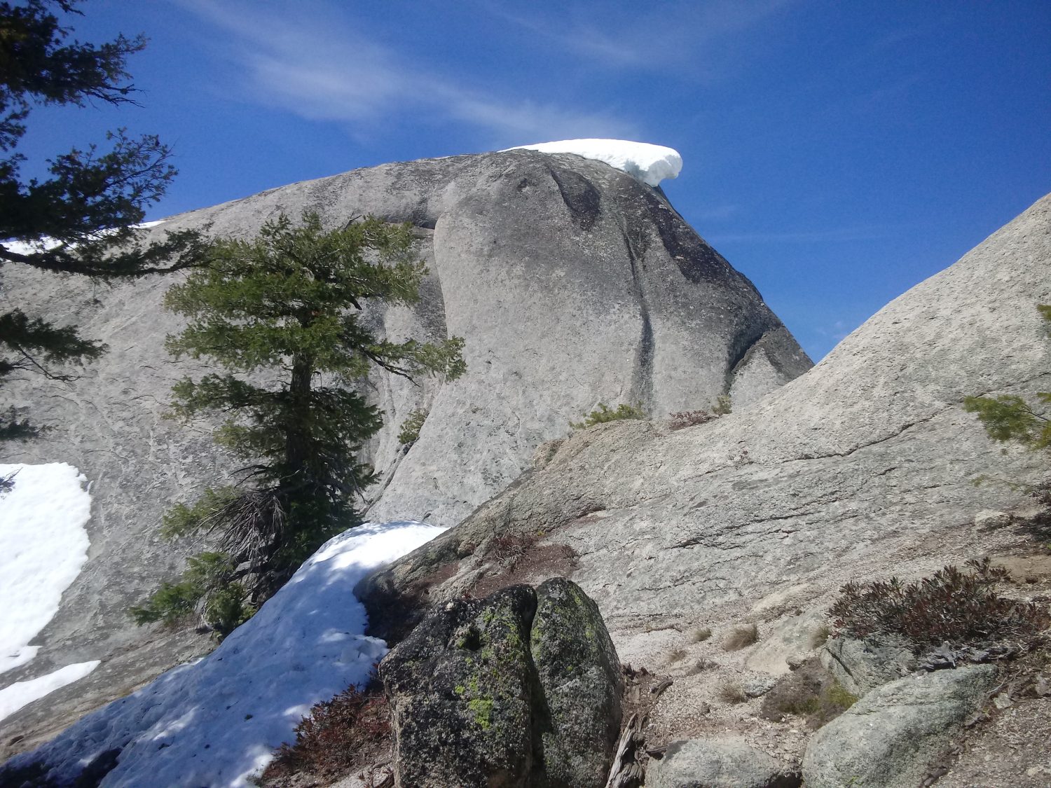
The Long Fork of Silver Creek can be quite high in the Spring. I ended up staying on the North Side of the creek. Bushwhack your way north up the drainage and climb up to the South Ridge. I think the true summit is the West Summit despite the GPS on my phone indicating it was 7 feet lower than the East Summit. The West Summit is a granite slab and can be walked up from its South Side, although it is somewhat exposed.
The East Summit is easy Class 3. It is possible to access the peak from the Silver Creek Summit Trail but there are quite a few granite towers to navigate around. I took this route on the ascent and descended the Long Fork Trail on the way back. The summit views of the surrounding Salmon River Mountains are spectacular. My round-trip stats: 10.0 miles with 3,500 feet of elevation gain (I parked about a mile before the trailhead).
The summit block of Peak 7660. Brett Sergenian Photo
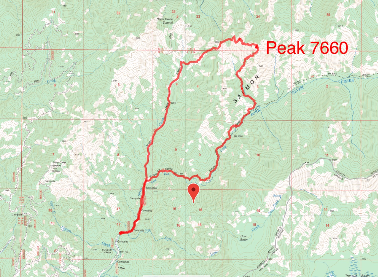
Brett’s GPS track.
Additional Resources
Mountain Range: Western Salmon River Mountains
Longitude: -115.7291 Latitude: 44.4103