Elevation: 11,516 ft
Prominence: 336
Climbing and access information for this peak is on Pages 246-247 of the book. Derek Percoski added a new route up the peak’s west face. Updated August 2020
Abel Peak is the 45th-highest Idaho summit. It is a difficult, seldom-climbed peak. Use the link below to see Rick Baugher’s account of his first ascent. USGS Phi Kappa Mountain
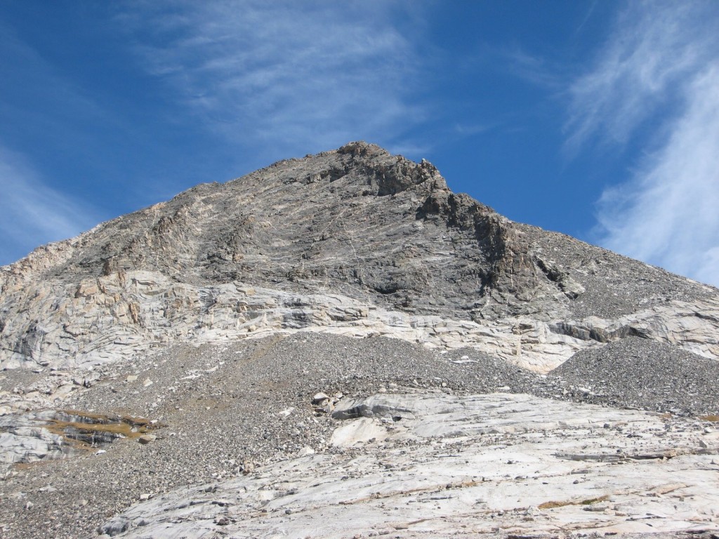
Abel Peak. George Reinier Photo
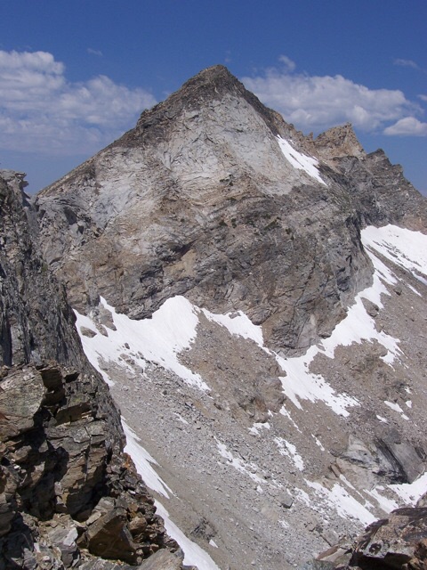
Abel Peak as viewed from Rearing Stallion on 7/20/08, showing the upper section of the South Ridge. My 9/17/94 ascent of Abel Peak was via the South Ridge. Rick Baugher Photo and Commentary
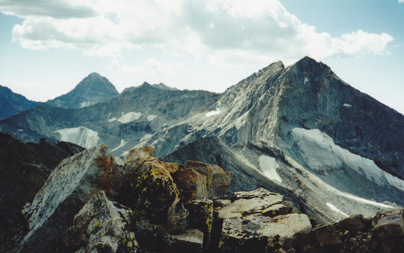
From the pristine summit of Abel Peak, this view is looking south to Goat Mountain (climber on the summit). The Northeast Ridge of Goat Mountain is rated a difficult Class 5.8 climb. Note the permanent ice features in this section. Hyndman Peak is on the left (9/17/94). Rick Baugher Photo and Commentary
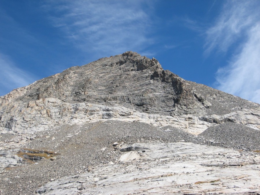
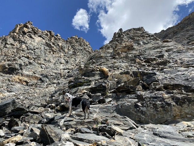
West Face, Class 4 by Derek Percoski
I climbed this route with my wife, Danielle Percoski, and our dog. I’ll call this Class-4 and perhaps in the future someone can poke around more and downgrade that. The route is blocked by a white cliff band at 11K. We traversed north a bit to find passable weaknesses, but we worked with a bit of exposure. After you get above that shelf you’ve got fantastic scrambling terrain with options everywhere. Once you get about 50’ from the summit you’ve got some options, but from what I saw they all involve at least one significant tricky or exposed move. My route from there is probably different from what most climbers would do, since there are some things my dog can do really well and somethings that aren’t possible for her. Recommended only for scramblers looking to solve a puzzle.
We descended on the south side of the imposing rib that divides the west face. It was fairly easy to get down, but once we hit the cliff band we traversed a ways south before finding a way past it. In hindsight, it would have been better to descend the south ridge.
This excellent scrambling zone makes the route worthwhile for those up to the challenge of getting to it. Derek Percoski
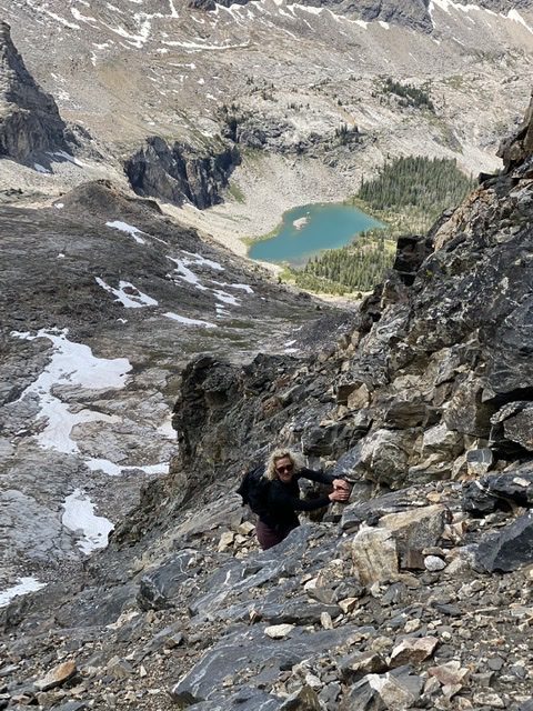
Danielle Percoski climbing the west face. Kane Lake in the background. Derek Percoski Photo
Additional Resources
Regions: EASTERN IDAHO->Pioneer Mountains
Mountain Range: Pioneer Mountains
First Ascent Information:
- First Ascent Year: 1994
- Season: Summer
- Route:
- Party: Rick Baugher