Elevation: 7,380 ft
Prominence: 840

This peak is not in the book. Livingston reported that “This was probably the single most dangerous, most difficult climb of the summer. No kidding.” Considering that he climbed over 300 Idaho summits in 2019, it is wise to approach this peak with caution. Published November 2019
Arco Hills High Point is the most rugged summit in the Arco Hills and is the high point for this area. It is rarely climbed. It is most easily accessed from a road junction at the mouth of Deadman Canyon. Point 7352 (the south summit) is not too difficult to reach but it is a FALSE SUMMIT. The true summit is at the north end of the summit ridge crest, a good 0.3 miles away. The ridge traverse from Point 7352 to the true summit is difficult. The descent off the true summit (to the north) is even worse. This is no walk-up like many of the gentle hills in Arco Hills. Do not take this mountain lightly. USGS Arco Hills
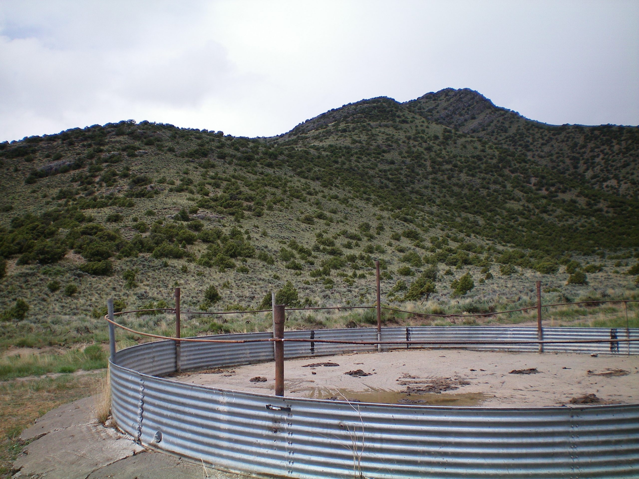
The southeast ridge of Arco Hills HP is the left skyline leading rightward up to two ridge humps. The right/highest hump is forested Point 7352. The summit is behind Point 7352 by a good 1/4 mile. The large concrete-based cistern in the foreground is the landmark for the start of this climb. Livingston Douglas Photo
Southeast Ridge, Class 3
Access
From the junction of ID-33 and ID-20/26, drive east on ID-33 for 2.3 miles to an unmarked dirt road on the left/north side of the highway. This is Deadman Canyon Road. Drive 1.8 miles up Deadman Canyon Road and park at a large, concrete cattle cistern on the right/east side of the road. If you’re really desperate, you can camp here (5,425 feet).
The Climb
From the parking area, scramble west up a steep slope of field grass, sagebrush, and scattered junipers to reach the crest of the southeast ridge. Once on the ridge, follow the ridge crest northwest up to Point 7352. The terrain is a mix of embedded rock/boulders, junipers, and short scrub. Mountain mahogany join the cavalcade higher up. The difficulty is Class 2/2+. The ridge narrows considerably when you reach Point 7352. You might even mistake it for the true summit. After all, it is only about 25 vertical feet lower than the true summit to the north (both by map measurements and by my Casio altimeter assessments).
The true summit of Arco Hills HP is another ¼ mile to the north. The narrow, rocky, forested ridge traverse goes at Class 3. It is tedious. The ridge blocks are cumbersome to either skirt or climb over. There is a series of ups and downs on this ridge traverse as well. The high point is a rocky buttress with a small cairn on top (which I built up a bit). It is the southern of two ridge blocks in the summit area. The northern block is 10 feet lower (altimeter + visuals). My altimeter determined that the high point is 20 vertical feet higher than Point 7352.
North Ridge/Northeast Spur, Class 4
Access
Same as for the southeast ridge. This route is part of a ridge traverse from Arco Hills HP to Peak 6990.
The Descent
From the true summit, scramble on or near the ridge crest north-northwest for a short distance until a serious problem emerges: the ridge cliffs itself out. Descend the right/east side of the ridge down steep face rock and chutes to skirt this difficulty. The ridge cliffs emerge at about 7,200 feet. Descend 200 vertical feet to skirt around the right/east side of them. This is serious Class 4 work and it’s even worse when it’s wet, which it was when I was there. Once past the ridge cliffs, contour on angled scrub/grass at 7,000 feet to reach a saddle just below, and south of, Point 7092. Leave the north ridge here and descend the relatively-easy northeast spur to a gentle saddle. The terrain on the northeast spur is mostly open grass/sage with a gravel/scree base. It goes quickly. You will even get help from an old 2-track jeep road as you approach the saddle.
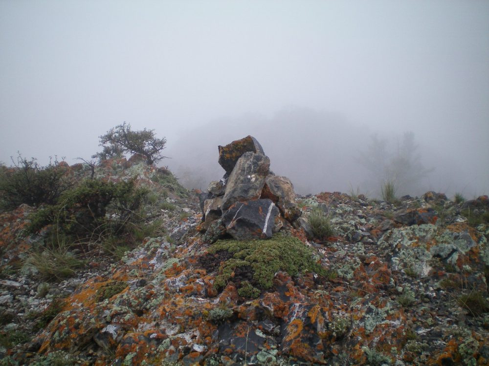
The newly-refurbished summit cairn atop Arco Hills HP on a cold, rainy morning in eastern Idaho. Livingston Douglas Photo
Additional Resources
Regions: EASTERN IDAHO->Lost River Range
Mountain Range: Lost River Range
First Ascent Information:
- Other First Ascent: Southeast Ridge
- Year: 2019
- Season: Spring
- Party: Livingston Douglas
- Other First Ascent: North Ridge/Northeast Spur —Descent
- Year: 2019
- Season: Spring
- Party: Livingston Douglas
Longitude: -113.15969 Latitude: 43.66479