Elevation: 7,547 ft
Prominence: 607
This peak is not in the book. Margo Mandella prepared the original post. Livingston Douglas provided two additional routes which are set out down the page. Updated November 2021
South/Southeast Ridges by Margo Mandella
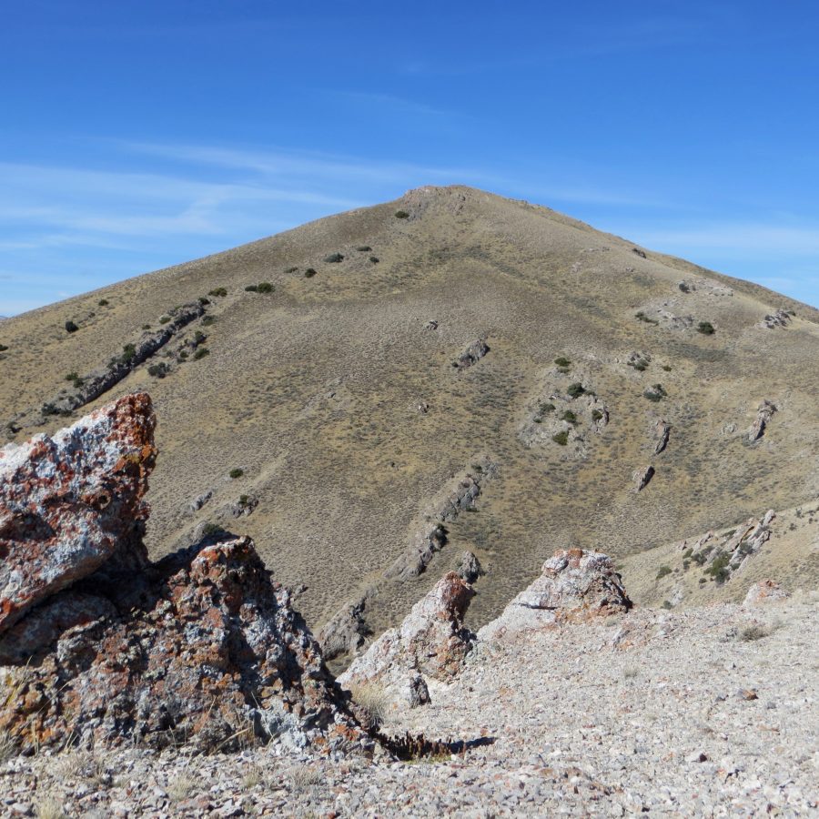
Arco Peak lies north of the town of Arco, Idaho. The historic graffitied lower section of the peak is what people think about when Arco Peak is mentioned. The true summit, however, is 1,000 vertical feet higher to the north. We climbed this peak in October 2017. USGS Arco North
Arco Peak. Steve Mandella Photo
Access
Arco Peak is on public land, surrounded on three sides by private land. Even though there are multiple ways to climb it, your ability to access the peak will be determined by your vehicle type and conditions. You will need a 4WD to get close to the peak, and there are a number of unmarked dirt roads around the peak. We were able to access one from Arco Pass Road (a county road). We drove to a point close to the peak where we parked at an unofficial pullout.
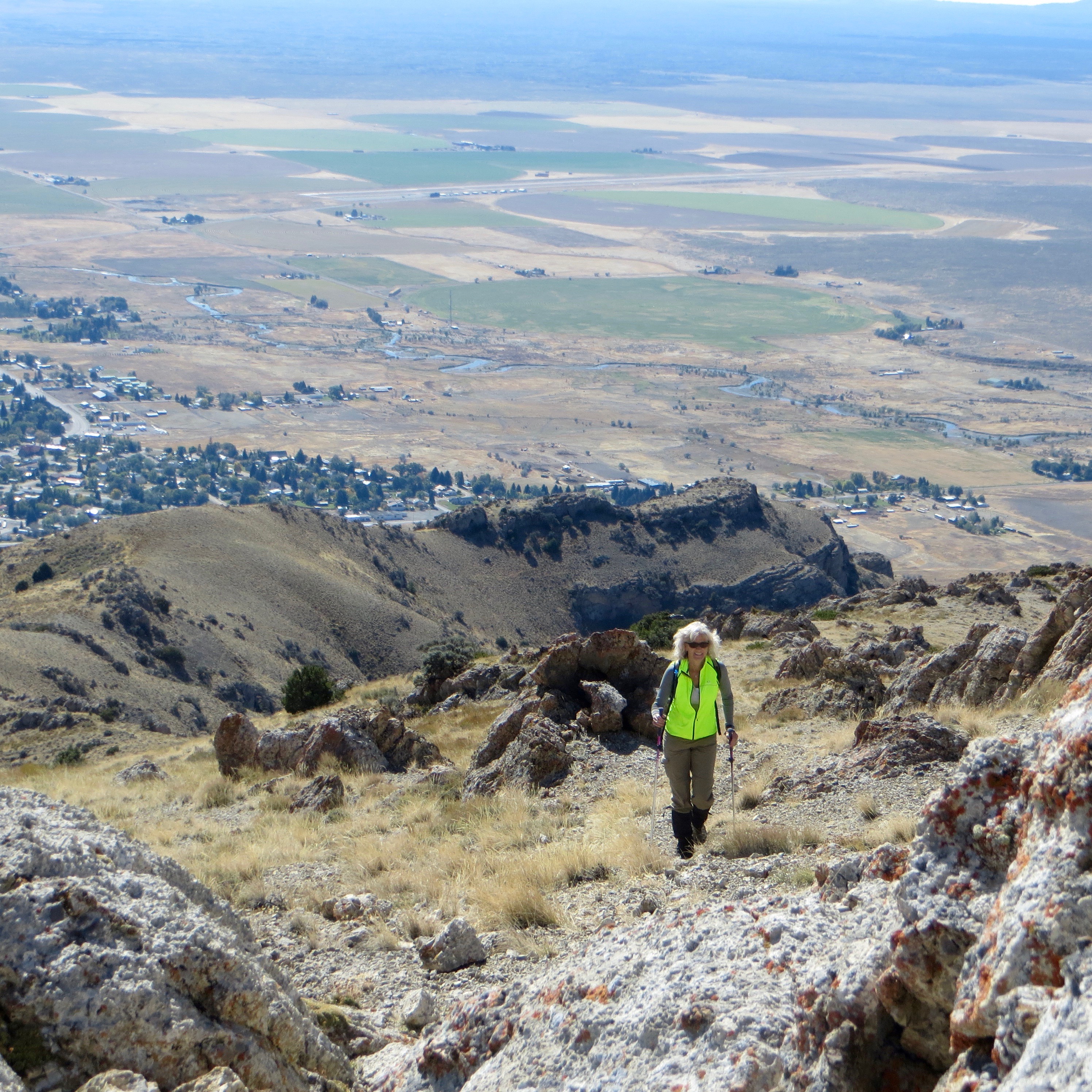
Margo climbing Arco Peak. Steve Mandella Photo
South/Southeast Ridges Route, Class 2
There are obvious 4WD, motorcycle, hiking trails all around Arco Peak. From our parking spot, we chose to ascend directly to the ridge, staying up high where we could see our climbing options. We noticed on the way that we could have stayed in the gully longer and then climbed to the ridge. On a hot day, the gully might be the better approach. We took the gully on our way down. Trip stats: 7.4 miles with 1,791 feet of elevation gain round trip.
The summit cairn atop Arco Peak. Steve Mandella Photo
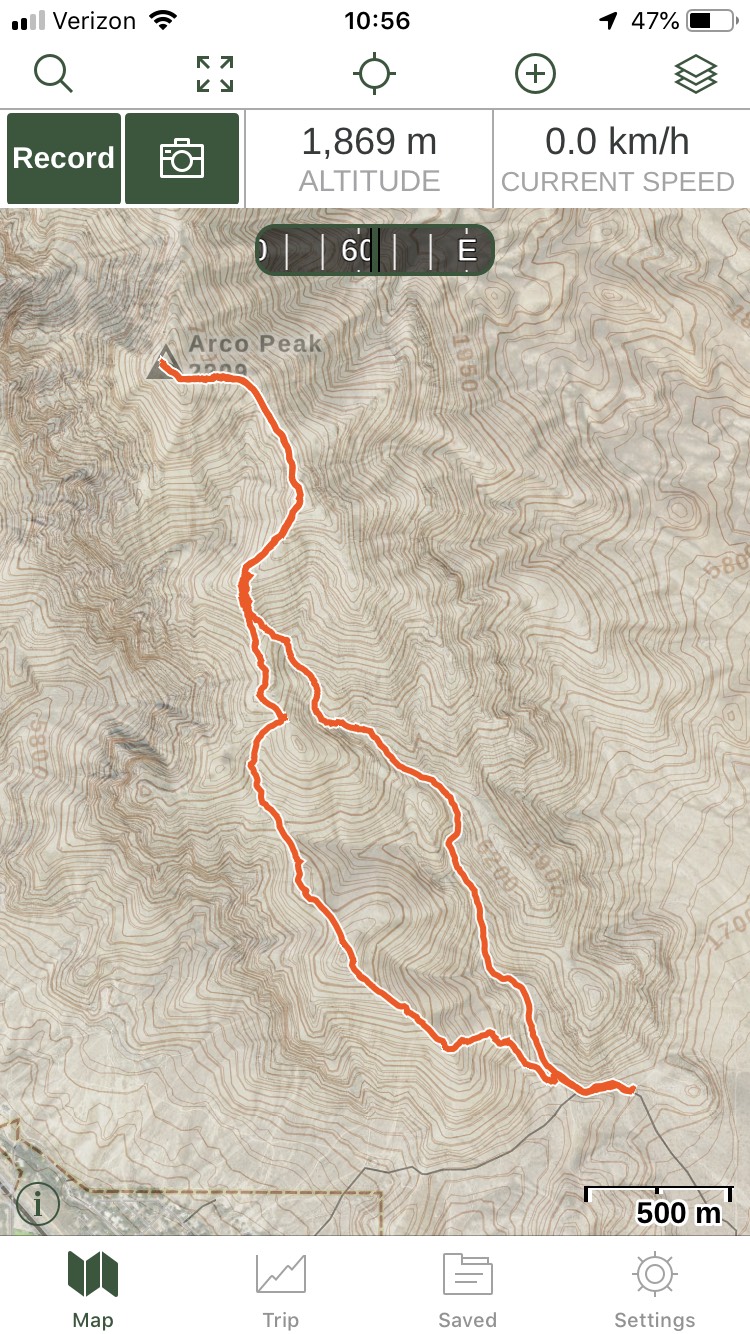
Arco Peak track. Margo Mandella
East Ridge and East Gully by Livingston Douglas
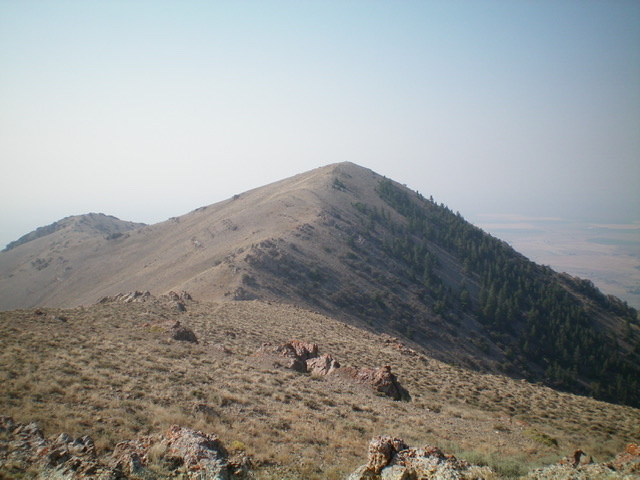
Arco Peak and its north ridge as viewed from the summit of North Arco Peak. Livingston Douglas Photo
East Ridge, Class 2
Access
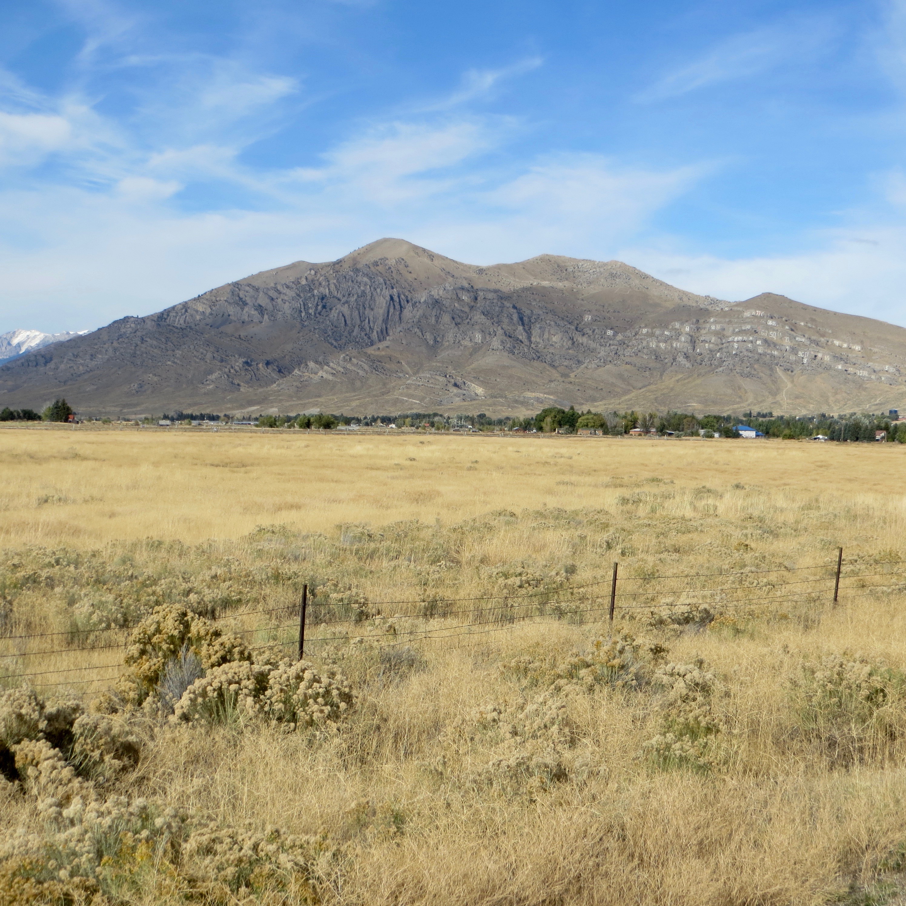
At the south end of Arco (ID) along US-20/26, there is a frontage road (Highway Drive) on the east side of the highway. Just north of the Conoco gas station, look for the Lost River Motel on the right/east side of the highway. Find an access road here that goes east to intersect Highway Drive. There is a public park of sorts here with a picnic table.
When you reach the “T” junction with [signed] Highway Drive, turn right/south and drive 0.3 miles to a signed junction. Go left/east here onto 2450N. This junction is directly east of the Conoco gas station. Drive 1.0 mile on 2450N to a signed road junction. Go left/north here. This is the start of Arco Pass Road. Reset your odometer here. At 2.6 miles, the road crosses a cattle guard. Park in large pullout on the left/west side of the road just after passing the cattle guard. The elevation here is 5,565 feet.
View of the east side of Arco Peak from the parking pullout along Arco Pass Road. Livingston Douglas Photo
The Climb
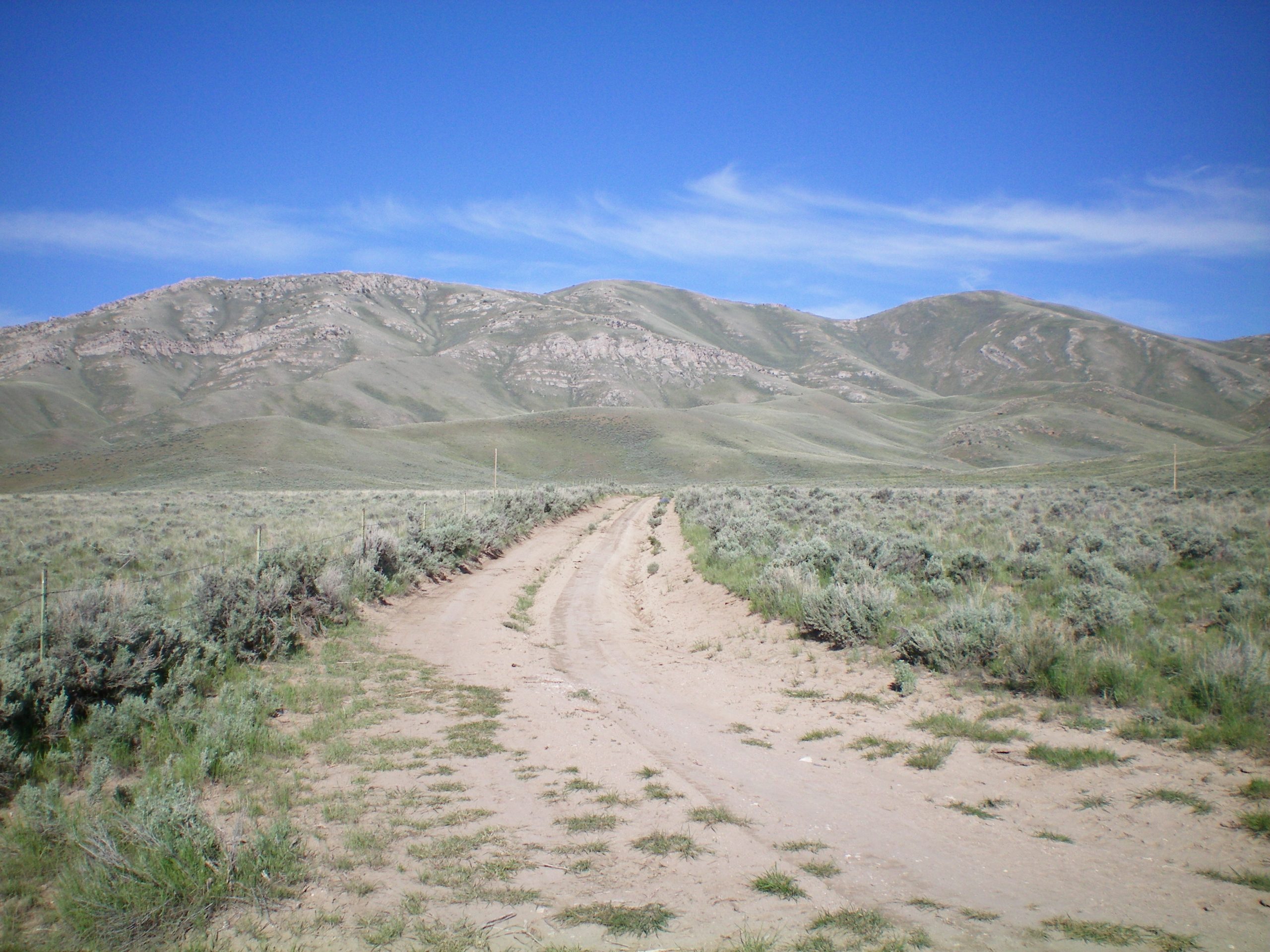
From the parking pullout, follow a decent 2-track jeep road heading west on the right/north side of a fence row. This fence row is the dividing line between public land and private land, so be sure to stay on its right/north side. When you reach a fence corner, leave the road and head southwest toward the top of a minor sub-ridge, weaving through the thick sagebrush to reach a visible cattle trail that heads up to the top of the ridge. Once you reach the ridge line, descend southwest 50 vertical feet into a wide gully with terrain undulations in it.
Scramble across easy sage/grass to reach the northeast side of the east ridge near a minor saddle just west of Point 5972. Climb south up onto the crest of the east ridge. Follow the ridge crest on easy scrub/grass heading west then west-northwest with a prominent gully below you on the left/south side of the ridge. The gully to your left ends at a lateral ridge. The section of the east ridge that leads up to this lateral ridge has some rocky outcrops to climb over or skirt around (Class 2).
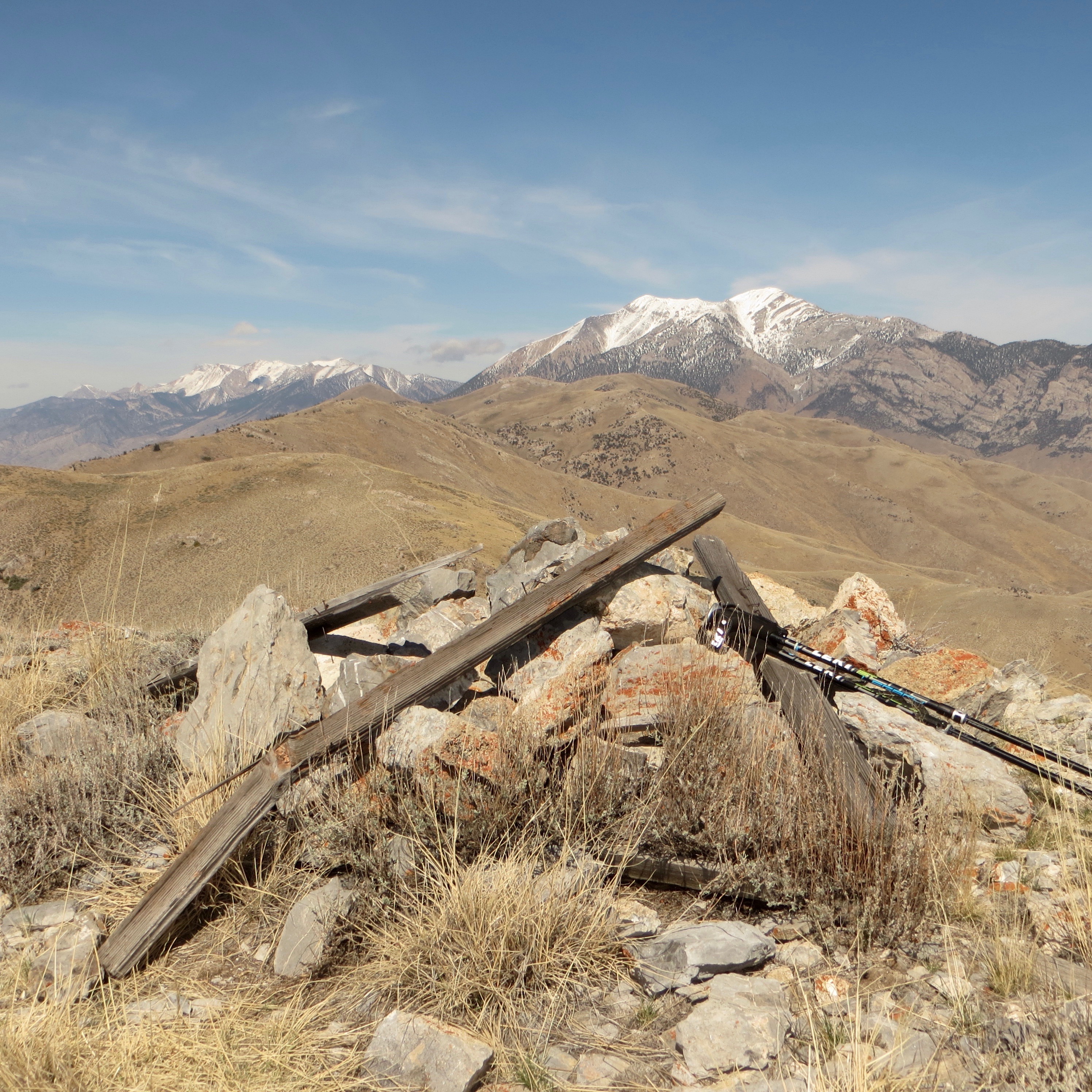
The lateral ridge is the precursor to the north-to-south summit ridge (at about 7,225 feet). When you reach the summit ridge, turn right/north and follow a good use trail that tracks the south ridge and north ridge of Arco Peak for a long ways. The trail bends left-ish/northwest and goes to the well-cairned summit of Arco Peak. The summit has a decent cairn with large talus and several pieces of triangulation posts. The summit offers a beautiful view of town of Arco, ID.
East Gully, Class 2
Access
Same as for the east ridge
The Descent
From the summit, descend the north ridge on a use trail (which disappeared in a choppy ridge section) to a grassy saddle at the head of the southwest branch of the east gully. Leave the summit ridge at this saddle and descend this feeder gully northeast through steep, thick sagebrush and steeply-angled shorter-scrub sides for 800 miserable vertical feet to reach a flatter area down below. After another 400 vertical feet of descent, reach a meadow where cattle are often grazing.
There is a faint 2-track jeep road here. Follow this jeep track east down the gully. It soon morphs into a much better jeep road and takes you all the way southeast back to the jeep road on the north side of the fence row leading back to Arco Pass Road and your parked vehicle. The north summit of Arco Peak does appear to be slightly lower than the measured south summit.
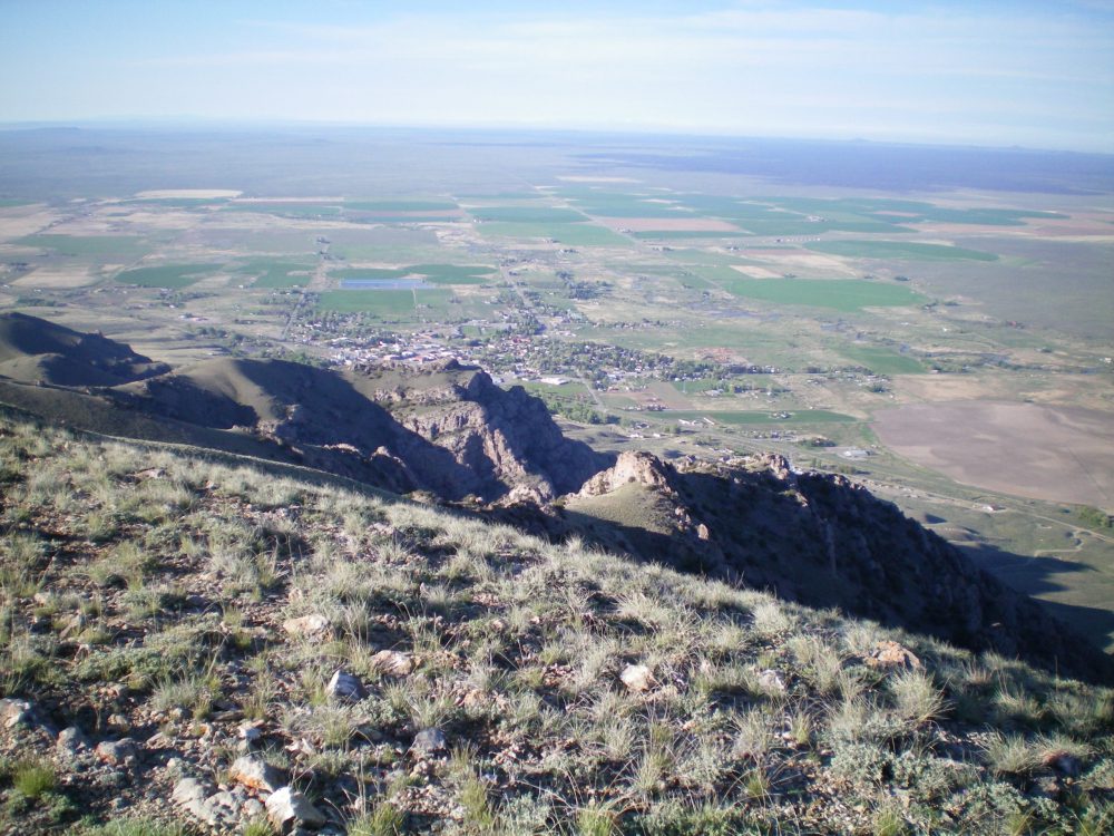
The view of Arco, ID from the summit of Arco Peak. Livingston Douglas Photo
Additional Resources
Regions: EASTERN IDAHO->Lost River Range
Mountain Range: Lost River Range
Longitude: -113.299969 Latitude: 43.66659