Elevation: 7,943 ft
Prominence: 643
This peak is not in the book. Published January 2023
Argument Ridge is a forested ridge that is located on the east side of Lime Kiln Canyon in the Big Hole Mountains. It is most easily reached via FSR-218 which passes through the Kelly Mountain Ski Resort area. Two different ATV trails lead to the summit. USGS Temple Peak
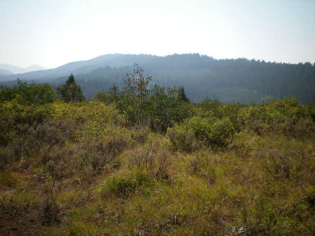
Argument Ridge as viewed from the summit of East Farnes Mountain to its west. Livingston Douglas Photo
Access
Access for the southwest ridge route is via FST-213 (an ATV trail) along FSR-218 exactly 7.7 miles up from the “Y” junction at the Kelly Mountain Ski Resort. The junction of FSR-213 and FSR-218 is signed and is at 6,545 feet. There is a large parking/camping area at this junction. Access for the northwest ridge route is via FSR-659 (signed) along FSR-218 about two miles farther up (northeast) FSR-218 from FSR-213.
Map Errors
The DeLorme trail map fails to show the ATV trail that leads to the summit from FST-213 and fails to show FSR-659 and the subsequent ATV trail that follows the northwest ridge to the summit from FSR-218. The USGS topo map fails to show ANY of the road/trail that heads up the northwest ridge. The Caribou-Targhee NF map fails to show the continuation of FSR-659 (which becomes an ATV trail) that heads up the northwest ridge to the summit.
Northwest Ridge, Class 1
The Climb
From the junction of FSR-218 and FSR-659, hike up FSR-659 (which becomes an ATV trail) as it follows the forested northwest ridge to the summit. Though I have not personally climbed this route (I wish that I had), I can vouch that FSR-659 still exists and the ATV trail exists on the upper northwest ridge in the summit area. I can only conclude that, based on other roads/trails in this area, the road/trail exists along the entire length of the northwest ridge all the way from FSR-218.
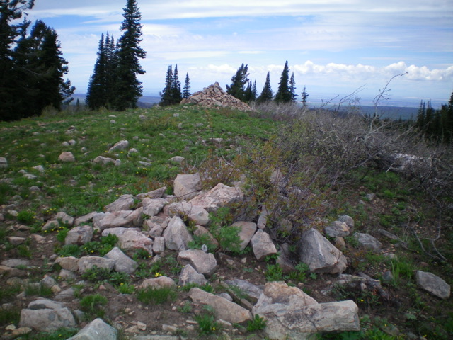
The summit of Argument Ridge. The large cairn is probably not the high point. The more modest cairn in the foreground is about five feet higher. Livingston Douglas Photo
Southwest Ridge, Class 1-2
The Climb
From the junction of FSR-218 and FST-213, hike up FST-213 as it follows Hinckley Creek east for about 1.5 miles to a saddle at 7,180 feet. The trail turns hard left/east here and begins its climb up the southwest ridge of Argument Ridge. FST-213 weaves and undulates its way east for about 1.2 miles to an unsigned ATV trail junction at a saddle at 7,380 feet. The main ATV trail heads right/southeast from here down Coalmine Canyon. Leave the main trail and head left/north up an unofficial ATV trail (shown only on the USGS topo map) that heads north then east up to the summit. Depending upon lingering snow conditions in the forest, you may have to bushwhack some of the upper route to reach the summit as I did.
Additional Resources
Mountain Range: Big Hole and Snake River Mountains
Longitude: -111.44909 Latitude: 43.65619