Elevation: 8,854 ft
Prominence: 714
This peak is not in the book. I added a photo to this page. Updated June 2025
Basin Butte is located on a high ridgeline and sits at the head of the Sunday Creek and East Fork Valley Creek drainages. It has a nice fire lookout on its summit and can be reached by a 4WD service road (FSR-432/Basin Butte Road). Regrettably, Basin Butte is located in a massive burn area. It can be climbed in combination with nearby Peak 8561 but that peak requires a bushwhack through the unpleasant, charred pine forest. USGS Basin Butte
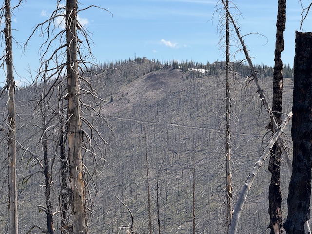
Basin Butte viewed from Peak 8561.
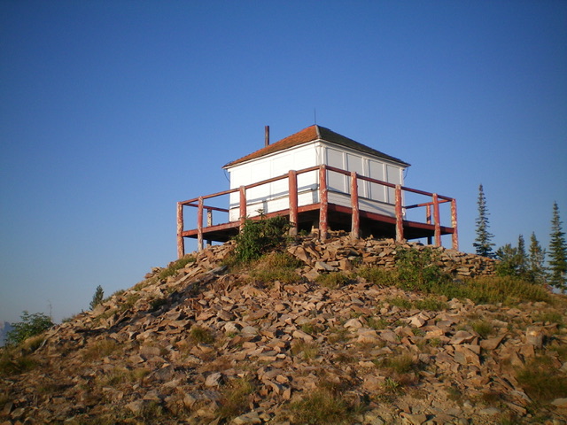
The lookout atop Basin Butte. Livingston Douglas Photo
Access
From ID-21 west of Stanley, turn right/east onto [signed] Stanley Creek Road/FSR-653. At 1.3 miles, go left at a signed junction to stay on FSR-653. At 1.5 miles, reach an unsigned “T” junction. Go left/northwest onto Basin Butte Road/FSR-432. Reset your odometer here. At 3.9 miles, reach a signed junction with the Little Basin Cutoff Trail/FST-4042 (an ATV trail). Go straight to stay on FSR-432. At 5.7 miles, reach a pullout at the base of a steep, rocky road section (7,980 feet). Park here (GPS coordinates: 44⁰18’57”N, 114⁰58’58”W) or continue up the rough road to the fire lookout and summit parking area.
South Ridge, Class 1
The Climb
From the parking pullout at 5.7 miles, hike about two miles up the steep, rocky road to the summit and fire tower.
Additional Resources
Regions: Eastern Salmon River Mountains->Salmon River Mountains->Southeast Corner Peaks->WESTERN IDAHO
Mountain Range: Eastern Salmon River Mountains
Year Climbed: 1984
Longitude: -114.97771 Latitude: 44.33849