Elevation: 6,740 ft
Prominence: 80
This peak is not in the book. Published November 2020
Beacon Hill is quite visible from I-15, particularly for northbound travelers. Be very careful with private land around Beacon Hill, particularly at its south end. The private land is fenced and rigorously posted so stay off it. Bushwhacking here is thick and rough so be prepared for a battle if climbing the east side of Beacon Hill, which is the shortest route to the top. There is an old jeep road that comes in from the north but it might not be accessible due to private land and a borrow pit at its base. USGS Spencer North
Access
From Exit 180/Spencer on I-15, drive 1.0 mile north up the frontage road on the west side of I-15 to reach the [signed] Targhee National Forest boundary at a cattle guard/fence. Park on the left/west side of the road just inside the National Forest boundary (5,900 feet).
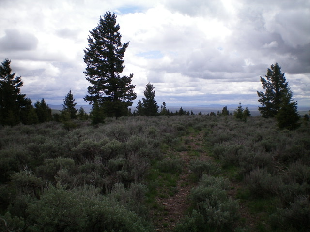
The summit area of Beacon Hill, looking south. Livingston Douglas Photo
East Face/South Ridge, Class 2+
The Climb
From the parking pullout, follow the right/north side of the fence row and climb up through steep, brushy terrain on the east face. The fence row ends just below a rocky outcrop with a boulder/brush mix. Scramble up this unpleasant combination of boulders/brush/veg (Class 2+) to get atop a rocky buttress. I avoided these boulders on the descent by staying farther to the north of the fence row here.
From the top of the buttress, bash your way upward through easier brush to reach the south ridge, which greets you with more sagebrush. Move left/west to find remnants of an old jeep road on the south ridge and follow it to the summit. The summit of Beacon Hill is sagebrush-covered with no clear high point and no summit cairn. The general area of the high point IS obvious as the old jeep road begins to descend downhill to the north.
Additional Resources
Regions: Beaverhead Range->EASTERN IDAHO
Mountain Range: Beaverhead Range
Longitude: -112.19859 Latitude: 44.38189