Elevation: 9,595 ft
Prominence: 695
Idaho climbing and access information for peak is on Page 323 of the book where, consistent with local usage, it is identified as Bear Peak. Livingston Douglas provided the Montana access and route information found below. Published November 2020
Bear Benchmark is a ridgeline summit on the Continental Divide. It sits above the headwaters of both Big Bear Creek (ID) and Meadow Creek (ID). It is most easily climbed via its west face from Big Bear Creek Road/FSR-177 on the Idaho side. But it can also be climbed via its east ridge from Medicine Lodge Road on the Montana side. USGS Tepee Mountain
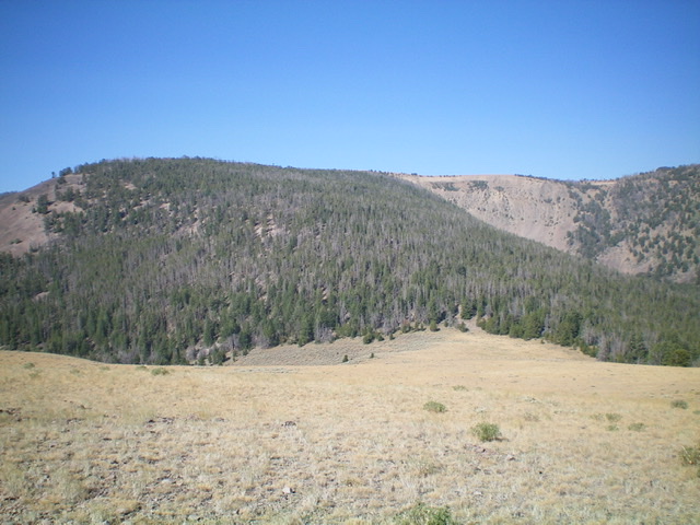
Bear Benchmark as viewed from the east, just above the final saddle (right of center). The summit is left of center and is hidden behind the trees. From the grassy saddle, bushwhack diagonally left to reach the summit ridge and then head west for over 1/2 mile to FINALLY reach the top. Livingston Douglas Photo
Montana Access
There is a lot of private land on the Montana side of Bear Benchmark so be careful. This climb is entirely on BLM land. The starting point for this climb is at the junction of an unsigned BLM road and Medicine Lodge Road. The BLM road is located exactly 0.4 miles north of the crossing of Craver Creek and 3.0 miles north of “Medicine Lodge Pass” (the high point on Medicine Lodge Road).
The easiest highway access is from Exit 44/Clark Canyon Reservoir on I-15. Drive west on MT-324 for 8.0 miles to [signed] Medicine Lodge Road. Go left/south on Medicine Lodge Road and drive 23.1 miles to reach the unsigned junction on the right/west side of the road. Park in a small pullout at the base of the BLM road (7,320 feet).
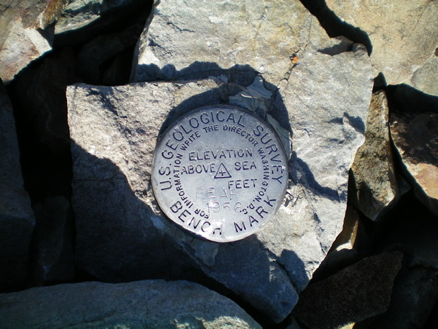
The USGS benchmark atop Bear Benchmark. Livingston Douglas
East Ridge, Class 2
The Climb
Hike up the 2-track BLM road to reach the end of the public road at a cattle gate/fence (7,800 feet). The road moves onto private land here and it is posted. There is a BLM sign here for a foot trail (which is really just a cattle trail) that continues from here and parallels the private road. Hike southwest up the trail on the left side of a fence row. The trail and fence cross a hilltop saddle between Point 8126 and Point 8219. The trail now descends southwest to a broad saddle at 7,980 feet. At this saddle, the private road comes in from the right/north and crosses back onto BLM land via a cattle gate. It is now public again.
From the saddle, hike along the BLM road south then west to its end on the crest of another hilltop (8,660 feet). Descend west down an easy hillside of tall field grass to reach a final saddle. You now must bushwhack up through a thick pine forest to reach the broad, rounded summit ridge crest east of Bear Benchmark. Thankfully, there is a good elk trail that climbs diagonally left/southwest from the saddle. Follow it steeply up through the forest. The elk trail stays a bit below (and left/east of) the rounded ridge crest.
The elk trail eventually disappears. At that point, continue to climb southwest to reach the east ridge proper. The slope eases considerably here and the pine forest is more open. However, there are a scattering of LARGE downed trees to maneuver around as you make your way west toward the summit. Overall, the bushwhack isn’t too bad up here. Pass a large grassy meadow on its left/south side and, soon after, exit the forest into open terrain. Climb west up a steep scrub-and-scree hill then continue across easy tundra and broken rock to the large cairn and posts atop the summit of Bear Benchmark.
The summit has both a USGS benchmark (in a ground boulder) and an ID/MT boundary post in a cairn. There is an expansive view from the top but this is just the highest hump on a LONG ridge crest that has many humps and extends both north and south from here. I must caution you that, when you descend the ascent route, finding the final saddle is challenging due to thick forest and lots of blowdown. If you go too far right or left of it, you will end up WAY off course and down a steep gully that takes you in the wrong direction. Be diligent in your navigation when descending this route. Once you get back to the final saddle, it’s all open terrain (mostly on a cattle trail or road) all the way back to Medicine Lodge Road.
Additional Resources
Regions: Beaverhead Range->EASTERN IDAHO
Mountain Range: Beaverhead Range
Longitude: -113.06901 Latitude: 44.66339