Elevation: 6,022 ft
Prominence: 62
This point is not in the book. Published December 2019
Bellevue Benchmark is located on a west-to-east ridge between Minnie Moore Gulch and Lees Gulch. It is positioned at the very eastern tip of this ridge and overlooks the town of Bellevue. It has two USGS benchmarks on the summit, one appropriately labeled “Bellevue.” The aforementioned ridge is between Peak 7158 to the north and Peak 7174 to the south. Its 850-foot aerial view of nearby Bellevue is stunning. USGS Bellevue
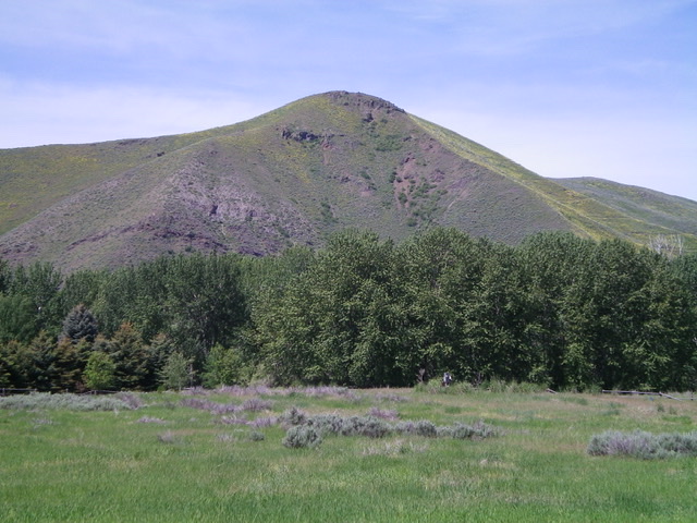
Bellevue Benchmark as viewed from Lower Broadford Road in Bellevue. Livingston Douglas Photo
South Slopes/South Ridge, Class 2
Access
From ID-75 in Bellevue, turn left/west onto [signed] Broadford Road (1 block north of Cedar Street). Drive 0.3 miles, cross a bridge, and reach a road junction. Turn left/south onto Lower Bradford Road and drive 0.9 miles to a signed junction with Townsend Gulch Road. Reset your odometer here. At 0.3 miles, go left at a “T” junction. At 0.4 miles, park in a pullout at the junction with Lees Gulch Road. You are not allowed to drive a motorized vehicle up Lees Gulch Road but foot/horse travel is permitted. Stay on the road because the surrounding land is private property until you reach BLM land at the mouth of the canyon. The elevation at the parking pullout is 5,150 feet.
The Climb
From the parking pullout, walk up Lees Gulch Road. You only need to walk ½ mile to reach the BLM land boundary. There are a few [unsigned] side roads to avoid. Early on, stay right at the first road fork. Go left at another road fork almost immediately after the first fork. There are no more forks to worry about. The BLM land is indicated by a cattle gate on the road. Leave the road here and bushwhack north up through thick sagebrush, staying just left/west of a dilapidated fence row. The fence row is the demarcation line between private land (to the right) and BLM land (to the left).
The fence row makes a sharp right/east turn partway up and goes east toward the crest of the south ridge. The fence row disappears temporarily but reappears later on the south ridge. Bash your way through the sagebrush right-ish to get up onto the south ridge. Follow the semi-open ridge crest to the small summit. There are a few areas of open terrain (gravel, short grass) on this climb, but not many. It’s mostly a sagebrush-bashing session.
The summit high point has two USGS benchmarks in separate ground boulders. There is a large summit cairn located about 50 horizontal feet down the south ridge (20 feet vertical) from the high point. The aerial view of nearby Bellevue is stunning.
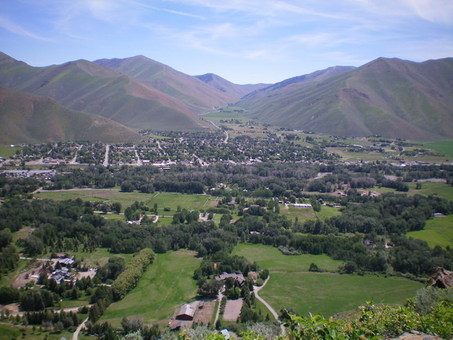
View of Bellevue and Muldoon Canyon from the summit of Bellevue Benchmark. Livingston Douglas Photo
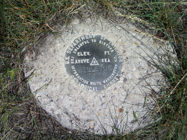
The USGS Benchmark (“Bellevue”) atop Bellevue Benchmark. Livingston Douglas Photo

The large summit cairn located just below the high point on Bellevue Benchmark. Livingston Douglas Photo
Regions: Smoky Mountains->WESTERN IDAHO
Mountain Range: Smoky Mountains
Longitude: -114.283200 Latitude: 43.462517