Elevation: 11,353 ft
Prominence: 613
Climbing and access information for this peak is on Page 253 of the book. Livingston Douglas has provided the updated route information found below. Updated February 2019
Big Black Dome is the 57th-highest Idaho summit. It is one of the easiest 11ers to climb because of good access and a straightforward route. USGS Big Black Dome
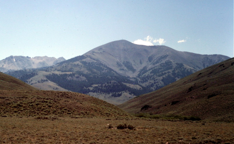
Big Black Dome as viewed from Copper Basin.
Big Black Dome as viewed from the Lake Creek Campground.
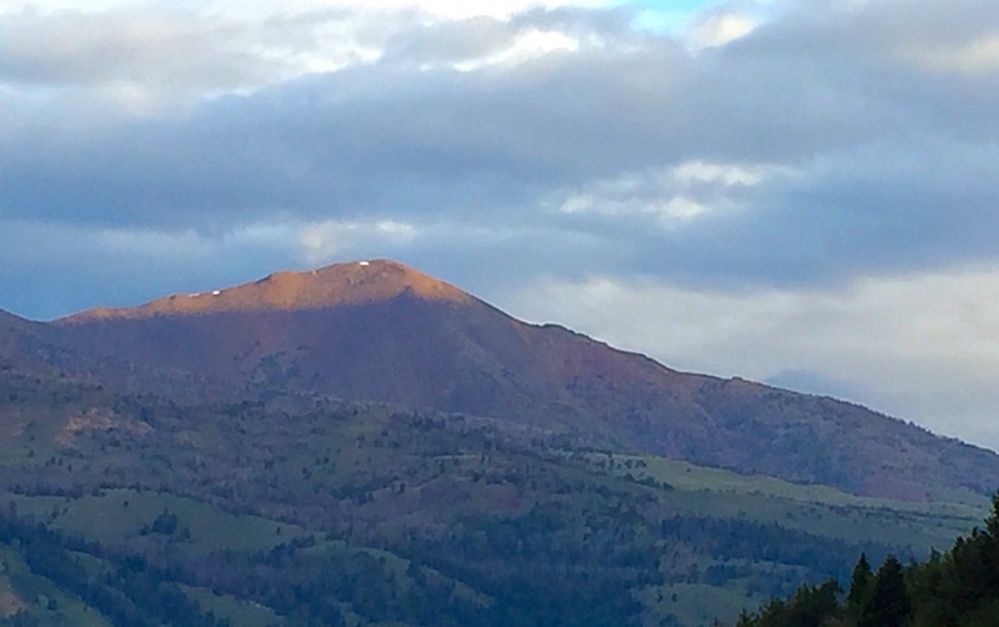
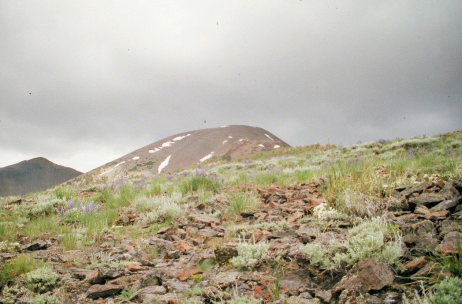
Big Black Dome as viewed from Altair Peak.
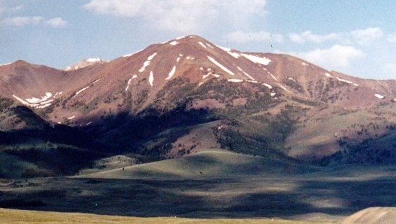
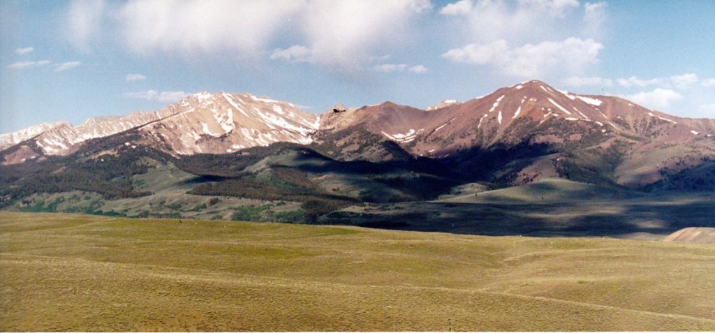
Pyramid Peak (left) and Big Black Dome (right) as viewed from Copper Basin.
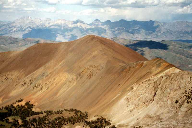
Big Black Dome as viewed from the east.
East Ridge, Class 2 by Livingston Douglas
Access
From the north end of Mackay, drive N on US-93 for 15.2 miles to its junction with Trail Creek Road. Turn L/W onto Trail Creek Road/CR-208 and drive 18.4 miles to its junction with Copper Basin Road/FSR-135. Turn L/S onto Copper Basin Road. Reset your odometer to 0.0 here. At 2.1 miles, you reach a junction with Wildhorse Creek Road/FSR-136. Go L/E here to stay on Copper Basin Road. At 13.0 miles, you reach a junction with Copper Basin Loop Road/FSR-138. Go R/S onto FSR-138 and drive 2.1 miles S to reach its junction with FSR-472. Park here (7,780 feet). There is a nice, flat parking pullout about 100 feet S of the junction of FSR-138/FSR-472 on the E side of FSR-138. Depending upon road conditions, you may be able to drive partway up FSR-472 to shorten this climb.
Please be aware that are several map inaccuracies regarding the roads/trails on the E side of Big Black Dome. The Challis NF map correctly shows that there is only one road/trail that departs from the Copper Basin Loop Road/FSR-138. That road is FSR-472. The USGS topo map and the Sun Valley Idaho Trail Map (the map that includes the Pioneer Mountains) both show other roads/trails that depart from FSR-138 farther south (and closer to the East Ridge of Big Black Dome) near Ramey Creek. Those trails/roads no longer exist. You can shorten the East Ridge climb by parking at a hairpin turn at 7,800 feet, but you must bushwhack westward from there to intercept FSR-472. The connecting trail shown on the USGS topo map (and Sun Valley Trail Map) no longer exists.
The Climb
Big Black Dome doesn’t have an East Ridge. It has an East Spur which rises to join the Northeast Ridge of Big Black Dome. The mountain also has an East Face which can be scrambled. While I will use the term East Ridge to identify this route, I will describe the route based on its actual topography. The only true ridge on the eastern aspects of Big Black Dome is the magnificent Northeast Ridge, which extends from the summit for 2.5-3.0 miles down to the two forks of Fox Creek. There are no roads/trails leading up Fox Creek from Copper Basin Road, so a 2-mile bushwhack is required just to reach the base of the Northeast Ridge of Big Black Dome.
From the base of FSR-472 at its junction with FSR-138, hike up FSR-472 for about a mile to a signed junction with FSR-472A (8,150 feet). This road junction (and FSR-472A itself) is only shown on the Sun Valley Trail Map. Do not go straight on FSR-472; go R/W onto FSR-472A. Hike up FSR-472A for just over a mile to reach its junction with Wildhorse Trail/FST-059 near Ramey Creek. The elevation here is just under 8,650 feet. Go R/W onto FST-059 to begin the climb up the East Spur of Big Black Dome. The trail will get you up onto the Northeast Ridge after about 1.5 miles and 1,000 feet of uphill. Upon reaching the Northeast Ridge (at about 9,650 feet), leave FST-059 and follow the ridge for the final mile and 1,700 vertical feet to reach the summit. The total round-trip distance is about 9.0 miles and requires about 3,725 feet of vertical gain.
FSR-472 is an easy road hike through an area of open sagebrush. FSR-472A is a steeper, more overgrown, two-track jeep road that has a 40-foot drop after it reaches, and follows, a fence row. The East Spur is open terrain (a mix of scree and grasses) with elk trails here and there. The Northeast Ridge initially has trees on it and is an easy climb. A goat trail switchbacks up a good section of the ridge, helping you navigate the scree. The ridge morphs into a combination of tundra and rocky outcrops, but is still relatively easy terrain. After the final rocky outcrop, it is simply a scree slog to the summit. The summit of Big Black Dome has a USGS benchmark in a ground boulder. Surprisingly, the Northeast Ridge is mostly firm and enjoyable. It is NOT a steep, loose scree/talus slog as it appears to be from a distance.
Additional Resources