Elevation: 9,476 ft
Prominence: 2,726
Climbing and access information for this peak, the 37th most prominent Idaho summit, is on Pages 370-371 of the book. Livingston’s route description for this peak covers an ambitious traverse starting at the Bear Creek Trailhead and climbing over Peak 7314, Peak 7860, and Peak 9142 before reaching Big Elk Mountain. Climbers who are only interested in Big Elk Mountain can continue up FSR-058 to its junction with FSR-863. FSR-863 climbs up the West Fork Elk Creek to roughly 8,100 feet. From the road’s end, a steep Class 2 climb takes you to the top of Big Elk Mountain. FSR-863 is a steep, rocky, difficult jeep road which requires a 4WD with good tires. Published November 2020
Big Elk Mountain is one of five peaks that surround Muddy Creek: Peak 7314, Peak 7860, Peak 9142, Big Elk Mountain (9,476 feet), and Peak 7911. This is a challenging multi-peak adventure that covers 11.0 miles with 5,150 feet of elevation gain round trip. It includes some trail hiking, a bit of bushwhacking, and a long, up-and-down ridge traverse. Big Elk Mountain is the big daddy of the Muddy Creek drainage. It simply towers over all of the surrounding peaks. As a P2K peak, it attracts many climbers. USGS Big Elk Mountain
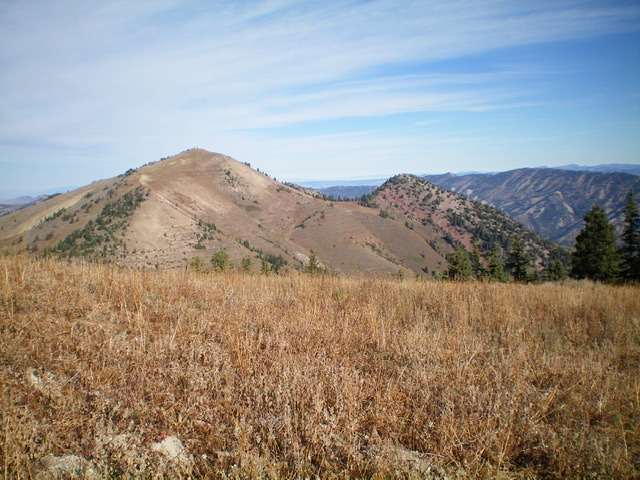
Big Elk Mountain as viewed from the summit of nearby Peak 9142 to its northeast. Livingston Douglas Photo
Access
This is the fourth leg of a five-peak adventure.
From the junction of US-26 and ID-31 in Swan Valley, drive about 10 miles southeast on US-26 to a [signed] turnoff for “Little Lemhi/Riverside Park” just north of Palisades Reservoir Dam. Turn right/south off US-26 and reset your odometer. Follow the paved road south briefly then right/west as it skirts the Riverside Park Campground and crosses the Snake River on a good bridge. Please note that the USGS topo map does NOT show this road or bridge crossing but the Caribou-Targhee National Forest Map does show it.
Please be advised that the Palisades Dam Road is closed and has been closed for years. Both the USGS topo map and the NF map make the dam road look drivable but it’s not. At 2.1 miles, turn left onto [signed] Bear Creek Road. At 4.7 miles reach a [signed] “T” junction. Go right on FSR-058/Bear Creek Road. At 10.3 miles, reach the [signed] right turnoff for the Bear Creek trailhead. Turn right here and drive 0.3 miles to the trailhead parking area (5,660 feet). The Bear Creek Trail/FST-273 heads west up Bear Creek from here.
Trail Update
Muddy Creek Trail is now FST-272, not FST-164 as the book indicates on Page 371 under the Big Elk Mountain information. After 1.7 miles, FST-272 reaches a [signed] trail junction at a ridge saddle on the long north ridge of Big Elk Mountain, just southwest of Point 7010. FST-272 is labeled FST-044 here, for whatever reason. At the [signed] triple junction on the saddle, go left/south onto FST-147/Big Elk Mountain Trail to climb to the top of Big Elk Mountain. Once again, this trail is NOT labeled FST-164 as the book indicates.
Sadly, the USGS topo map fails to show ANY of FST-147/Big Elk Mountain Trail and only shows the first mile of FST-272/Muddy Creek Trail. The trail signage at the base of FST-272 (at its junction with FST-273/Bear Creek Trail) incorrectly states “Big Elk Creek Trail 1.7 Miles” when it should state “Big Elk Mountain Trail 1.7 Miles.”
Northeast Face, Class 2
The Climb
From the 8,860-foot connecting saddle with Peak 9142, scramble up the loose scree/dirt of the STEEP northeast face of Big Elk Mountain. Cross several man-made terraces (from coal prospectors) on the way to the summit. Make a final, flatter push to reach the summit ridge in a section of brush. Once on the ridge, walk right/northwest on a trail to reach the summit high point. The summit has triangulation posts and a torn-down cairn. It offers magnificent views of the surrounding area.
North Ridge, Class 2+
The Descent
From the summit, descend northwest on the ridge crest on FST-147/Big Elk Mountain Trail to a 9,060-foot saddle southeast of Point 9145. Leave the trail here and follow a lateral man-made terrace northward to skirt the right/east side of Point 9145 and reach a small saddle near Point 8997. The terraces are overgrown with field grass and brush in this area so it’s not a cruise. The final bushwhack to the saddle is in thick sage and brush. From the small saddle, bash your way through thick, tall brush to reach the top of Point 8997.
From Point 8997, descend north-northeast then northeast on a somewhat rounded, ill-defined ridge. Stay in open terrain on the right/east side of the nearby forest. This descent has some wickedly loose, steep talus/scree high up (Class 2+). Don’t wander north toward the Currant Creek drainage or you will go WAY off course. Keep the massive Muddy Creek drainage on your right/east side at all times. You will soon see Peak 7911 down below you.
Descend the ridge crest directly to the saddle that sits underneath it. Just before reaching the saddle, there is a ridge hump to reckon with. Skirt it on FST-147 (a MC trail) which has now reappeared after no sight of it since far up on the ridge. FST-147 gets you to the 7,620-foot saddle underneath, and southwest of, Peak 7911. This concludes the fourth leg of today’s five-peak journey. Peak 7911 is up next.
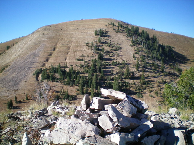
Big Elk Mountain (left) and Peak 9142 (right) as viewed from the southeast. Livingston Douglas Photo
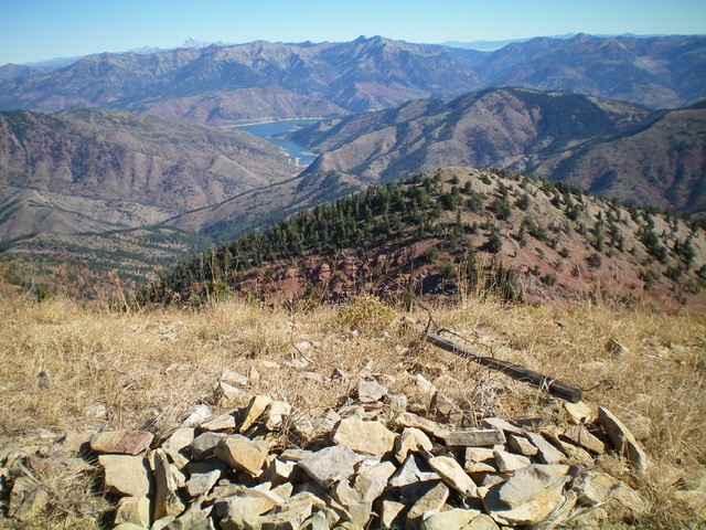
Looking northeast from the summit of Big Elk Mountain. Palisades Reservoir is in the distance. Livingston Douglas Photo
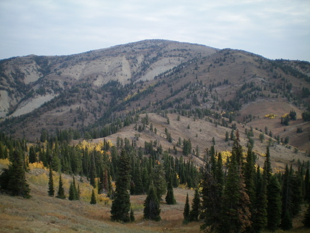
Big Elk Mountain (dead center in the distance) as viewed from the southwest. Livingston Douglas Photo
Additional Resources
Regions: Caribou Range->SOUTHERN IDAHO
Mountain Range: Caribou Range
Longitude: -111.27489 Latitude: 43.23579