Elevation: 8,988 ft
Prominence: 122
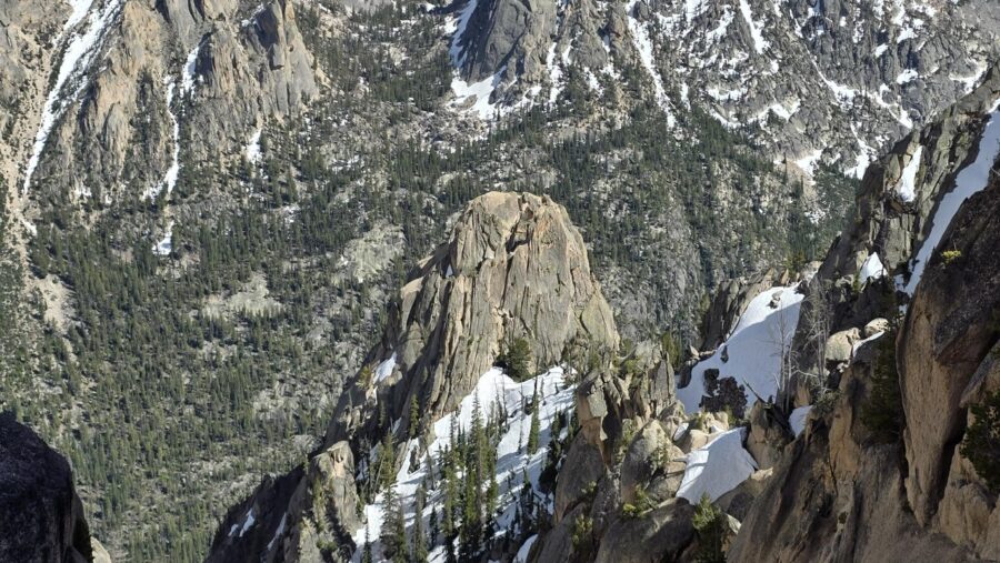
Climbing and access information for this formation is on Page 175 of the book. The exact location of a number of formations located above Redfish Lake Creek have been subject to conjecture. This is primarily because there were no USGS quads available when the formations were named. Thanks to Brian Westphal and Kaden Platt we now have exact location and updated route information for this spire. Updated July 2026
This formation was first climbed by the Iowa Mountaineers. It is located just east of Quartzite Peak. Kaden Platt’s route description and photos are found down the page. USGS Mount Cramer

Black Aiguille. Kaden Platt Photo
Iowa Mountaineers Route, Class 5.? /A 1
AAJ article from Iowa Mountaineers (Volume 12 Issue 2 1961): “Black Aiguille was ascended for the first time. It lies on the Redfish Creek flank of the Groin and Quartzite Peak. It was approached by a steep, rock-filled couloir beginning about a half mile up Redfish Creek from the Heyburn Creek side. After a delicate climb up a flaky granite wall, the climbers were confronted with a final steep ridge of classical “ball-bearing granite.” A small pinnacle near the top was lassoed to gain access to the summit. The party consisted of Hans Gmoser, Bill Echo, Paul Bloland, Wilbur Davis, Cornelia Davis, Rodney Harris, James Luce, James Ross, Stanton Taylor, John Walker, and Jack Wilson. Quartzite Peak was an unspectacular first ascent. The point is on the Redfish Creek end of a ridge that runs south from Mount Iowa. The summit lies directly west of the Groin. It was approached up the same couloir as that used to climb the Black Aiguille. It was fairly easy all the way.”
Black Aiguille, North Ridge, YDS 5.8R by Kaden Platt
Brian Westphal and I approached this formation via a steep rocky drainage East of the formation, to Black Aiguille’s saddle. From here short class 3 scramble to a sand bar where we set a belay station.

Topo of route as seen from the West. Kaden Platt Photo
From the belay, climb an easy but loose chimney. At the top of the chimney, scamper over to the summit flake, and make a delicate unprotected move to possibly the only crack on the West face. Here, place gear, because it’s all you have… Then climb the flaky crack then saddle the summit fin. I chose to butt scoot the entire fin, until you reach the rotten summit “block”.

Summit fin. Kaden Platt Photo

Butt scoot on rappel, did the same movement climbing. Brian Westphal Photo

Summit block, notice the Piton hammered in rubble, and the saddlehorn carved by FA party in 1960. Kaden Platt Photo

Looking back down the fin. Kaden Platt Photo

Rappel setup. Made true to the FA, carved a 3 inch deep groove with my nut tool for my rope to sit in. Kaden Platt Photo
I’d recommend bringing a 60m rope, then a stack of nuts, and maybe a #3 sized cam, and 6 alpines. Bring 30 feet of thicker accessory cord to build a better rappel.

Looking up South face. Kaden Platt Photo

Looking at top of the Iowa Mountaineers East Face route by FA, low 5th to this point. Kaden Platt Photo

Hanger found on the Iowa Mountaineers East face route. Kaden Platt Photo

The historic register found wedged in a crack 20 feet off the South face. Kaden Platt

The register lid. Kaden Platt Photo
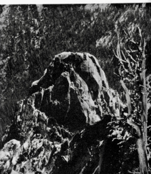
Black Aiguille. Lyman Dye Photo
Additional Resources
Mountain Range: Sawtooth Range
First Ascent Information:
- First Ascent Year: 1960
- Season: Summer
- Route: South Face
- Party: Iowa Mountaineers: Hans Gmoser, Bill Echo, Paul Bloland, Wilbur Davis, Cornelia Davis, Rodney Harris, James Luce, James Ross, Stanton Taylor, John Walker, and Jack Wilson.
Longitude: -114.981829167 Latitude: 44.088092796