Elevation: 5,702 ft
Prominence: 92
This peak is not in the book. Published November 2022
The high point of the Black Canyon II Wilderness Study Area is located on the south side of the City of Rocks Road in the Bennett Hills. This hike is entirely on BLM land. The sagebrush bashing required to reach the summit of this peak is challenging. It can be climbed in combination with nearby Little City of Rocks WSA HP but the easiest, shortest route through the sagebrush is from the north at a bend in the City of Rocks Road at Point 5621 on the USGS topo map. USGS McHan Reservoir
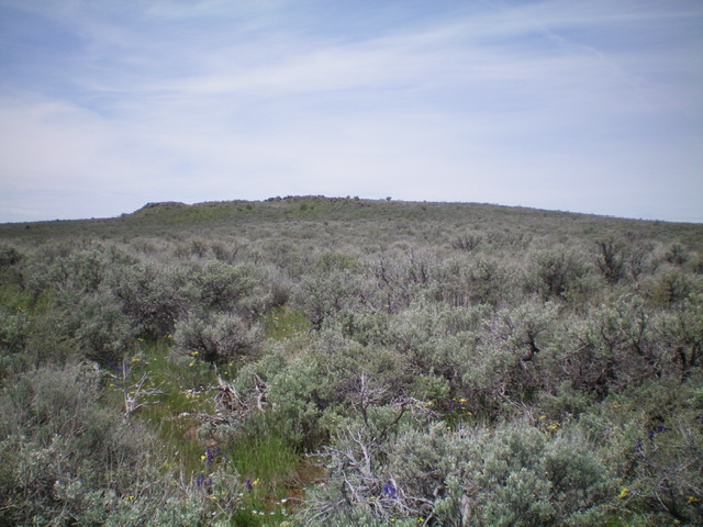
Black Canyon II WSA HP as viewed from the east. Livingston Douglas Photo
Access
From ID-46, drive west up the City of Rocks Road for 2.9 miles and park at an unsigned road junction at 5,535 feet just before a sharp right/northwest bend in the City of Rocks Road. An old 2-track road (closed to motor vehicles) heads south from this junction. GPS coordinates: 43⁰10’42”N, 114⁰42’11”W. Please refer to the Bennett Mountain Hills page for more information about the City of Rocks Road.
East Face, Class 2
The Climb
From the road junction, bushwhack west-southwest directly at a ridge that blocks your view of the high point that you seek to stand upon. Once atop the intervening ridge, continue west on a ridge of sorts to reach the summit. The sagebrush bashing on this route is simply miserable. It just never lets up. Thick, tall, and endless. Surprisingly, the summit is rocky and you can stand atop the large summit boulders to escape the nearby sagebrush. It will be your only happy moment of this climb.
East Gully, Class 2
The Descent
From the summit, descend southeast to a grassy meadow in a wide gully then head east directly at the Little City of Rocks WSA HP to the east. When you reach a north-south 2-track road, you are at the base of the west ridge of that peak and the conclusion of the first leg of today’s 2-peak adventure. The Little City of Rocks WSA HP is up next. The east gully was a much easier route than the sage-clogged ascent route. The terrain is much more open and sage-free.
Additional Resources
Regions: Bennett Mountain Hills->WESTERN IDAHO
Mountain Range: Bennett Mountain Hills
Longitude: -114.71459 Latitude: 43.17611