Elevation: 8,677 ft
Prominence: 722
This peak is not in the book. Livingston Douglas added the paragraph covering the road that leads from FSR-038 to the summit. Updated November 2023
Blue Nose is located on the Idaho/Montana border on top of the Bitterroot Mountains crest. This remote summit is a former fire lookout site operated by the Salmon National Forest. As such, a road leads to its summit. It is often visited by ATV and dirt bike riders. USGS Shoup
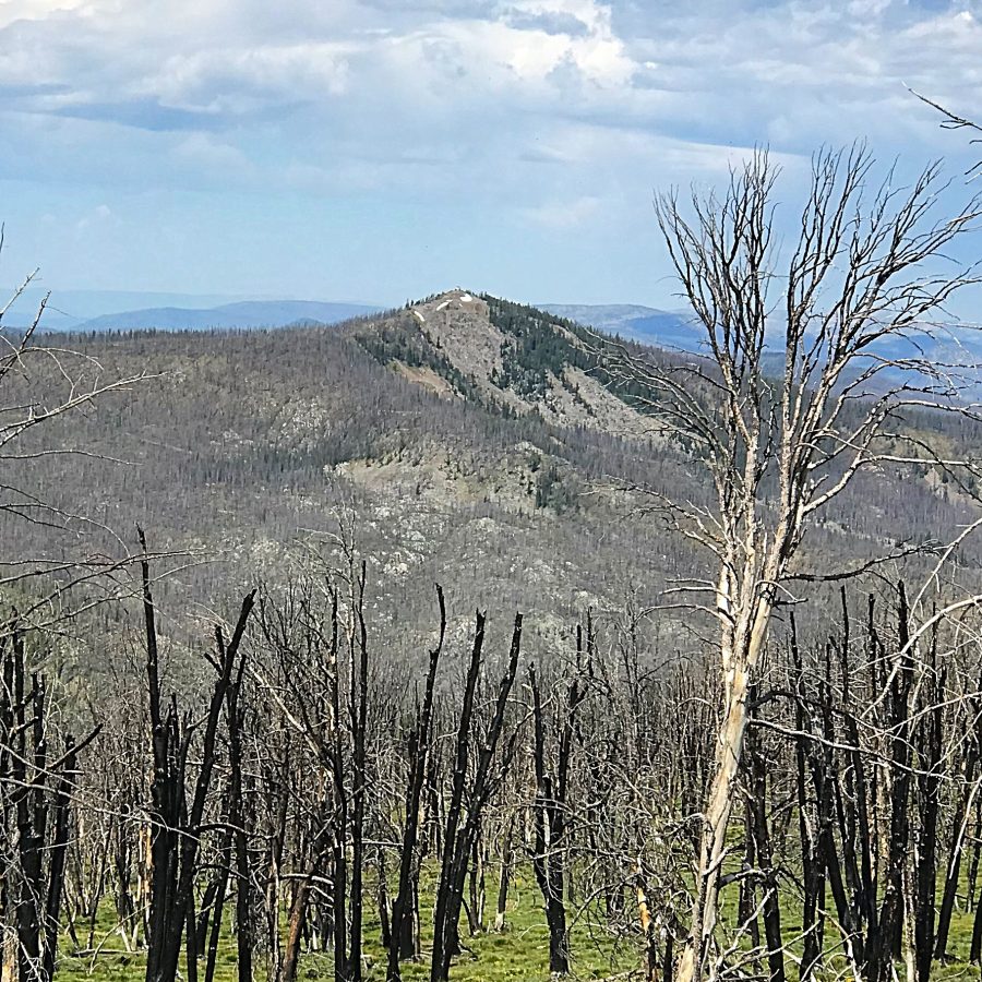
Blue Nose as viewed from Johnson Benchmark
Bing Young provided the following: Blue Nose is located in the Bitterroot Mountains along the Idaho/Montana border, close to Horse Creek Pass. Travelers going along Spring Creek towards Alta, Montana, pass Blue Nose along the way. Access is easy in the Summer months. Blue Nose is probably the second-oldest lookout in the Forest. It was evidently being used in 1916, and appears as a primary lookout on the 1923 Fire Plans. By 1932, it had become a secondary lookout, but was manned at least through the 1940s and probably into the late 1950s.
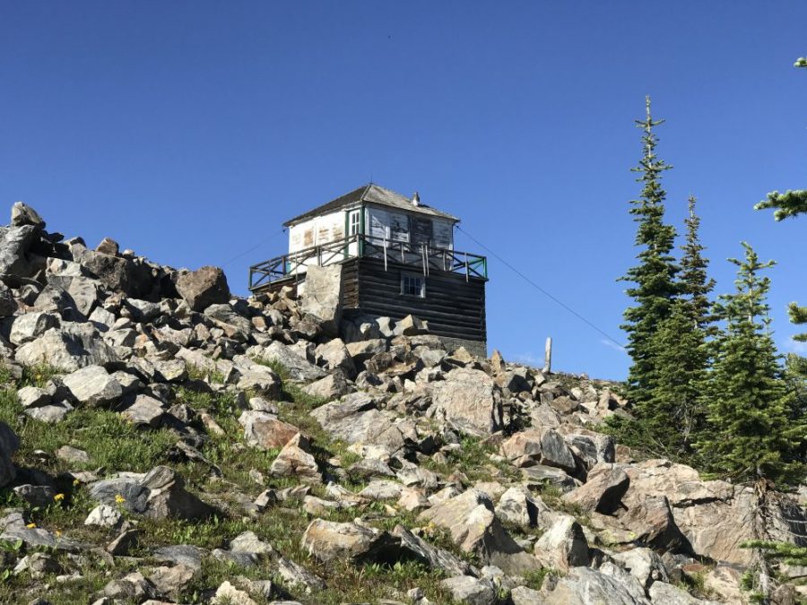
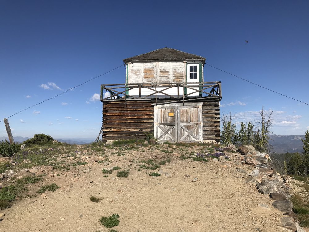
It is not known what sort of structure existed on Blue Nose before the Depression Era, but there is a 1930s-style lookout now in place. The lookout is one that the North Fork District has left open for public use. It is being considered as a Historical Landmark Site.
Like most of the early lookouts, Blue Nose has an incredible view at 8,677 feet. But its greatest service as a lookout would likely have been for the Bitterroot National Forest, as Blue Nose sees very little high fire-hazard country directly in the Salmon National Forest. —Salmon National Forest Fire Lookouts by Bing Young 1982, Page 20.
Access and Route, Class 1
Access is via Spring Creek Road/FSR-038, which is reached from North Fork, Idaho via Salmon River Road/FSR-30. Google Maps provides directions to this remote peak from North Fork, Idaho. Check with the Forest Service for current road conditions. The route is 32.0 miles long and will take nearly two hours to drive, assuming it is dry. The road to the turnoff for the lookout is single lane with turnouts, rough in spots but built for logging trucks.
The unsigned junction with the Blue Nose Lookout Road is 3.4 miles west of the signed trailhead for FST-106 near Johnson Benchmark. The Lookout Road is in very bad shape with treefall across it. It is not currently drivable. Park in a small roadside pullout along FSR-038 near the aforementioned road junction. This pullout is at 8,380 feet and 45⁰27’48”N, 114⁰19’24”W. The final 1.5-2.0 miles of FSR-038 is pretty rough and narrow with bad rutting problems. It is not currently used by logging trucks and lacks regular maintenance.

The Blue Nose lookout is unlocked and is in need of some serious repair work
The lookout observation deck is accessed from inside the lower floor. Based on the structure’s condition, accessing the deck is not recommended.
A room with a view
Additional Resources
Regions: Bitterroot Mountains->NORTHERN IDAHO
Mountain Range: Bitterroot Mountains
Longitude: -114.35849 Latitude: 45.47259