Elevation: 9,311 ft
Prominence: 411
This peak is not in the book. Published November 2022
Bonanza Peak is a high peak that is situated east of Yankee Fork Road and at the head of Preachers Cove. It stands at the headwaters of Jerrys Creek, Adair Creek, and Cearley Creek in the Eastern Salmon River Mountains. Bonanza Peak is most easily reached via the Fourth of July Creek Road and the Lucky Boy Mine to its northeast. USGS Sunbeam
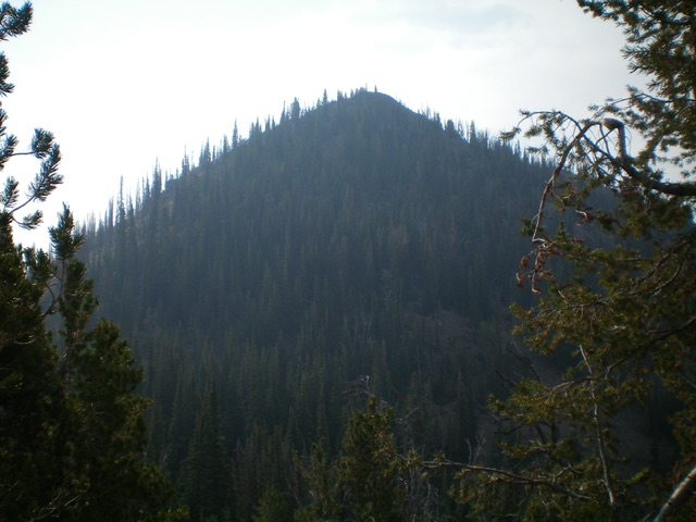
Bonanza Peak as viewed from the northwest. The northwest face was my descent (then ascent) route on the ridge traverse to nearby Peak 9326. Livingston Douglas Photo
Access
From ID-75, drive north from Sunbeam on [signed] Yankee Fork Road/FSR-013 for 6.4 miles to an unsigned road junction that is just below [signed] Preachers Cove. This junction is 1.9 miles south of the signed junction with Loon Creek Road. This jeep road heads right/east from FSR-013 up a gully then ridge between Preachers Cove and Cearley Creek. Park along Yankee Fork Road at this road junction (6,330 feet). GPS coordinates: 44⁰21’09”N, 114⁰43’34”W.
Map Errors
The USGS topo map fails to show the aforementioned side road heading east up a gully south of Preachers Cove. This side road IS shown on the Challis National Forest map. There is a decent use trail on part of the west ridge of Bonanza Peak that is not shown on any maps.
West Ridge, Class 2
The Climb
From the road junction, hike east up the jeep road until it reaches a forested shoulder. Leave the road to climb the west ridge or stay in the dry gully to reach the base of the west ridge. The road is just south of two prominent humps near the base of Preachers Cove. On the descent, these two humps serve as a good navigational tool in case you get off course. Once on the forested west ridge, scramble east up the ridge and quickly find up a use trail that follows the ridge on the crest or on its right/south side until it goes right/south to cross a dry gully and reach a narrow, open side ridge, where it ends. The trail is very weak in sections, especially in the uphill push through the pine forest to the side ridge.
This area is a convoluted mess of multiple ridges and dry gullies. Ironically, this “side ridge” is actually a continuation of the west ridge. It leads directly northeast to the summit of Bonanza Peak. The west ridge is open terrain from here to the summit. The terrain is a mix of scattered pines, blowdown, scrub, and loose gravel. The final push to the rocky summit hump is on reasonably stable talus/scree. The summit of Bonanza Peak has a large cairn.
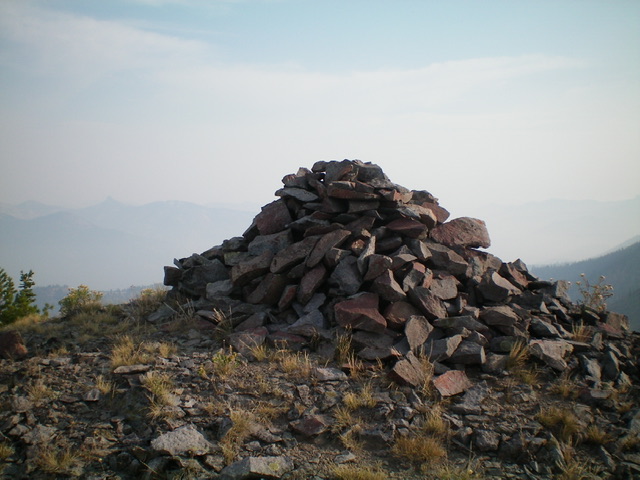
The large summit cairn atop Bonanza Peak. Livingston Douglas Photo
Northwest Face, Class 2
The Descent
From the summit, descend northwest through a thick pine forest to reach a hidden connecting saddle. Stay to the right/east in some semi-open areas to avoid the worst of the thick pines and blowdown. There is a lot of loose gravel on this forested face so stay near the right/east edge of the face for the best traction, especially when re-ascending Bonanza Peak to return to Yankee Fork Road. The forested saddle is at 8,900 feet and concludes the first leg of today’s 2-peak adventure. Peak 9326 is up next.
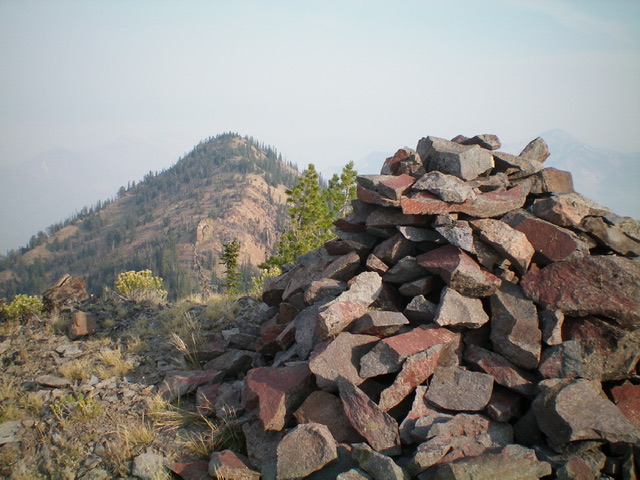
View of Peak 9326 from the summit of Bonanza Peak to its southeast. Livingston Douglas Photo
Additional Resources
Regions: Eastern Salmon River Mountains->Salmon River Mountains->Southeast Corner Peaks->WESTERN IDAHO
Mountain Range: Eastern Salmon River Mountains
Longitude: -114.69111 Latitude: 44.35679