Elevation: 5,272 ft
Prominence: 387

This peak is not in the book. Published November 2021
Bonny Benchmark is located west of I-15/Exit 128 (Osgood Area), about 9 miles north of Idaho Falls. This peak is located on private land, so please obtain permission from the landowner before undertaking this hike. An old 2-track road leads most of the way to the summit. USGS Shattuck Butte
The [lower] antenna-clad north summit of Bonny Benchmark (Point 5265). Livingston Douglas Photo
Access
From Exit 128 (Osgood Area) on I-15 north of Idaho Falls, drive west then south on [signed] North 26th West Road for 1.9 miles to a signed junction with West 113th North Road. Turn right/west onto West 113th North Road and drive 5.9 miles to an unsigned junction with a dirt road that heads right/north directly at [obvious] Bonny Benchmark, which has two radio antennas on top. Park at this junction (4,970 feet) near some farm buildings and farm machinery. There are no signs, orange paint, or fences prohibiting entry but this is private land.
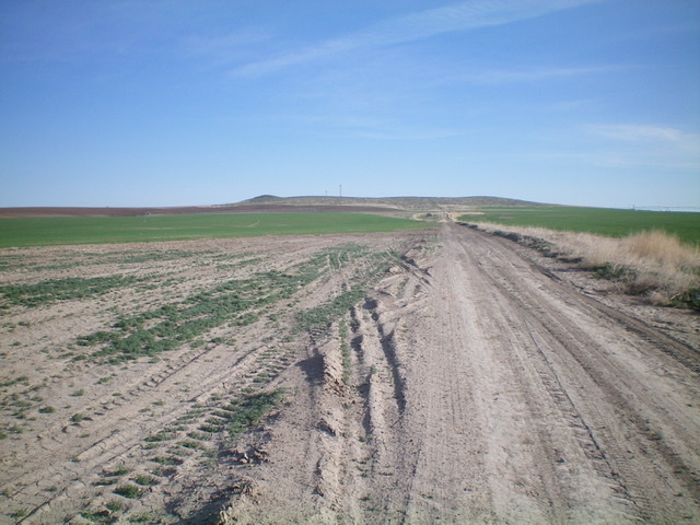
Bonny Benchmark as viewed from the dirt road to its south. The summit is the hump at far left in the distance. Livingston Douglas Photo
South Face, Class 2
The Climb
Hike north up the 2-track road to where it bends sharply left/west. Leave the road here (or soon after) to scramble up through easy scrub in a north-northwest direction to reach the flat summit area. The hump to the left/south of the radio towers is the high point and has a benchmark near the summit boulders.
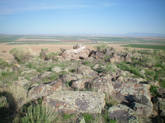
The summit of Bonny Benchmark, looking west. Livingston Douglas Photo
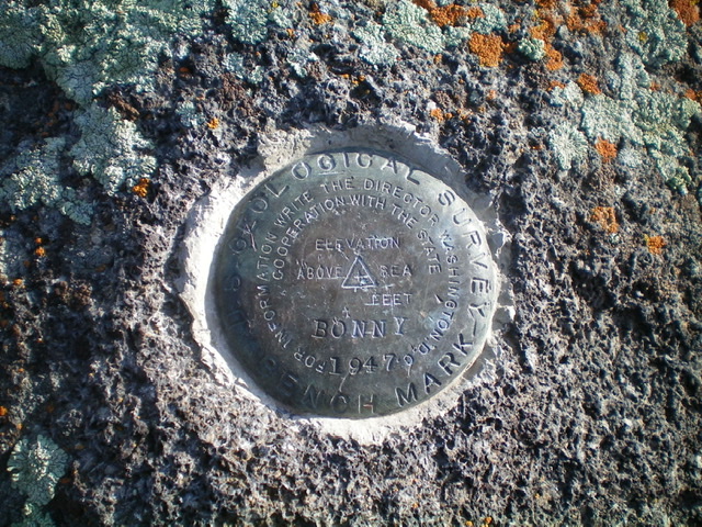
This is why they call it Bonny Benchmark. Livingston Douglas Photo
Additional Resources