Elevation: 8,390 ft
Prominence: 420
This peak is not in the book. Published January 2023
Books Benchmark is located in the heart of the Webster Range between Manning Creek and Deer Creek. This area is a mix of private and public land. This climb is entirely on public land and it took some work to figure out a route that avoids private land. The more direct route up the southeast ridge from the mouth of Deer Creek is blocked by fenced, posted private land. USGS Snowdrift Mountain
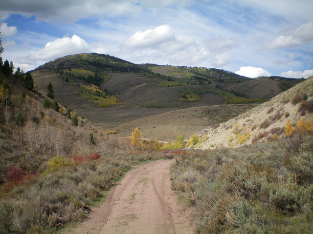
Books Benchmark is the minor hump in dead center in the distance, as viewed from Crow Creek Road to its southeast. Livingston Douglas Photo
Access
Crow Creek Road/FSR-111 is located at the west end of North Fairview Road/CR-236, about three miles west of US-89 at the hamlet of Fairview, WY. Reset your odometer at the signed junction of Crow Creek Road and North Fairview Road. Turn left/south onto Crow Creek Road. At 8.4 miles, reach the Caribou National Forest boundary. At 9.7 miles, reach a signed junction with FSR-740 at Quaking Hollow. Park here (6,511 feet). GPS coordinates: 42⁰36’03”N, 111⁰07’16”W.
Map Errors
The USGS map fails to show the critical junction of FSR-740 and FST-531 partway up Manning Creek. It doesn’t even show northbound FSR-740 from there at all. Both the USGS map and the Caribou-Targhee National Forest map fail to show the multiple spur roads along Manning Creek, making it confusing on where to go. The Caribou-Targhee National Forest map shows trailheads for Camel Hollow and Deer Creek, which don’t exist. The Caribou-Targhee National Forest map incorrectly labels FSR-588 as FSR-586.
East Face/Northeast Spur/North Ridge, Class 2
The Climb
From the road junction, hike west up FSR-740 (a rugged 4WD road) through Quaking Hollow. The road soon turns sharply right/north and leaves Quaking Hollow to head to Manning Creek. Reach a road junction at the mouth of Manning Canyon. Go left/west to remain on FSR-740 and head up Manning Creek. The hiking distance to this junction is about 0.8 miles. After hiking about 0.5 miles up Manning Creek, reach an unsigned junction where FSR-740 goes right/north to leave the drainage. Continue straight on a 2-track road heading up Manning Creek.
A bit farther up the creek drainage, reach another unsigned junction. You have two options here. Continue straight on a 2-track that soon reaches the northeast spur of the north ridge of Books Benchmark (my original planned ascent route) or go left/southwest onto another 2-track road (in better condition) and follow it to its end at a saddle (7,290 feet) at the base of the east face. Given the road condition, I chose the latter and missed the intended ridge climb. Follow the 2-track road southwest to the aforementioned saddle, where the road turns right/west to climb a forested shoulder of sorts and quickly ends at about 7,350 feet.
From the end of the road, bushwhack west-northwest up the steep, forested shoulder (which eventually turns into a face) to intercept the northeast spur (my intended ascent route) high up. This bushwhack has some thick sections but, overall, isn’t too bad. The brush is tolerable, the aspens are mostly avoidable, and game trails help (especially on any ridge/shoulder crest). Follow the northeast spur up to a flat, open scrub area at 8,210 feet (just east of Point 8307). From here, you can see the forested summit hump to the left/south, still a good 0.7 miles away with a forested saddle in between.
Bushwhack southwest to reach another east shoulder then climb west up it to the north-south summit crest. Much of this bushwhack is on game trails. Descend southwest then southeast to the forested ridge saddle in reasonable aspen/pine forest with game trails to help. From the saddle, bushwhack south up through more pine forest (mostly on game trails) to reach the open summit of Books Benchmark at the south end of the ridge. The summit had the USGS “Books” benchmark but no summit cairn so I built one next to the benchmark. The summit offers a great view of the noisy phosphate mining operation to the southwest.
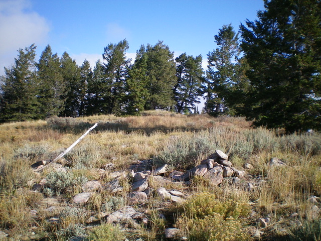
The summit of Books Benchmark. Livingston Douglas Photo
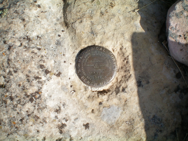
The USGS benchmark atop Books Benchmark. Livingston Douglas Photo
North Ridge/Northwest Face, Class 2
The Descent
From the summit, return to Point 8307 (which I skirted on the ascent) and descend the northeast spur. Unfortunately, the spur becomes pretty ill-defined and I lost it in the thick forest. Bushwhack northeast then north down the northeast face. This is a miserable bushwhack through a dense pine forest with thick underbrush, and copious amounts of blowdown. It is quite a steep descent as well. When you reach Manning Creek, find the remnants of an old hiking trail. Follow this trail downstream until you intercept the 2-track road that heads down Manning Creek to the mouth of Manning Canyon and the road junction. Head right/south on FSR-740 and return to Crow Creek Road and your parked vehicle.
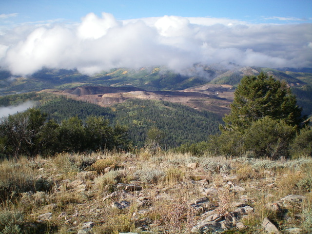
The active phosphate mining operation southwest of Books Benchmark as viewed from the summit. Livingston Douglas Photo
Additional Resources
Regions: Peale Mountains->SOUTHERN IDAHO->Webster Range
Mountain Range: Peale Mountains
Longitude: -111.1596 Latitude: 42.5978