Elevation: 6,502 ft
Prominence: 562
This peak is not in the book. Published December 2020
Calamity Point is a semi-forested, brushy hump that towers over the Palisades Dam, Palisades Reservoir, and the Snake River. Unfortunately, it is a steep, unpleasant bushwhack through unending brush and a patch of dense aspens. The only public access is probably from its south side. There are private summer homes on the southwest side. The southeast and east sides are riddled with cliff bands and thick brush and are probably not good options. USGS Palisades Dam
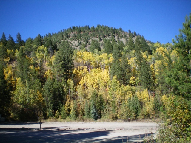
Calamity Point as viewed from the Calamity Campground to its south. Livingston Douglas Photo
Access
From the junction of US-26 and ID-31 in Swan Valley, drive about 10 miles southeast on US-26 to a signed turnoff for “Little Lemhi/Riverside Park” just north of Palisades Reservoir Dam. Turn right/south off US-26 and reset your odometer. Follow the paved road south briefly then right/west as it skirts the Riverside Park Campground and crosses the Snake River on a good bridge. Please note that the USGS topo map does NOT show this road or bridge crossing but the Caribou-Targhee National Forest Map does.
Please be advised that the Palisades Dam road is closed and has been closed for years. Both the USGS topo map and the National Forest map make the dam road look open but it’s not. At 2.1 miles, turn left onto signed Bear Creek Road. At 4.7 miles, reach a signed “T” junction. Go left onto FSR-076. At 5.1 miles, reach a sharp right turn. This is the base of the south face of Calamity Point. At 5.6 miles, reach the Calamity Campground and the day-use parking area for the boat ramp. Park here (5,640 feet).
Please be advised that although both the Caribou-Targhee National Forest Map and LOJ’s Land Management Layer show this entire area as public land (a combination of BLM land and Forest Service land), access is restricted in the “Summer Home” area at the base of Calamity Point. There is a jeep road that goes up past some summer homes onto the southwest face to about 6,020 feet. But this road is gated, locked, and posted at its junction with FSR-076. Be very careful on all sides of Calamity Point because there is a lot of private land here and, regrettably, the maps (and LOJ) don’t show it.
South Face, Class 2
The Climb
From the day-use parking area next to the Calamity Campground, bushwhack north up through a steep, thick, brush-laden aspen forest to intersect a lateral 2-track road that is not shown on maps (it has been closed for years). Follow it briefly left/west to reach FSR-076. Go right/north on FSR-076 and follow it a short distance to a sharp left turn (shown on maps) at 5,795 feet. The bushwhack is so wicked that I wanted to avoid it in any way that I could, so I diverted onto the nearby [paved] road (FSR-076) to do so. When I descended this route, I stayed on FSR-076 all the way down to the day-use parking area (about ½ mile from the sharp turn in the road).
Don’t wander farther west than this sharp turn in the road, as there are summer homes (private property) nearby. When you descend back to this sharp turn, use the summer homes (visible from high up) as your guide to find the sharp turn because it will be hidden by the thick forest. From the sharp turn in FSR-076, leave the road and bushwhack north up through a dense aspen forest with thick brush to eventually reach semi-open terrain on the face. As you scramble up the steep, brushy face, be careful not to wander too far to the right/east or you will run into a Class 3 cliff band higher up, as I did.
Once you reach about 6,450 feet, you arrive on the summit cap and the slope flattens considerably. The terrain is now brushy and open with scattered pines. Continue scrambling north to the small, forested summit high point. The summit is on a forested ridge crest at the north end of the summit cap. Views are limited by the nearby pines. There is an old, badly-beaten USGS benchmark but no summit cairn. If you work around the ridge trees, there is a stunning view of Palisades Reservoir and the Snake River. Given the nearby summer homes, I am surprised that there is no use trail to the summit.
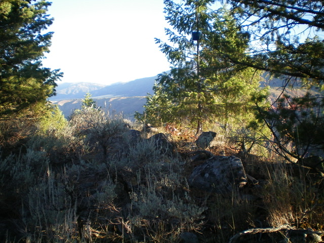
The small, forested summit of Calamity Point. Livingston Douglas Photo
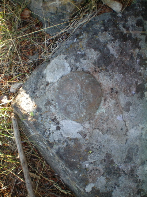
The badly-beaten USGS benchmark atop Calamity Point. Livingston Douglas Photo
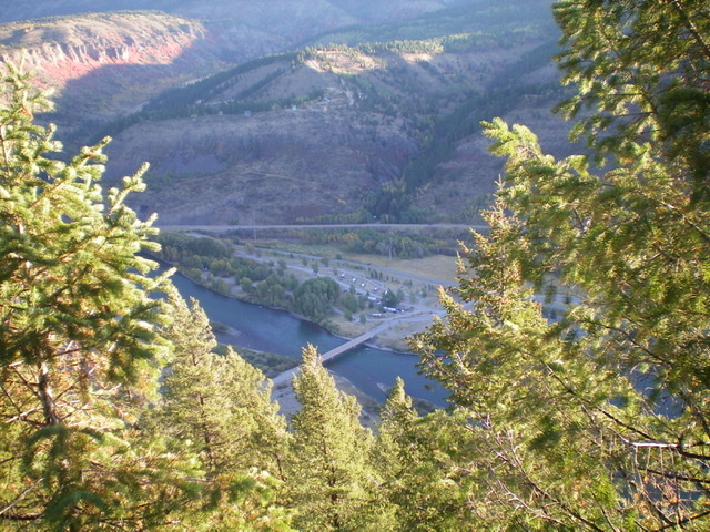
Looking down to the Snake River and the bridge crossing just below Palisades Dam from the summit of Calamity Point. Livingston Douglas Photo
Additional Resources
Regions: Caribou Range->SOUTHERN IDAHO
Mountain Range: Caribou Range
Longitude: -111.21189 Latitude: 43.33379