Elevation: 7,726 ft
Prominence: 1,271
This peak is not in the book. I added Rick Baugher’s trip report which contains interesting historical information. Published January 2023
Camp Peak is the high point on Pelican Ridge on the northeast side of Blackfoot Reservoir. It is most easily reached via Collett Creek Road on its southwest side. USGS Henry
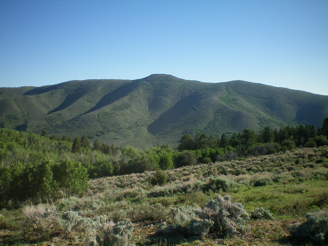
Camp Peak as viewed from the south. Livingston Douglas Photo
Access
From ID-34 just north of Henry, turn left/west onto Blackfoot North Access Road (shown as North Reservoir Road on the USGS topo map). Drive 3.9 miles west then northwest to an unsigned junction at a sharp left/west bend in the road. Turn right/northeast onto Collett Creek Road and drive 0.9 miles to an unsigned junction in a large meadow. Park here (6,283 feet).
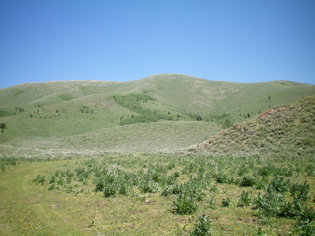
Camp Peak (dead center) as viewed from the south (start of hike) at the base of the southwest rib. Livingston Douglas Photo
Southwest Rib, Class 2
The Climb
From the road junction, hike north briefly on an old 2-track road to a junction at a fork in the meadow. Continue left/northwest along a 2-track road for a short distance. Leave the 2-track and bushwhack right-ish/north directly up onto the [obvious] southwest rib through somewhat thick sagebrush. Cattle trails and gaps help you get through the sage. Once on the crest of the rib, head right/northeast up the sagebrush-covered ridge. The sage is not as thick here and there are cattle trails to expedite the ridge climb. The ridge bends left-ish/north-northeast and becomes rockier higher up. The sage does not shorten until very high up, but there is almost always a cattle trail to help.
High up, the ridge becomes a steep climb up short scrub without any cattle trails. The summit of Camp Peak has a cairn and a USGS benchmark. The summit offers a splendid view of Blackfoot Reservoir to the southwest and the winding Blackfoot River to the northeast. When descending the southwest rib, stay on the rib all the way to its toe at a 2-track road to avoid the thicker sagebrush on the sides of the rib. Follow the 2-track road south back to the large meadow and the road junction and your parked vehicle.
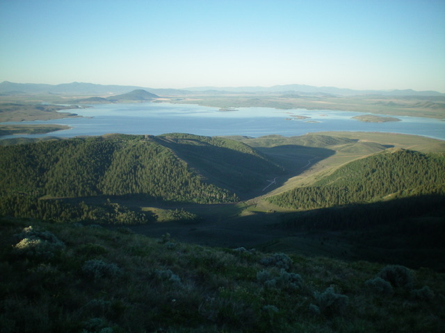
View of Blackfoot Reservoir from the summit of Camp Peak. Livingston Douglas Photo
Rick Baugher’s Trip Report
In 1994, I was drawn to Camp Peak as part of the “triangulation station recovery project.” I ascended this cross-country Southwest Slope to reach Station “Camp.” The peak name may have originated from the wagon encampment days of the the Lander Trail. Survey work and subsequent computations were done by either Thomas Bannon or Herbert Hodgeson. Which surveyor was here in 1915? The USGS field reports don’t specify. Let’s see if we can do some detective work.

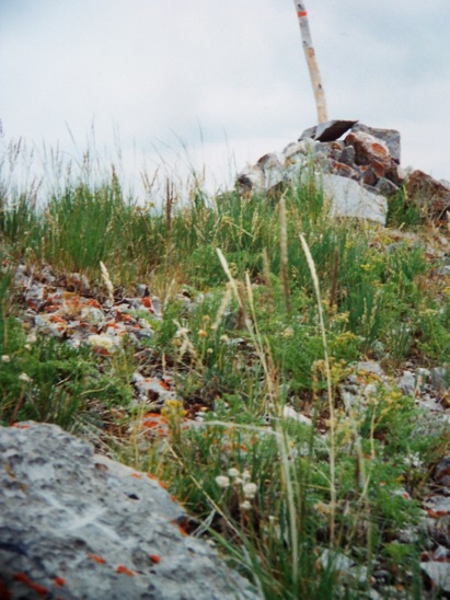
Camp Peak. Rick Baugher Photo
On the summit of Camp Peak, the report describes the station mark as “Flagpole with cairn around base.” Check. “Bronze triangulation tablet cemented in rock.” Check. “Reference mark: chiseled cross in rock, distance 8.8 feet.” Check. See lower left in above photo.
After visiting dozens of similar stations in ID/WY/MT, the individual quirks of the surveyor become apparent. He leaves footprints. Bannon was known to not stamp names or dates on benchmark tablets. Check. Bannon was known for his well-crafted chiseled crosses. Check. We conclude, therefore, that Station Camp was occupied by TM Bannon.
Camp Peak. Rick Baugher Photo
Additional Resources
Regions: Blackfoot Mountains->SOUTHERN IDAHO
Mountain Range: Blackfoot Mountains
Longitude: -111.5518 Latitude: 42.9616