Elevation: 5,591 ft
Prominence: 331
This peak is not in the book. Published November 2022
Canyon Benchmark is a minor peak in the Bennett Hills. It is located on the west side of Mount Bennett Road and sits above Little Canyon and Goodman Flat to its east. This area is a mix of private and public land, so be careful. This hike is entirely on BLM land. USGS Goodman Flat
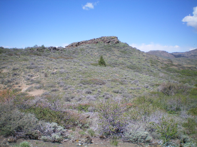
The elusive summit block of Canyon Benchmark as viewed from the east. Livingston Douglas Photo
Access
From just west of MM126 on US-20, turn south onto [signed] Mount Bennett Road and drive 13.8 miles south to a cattle guard crossing/fence row and an old 2-track road alongside it on the right/west side of Mount Bennett Road. The fence row is still shown on the USGS topo map but the 2-track road is not shown. Park at the base of this 2-track road (4,955 feet). GPS coordinates: 43⁰09’00”N, 115⁰18’35”W.
Southeast Ridge, Class 2
The Climb
From the road junction, hike west up the 2-track road as it follows the left/south side of the fence row until it crosses to the right/north side of the fence and soon goes onto private property. Leave the road and continue to follow the left/south side of the fence row on an old, overgrown cattle trail. The fence heads west then bends right/northwest for a short section. It then bends right/north and heads up to cross the southeast ridge. Leave the fence row here and scramble northwest then west to the summit. You must endure three false, rocky summits on your way to the true summit.
This climb is much longer and more taxing than the USGS topo suggests and there is a rocky hump (Point 5540) that looks like it is perhaps the true summit. Just keep heading west until you can’t go any higher to finally reach the high point of Canyon Benchmark. There are some tedious ridge ups and downs in thick sagebrush to navigate in order to reach the summit. The summit of Canyon Benchmark has three separate USGS benchmarks. It also has triangulation posts and a summit cairn amidst the large summit boulders. The true summit hides until you finally skirt the right/east side of a final false summit to reach it. It’s not obvious until you’re almost on top of it.
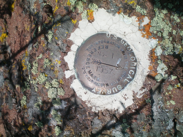
One of three USGS benchmarks atop Canyon Benchmark. Livingston Douglas Photo
Additional Resources
Regions: Bennett Mountain Hills->WESTERN IDAHO
Mountain Range: Snake River Plain
Longitude: -115.33001 Latitude: 43.15389