Elevation: 7,738 ft
Prominence: 438
This peak is not in the book. Published August 2021
Cherry Benchmark is located southwest of Liberal Mountain and west of Willow Creek. USGS Cannonball Mountain
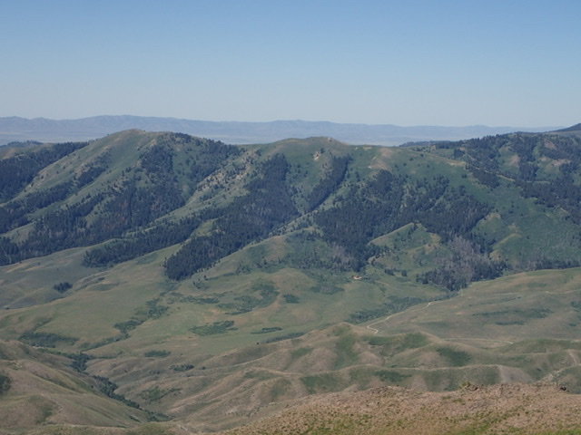
Cherry Peak as viewed from the southwest ridge of Buttercup Mountain. The long north ridge leads to the summit on the far left. Judi Steciak Photo
Access
Primary access is from US-20. From US-20, turn north onto N1000E Road. This road is located 16.0 miles west of the ID-75/US-20 junction. Follow N1000E north for 1.9 miles. Turn right/east onto E200N Road and follow it east for 1.4 miles. Turn L/R onto Willow Creek Road/FSR-017. Continue north to Wine Creek Road/FSR-096.
North Ridge, Class 2
Enjoy a nice walk along the North Ridge and observe how it delineates ecosystems: high desert sagebrush on the west slopes and alpine vegetation on the east slopes of the mountain. Native chokecherries probably lent their name to this summit and the creek across the valley to the east. The most direct route to the north ridge is to turn west from Willow Creek Road/FSR-017 onto Wine Creek Road/FS4-096. At the end of the road, you are faced with two unmarked trails, both with ‘No Motorized Vehicles’ signs. Walk up to the northernmost trail (the southern trail is for cattle access) which is FST-222/Wine Creek Trail.
Follow the trail until it approaches Wine Creek at the base of the north ridge. Leave the trail, head south and find a place to cross the creek (e.g., 43.484026 N, 114.649887 W). A network of game trails leads up steeply through the trees that survived the 2013 Beaver Creek Fire and brush higher on the ridge. Once past these difficulties, enjoy your walk south with generally good footing over several bumps to the summit. Or explore an alternative, longer, and less-steep route. Continue walking on FST-222/Wine Creek Trail to a saddle due west of Point 7608. An abandoned, unofficial ATV trail climbs east to the ridge.
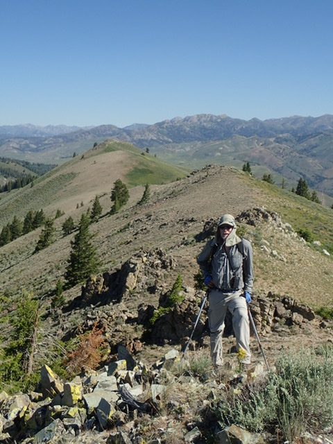
Carl Hamke hiking up the north ridge. Judi Steciak Photo
Additional Resources
Regions: Soldier Mountains->WESTERN IDAHO
Mountain Range: Smoky Mountains
Longitude: -114.64579 Latitude: 43.45769